Kernan Topo Map Louisiana
To zoom in, hover over the map of Kernan
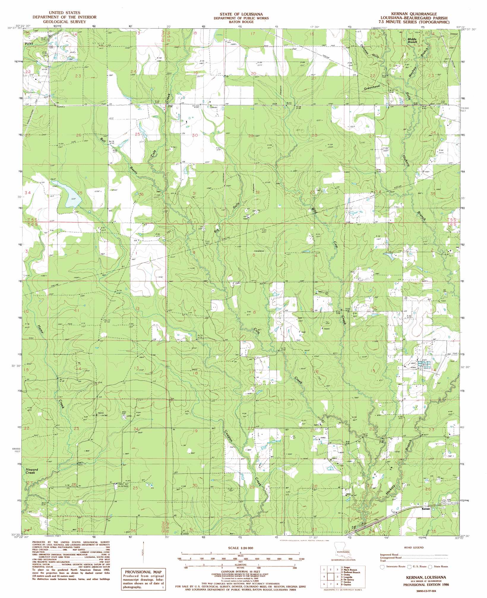
USGS Topo Quad 30093e3 - 1:24,000 scale
| Topo Map Name: | Kernan |
| USGS Topo Quad ID: | 30093e3 |
| Print Size: | ca. 21 1/4" wide x 27" high |
| Southeast Coordinates: | 30.5° N latitude / 93.25° W longitude |
| Map Center Coordinates: | 30.5625° N latitude / 93.3125° W longitude |
| U.S. State: | LA |
| Filename: | o30093e3.jpg |
| Download Map JPG Image: | Kernan topo map 1:24,000 scale |
| Map Type: | Topographic |
| Topo Series: | 7.5´ |
| Map Scale: | 1:24,000 |
| Source of Map Images: | United States Geological Survey (USGS) |
| Alternate Map Versions: |
Kernan LA 1986, updated 1986 Download PDF Buy paper map Kernan LA 2012 Download PDF Buy paper map Kernan LA 2015 Download PDF Buy paper map |
1:24,000 Topo Quads surrounding Kernan
Merryville North |
Neale |
De Ridder |
Boneset Creek |
Sugartown |
Merryville South |
Singer |
Mach Branch |
Redhead Branch |
Dry Creek |
Fields |
Oretta |
Kernan |
Longville |
Reeves |
Clark Hollow |
De Quincy |
Gordon |
Gaytine |
Topsy |
Lunita |
Brimstone |
Buhler |
Moss Bluff |
Hecker |
> Back to 30093e1 at 1:100,000 scale
> Back to 30092a1 at 1:250,000 scale
> Back to U.S. Topo Maps home
Kernan topo map: Gazetteer
Kernan: Dams
Louisiana Noname 75 Dam elevation 36m 118′Louisiana Noname 76 Dam elevation 29m 95′
Kernan: Oilfields
Bear Oil Field elevation 26m 85′Cowpen Creek Oil and Gas Field elevation 26m 85′
East Longville Oil Field elevation 32m 104′
Gordon Oil and Gas Field elevation 22m 72′
Longville Oil Field elevation 29m 95′
Ragley Oil Field elevation 21m 68′
West Cowpen Creek Oil Field elevation 26m 85′
Kernan: Populated Places
Kernan elevation 20m 65′Kernan: Streams
Big Gully elevation 26m 85′Bull Bayou elevation 30m 98′
Cole Creek elevation 16m 52′
Coleman Gully elevation 28m 91′
Greenhead Gully elevation 24m 78′
Howard Creek elevation 15m 49′
Mayhaw Branch elevation 26m 85′
Middle Branch elevation 29m 95′
Wild Cow Creek elevation 15m 49′
Kernan digital topo map on disk
Buy this Kernan topo map showing relief, roads, GPS coordinates and other geographical features, as a high-resolution digital map file on DVD: