Oretta Topo Map Louisiana
To zoom in, hover over the map of Oretta
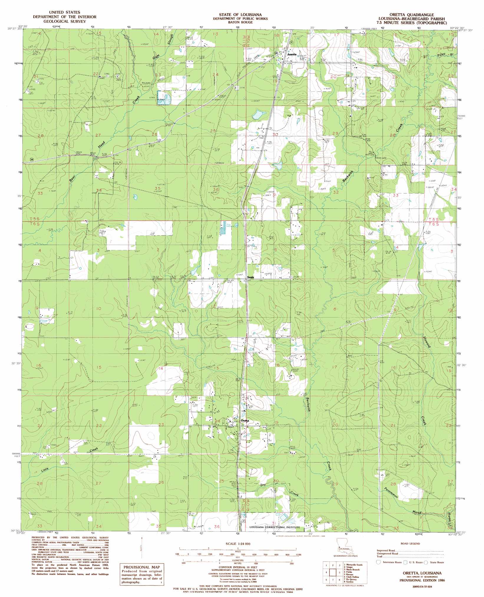
USGS Topo Quad 30093e4 - 1:24,000 scale
| Topo Map Name: | Oretta |
| USGS Topo Quad ID: | 30093e4 |
| Print Size: | ca. 21 1/4" wide x 27" high |
| Southeast Coordinates: | 30.5° N latitude / 93.375° W longitude |
| Map Center Coordinates: | 30.5625° N latitude / 93.4375° W longitude |
| U.S. State: | LA |
| Filename: | o30093e4.jpg |
| Download Map JPG Image: | Oretta topo map 1:24,000 scale |
| Map Type: | Topographic |
| Topo Series: | 7.5´ |
| Map Scale: | 1:24,000 |
| Source of Map Images: | United States Geological Survey (USGS) |
| Alternate Map Versions: |
Oretta LA 1986, updated 1987 Download PDF Buy paper map Oretta LA 2012 Download PDF Buy paper map Oretta LA 2015 Download PDF Buy paper map |
1:24,000 Topo Quads surrounding Oretta
Newton East |
Merryville North |
Neale |
De Ridder |
Boneset Creek |
Bon Wier |
Merryville South |
Singer |
Mach Branch |
Redhead Branch |
Bancroft |
Fields |
Oretta |
Kernan |
Longville |
Shoats Creek |
Clark Hollow |
De Quincy |
Gordon |
Gaytine |
Starks |
Lunita |
Brimstone |
Buhler |
Moss Bluff |
> Back to 30093e1 at 1:100,000 scale
> Back to 30092a1 at 1:250,000 scale
> Back to U.S. Topo Maps home
Oretta topo map: Gazetteer
Oretta: Dams
Acengys Pond Dam elevation 36m 118′Canerdays Pond Dam elevation 30m 98′
Oretta: Oilfields
North Oretta Oil Field elevation 33m 108′Oretta Oil and Gas Field elevation 25m 82′
Singer Oil Field elevation 35m 114′
Oretta: Populated Places
Juanita elevation 35m 114′Oretta elevation 32m 104′
Seale elevation 35m 114′
Oretta: Streams
Dry Bayou elevation 22m 72′Dry Creek elevation 17m 55′
Gum Slough elevation 30m 98′
Persimmon Marsh elevation 16m 52′
Poley Branch elevation 27m 88′
Oretta digital topo map on disk
Buy this Oretta topo map showing relief, roads, GPS coordinates and other geographical features, as a high-resolution digital map file on DVD: