Fields Topo Map Louisiana
To zoom in, hover over the map of Fields
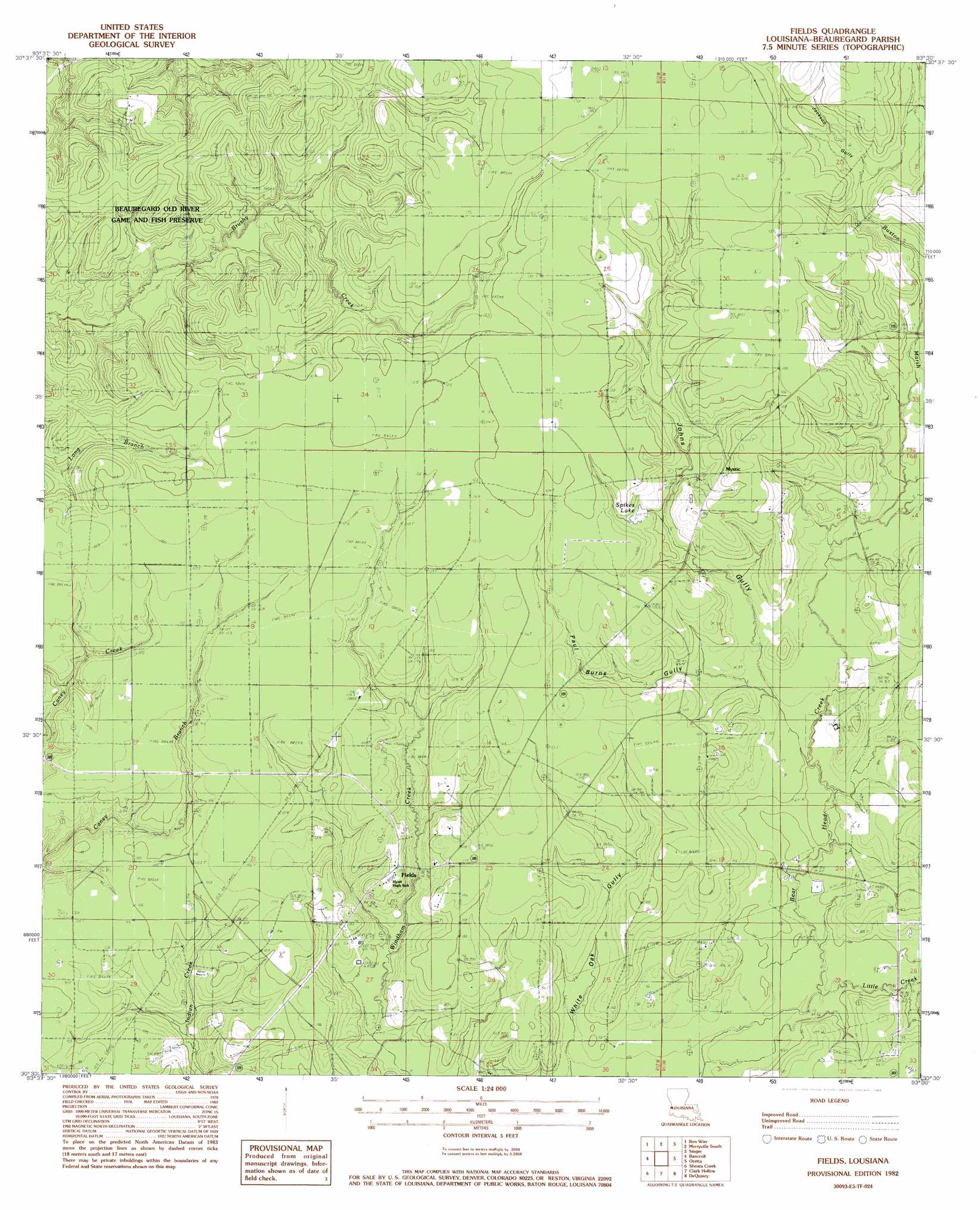
USGS Topo Quad 30093e5 - 1:24,000 scale
| Topo Map Name: | Fields |
| USGS Topo Quad ID: | 30093e5 |
| Print Size: | ca. 21 1/4" wide x 27" high |
| Southeast Coordinates: | 30.5° N latitude / 93.5° W longitude |
| Map Center Coordinates: | 30.5625° N latitude / 93.5625° W longitude |
| U.S. State: | LA |
| Filename: | o30093e5.jpg |
| Download Map JPG Image: | Fields topo map 1:24,000 scale |
| Map Type: | Topographic |
| Topo Series: | 7.5´ |
| Map Scale: | 1:24,000 |
| Source of Map Images: | United States Geological Survey (USGS) |
| Alternate Map Versions: |
Fields LA 1982, updated 1983 Download PDF Buy paper map Fields LA 2012 Download PDF Buy paper map Fields LA 2015 Download PDF Buy paper map |
1:24,000 Topo Quads surrounding Fields
Newton West |
Newton East |
Merryville North |
Neale |
De Ridder |
Bleakwood |
Bon Wier |
Merryville South |
Singer |
Mach Branch |
Trout Creek |
Bancroft |
Fields |
Oretta |
Kernan |
Sudduth Bluff |
Shoats Creek |
Clark Hollow |
De Quincy |
Gordon |
Hartburg |
Starks |
Lunita |
Brimstone |
Buhler |
> Back to 30093e1 at 1:100,000 scale
> Back to 30092a1 at 1:250,000 scale
> Back to U.S. Topo Maps home
Fields topo map: Gazetteer
Fields: Dams
Louisiana Noname 73 Dam elevation 32m 104′Fields: Oilfields
Bear Head Creek Oil Field elevation 23m 75′Buckston Marsh Oil Field elevation 30m 98′
East Bancroft Oil Field elevation 33m 108′
Fields Oil Field elevation 31m 101′
North Fields Oil Field elevation 34m 111′
South Bear Head Creek Oil Field elevation 24m 78′
Fields: Populated Places
Fields elevation 32m 104′Mystic elevation 35m 114′
Fields: Post Offices
Fields Post Office elevation 32m 104′Fields: Reservoirs
Spikes Lake elevation 31m 101′Fields: Streams
Buxton Marsh elevation 26m 85′Jackson Gully elevation 32m 104′
Johns Gully elevation 23m 75′
Little Creek elevation 21m 68′
Paul Burns Gully elevation 24m 78′
Fields digital topo map on disk
Buy this Fields topo map showing relief, roads, GPS coordinates and other geographical features, as a high-resolution digital map file on DVD: