Mach Branch Topo Map Louisiana
To zoom in, hover over the map of Mach Branch
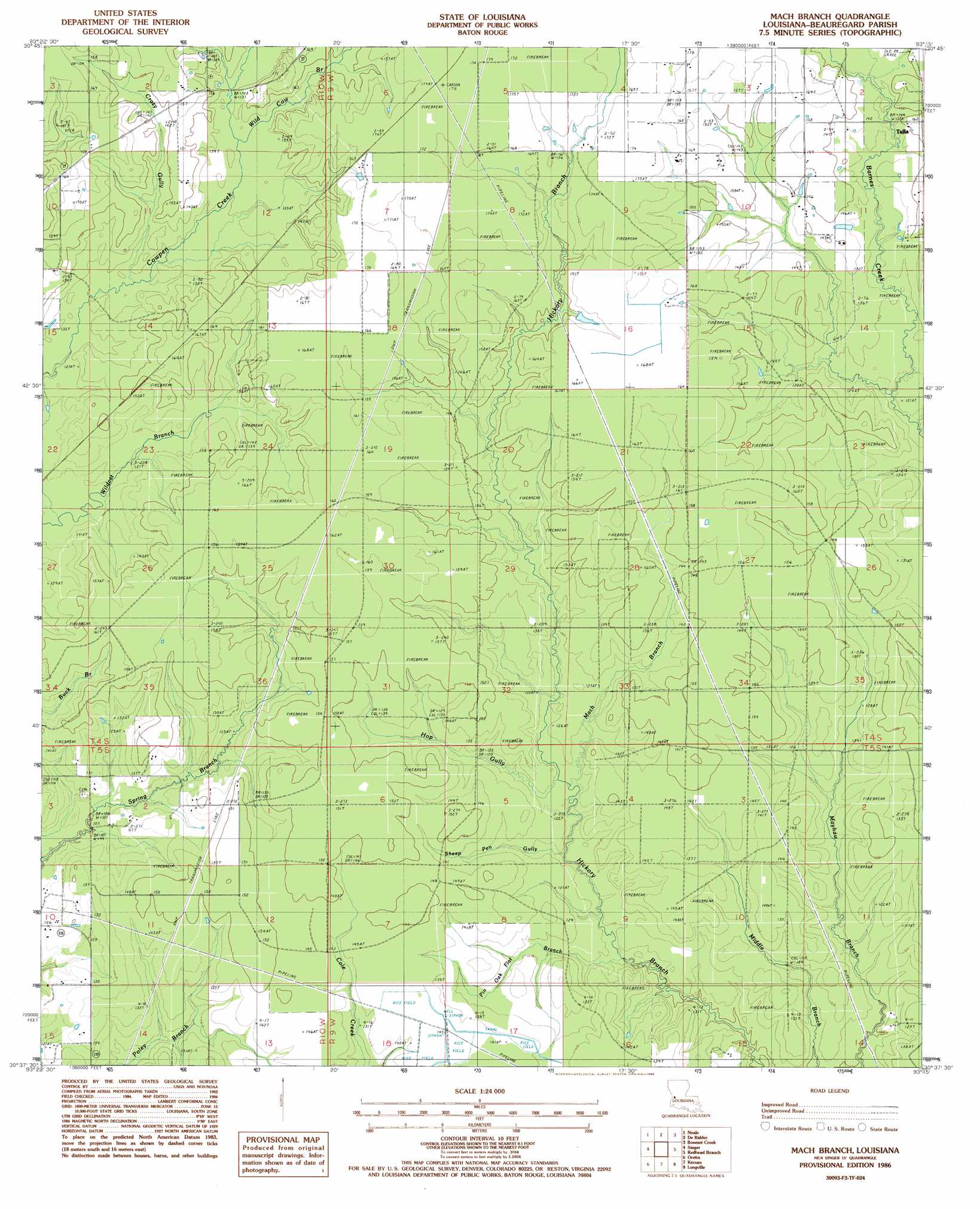
USGS Topo Quad 30093f3 - 1:24,000 scale
| Topo Map Name: | Mach Branch |
| USGS Topo Quad ID: | 30093f3 |
| Print Size: | ca. 21 1/4" wide x 27" high |
| Southeast Coordinates: | 30.625° N latitude / 93.25° W longitude |
| Map Center Coordinates: | 30.6875° N latitude / 93.3125° W longitude |
| U.S. State: | LA |
| Filename: | o30093f3.jpg |
| Download Map JPG Image: | Mach Branch topo map 1:24,000 scale |
| Map Type: | Topographic |
| Topo Series: | 7.5´ |
| Map Scale: | 1:24,000 |
| Source of Map Images: | United States Geological Survey (USGS) |
| Alternate Map Versions: |
Mach Branch LA 1986, updated 1986 Download PDF Buy paper map Mach Branch LA 2012 Download PDF Buy paper map Mach Branch LA 2015 Download PDF Buy paper map |
1:24,000 Topo Quads surrounding Mach Branch
Evans |
Knight |
Rose Pine |
Hurricane Branch |
Sugrue |
Merryville North |
Neale |
De Ridder |
Boneset Creek |
Sugartown |
Merryville South |
Singer |
Mach Branch |
Redhead Branch |
Dry Creek |
Fields |
Oretta |
Kernan |
Longville |
Reeves |
Clark Hollow |
De Quincy |
Gordon |
Gaytine |
Topsy |
> Back to 30093e1 at 1:100,000 scale
> Back to 30092a1 at 1:250,000 scale
> Back to U.S. Topo Maps home
Mach Branch topo map: Gazetteer
Mach Branch: Populated Places
Tulla elevation 47m 154′Mach Branch: Streams
Crazy Gully elevation 38m 124′Hop Gully elevation 35m 114′
Mach Branch elevation 35m 114′
Pin Oak Flat Branch elevation 34m 111′
Sheep Pen Gully elevation 36m 118′
Wild Cow Branch elevation 41m 134′
Mach Branch digital topo map on disk
Buy this Mach Branch topo map showing relief, roads, GPS coordinates and other geographical features, as a high-resolution digital map file on DVD: