Bon Wier Topo Map Texas
To zoom in, hover over the map of Bon Wier
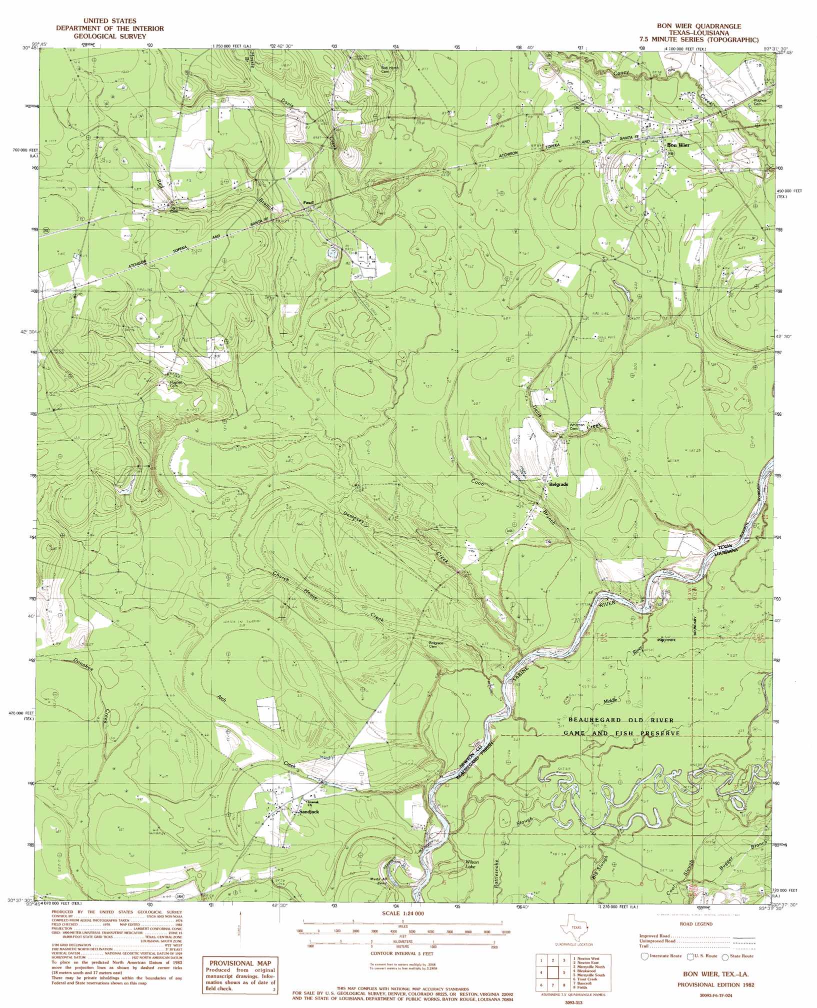
USGS Topo Quad 30093f6 - 1:24,000 scale
| Topo Map Name: | Bon Wier |
| USGS Topo Quad ID: | 30093f6 |
| Print Size: | ca. 21 1/4" wide x 27" high |
| Southeast Coordinates: | 30.625° N latitude / 93.625° W longitude |
| Map Center Coordinates: | 30.6875° N latitude / 93.6875° W longitude |
| U.S. States: | TX, LA |
| Filename: | o30093f6.jpg |
| Download Map JPG Image: | Bon Wier topo map 1:24,000 scale |
| Map Type: | Topographic |
| Topo Series: | 7.5´ |
| Map Scale: | 1:24,000 |
| Source of Map Images: | United States Geological Survey (USGS) |
| Alternate Map Versions: |
Bon Wier TX 1982, updated 1983 Download PDF Buy paper map Bon Wier TX 2010 Download PDF Buy paper map Bon Wier TX 2012 Download PDF Buy paper map Bon Wier TX 2016 Download PDF Buy paper map |
1:24,000 Topo Quads surrounding Bon Wier
Jasper East |
Jamestown |
Shankleville |
Evans |
Knight |
Roganville |
Newton West |
Newton East |
Merryville North |
Neale |
Kirbyville |
Bleakwood |
Bon Wier |
Merryville South |
Singer |
Call Junction |
Trout Creek |
Bancroft |
Fields |
Oretta |
Buna |
Sudduth Bluff |
Shoats Creek |
Clark Hollow |
De Quincy |
> Back to 30093e1 at 1:100,000 scale
> Back to 30092a1 at 1:250,000 scale
> Back to U.S. Topo Maps home
Bon Wier topo map: Gazetteer
Bon Wier: Dams
Wickersham Dam elevation 20m 65′Bon Wier: Lakes
Wilson Lake elevation 15m 49′Bon Wier: Populated Places
Belgrade elevation 21m 68′Bon Wier elevation 24m 78′
Fawil elevation 32m 104′
Sandjack elevation 19m 62′
Bon Wier: Reservoirs
Wickersham Lake elevation 20m 65′Bon Wier: Streams
Arch Creek elevation 17m 55′Church House Creek elevation 16m 52′
Coon Branch elevation 16m 52′
Davis Creek elevation 18m 59′
Dempsey Creek elevation 15m 49′
Hassle Branch elevation 27m 88′
Middle River elevation 15m 49′
Old River elevation 15m 49′
Red Branch elevation 20m 65′
Bon Wier digital topo map on disk
Buy this Bon Wier topo map showing relief, roads, GPS coordinates and other geographical features, as a high-resolution digital map file on DVD: