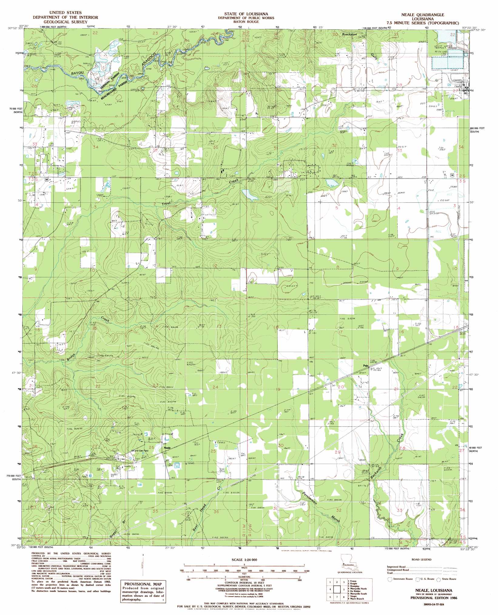
Neale Topo Map Louisiana
To zoom in, hover over the map of Neale
USGS Topo Quad 30093g4 - 1:24,000 scale
| Topo Map Name: | Neale |
| USGS Topo Quad ID: | 30093g4 |
| Print Size: | ca. 21 1/4" wide x 27" high |
| Southeast Coordinates: | 30.75° N latitude / 93.375° W longitude |
| Map Center Coordinates: | 30.8125° N latitude / 93.4375° W longitude |
| U.S. State: | LA |
| Filename: | o30093g4.jpg |
| Download Map JPG Image: | Neale topo map 1:24,000 scale |
| Map Type: | Topographic |
| Topo Series: | 7.5´ |
| Map Scale: | 1:24,000 |
| Source of Map Images: | United States Geological Survey (USGS) |
| Alternate Map Versions: |
Neale LA 1986, updated 1986 Download PDF Buy paper map Neale LA 2012 Download PDF Buy paper map Neale LA 2015 Download PDF Buy paper map |
1:24,000 Topo Quads surrounding Neale
Wiergate |
Wiergate Se |
Burr Ferry |
Newllano |
Fort Polk |
Shankleville |
Evans |
Knight |
Rose Pine |
Hurricane Branch |
Newton East |
Merryville North |
Neale |
De Ridder |
Boneset Creek |
Bon Wier |
Merryville South |
Singer |
Mach Branch |
Redhead Branch |
Bancroft |
Fields |
Oretta |
Kernan |
Longville |
> Back to 30093e1 at 1:100,000 scale
> Back to 30092a1 at 1:250,000 scale
> Back to U.S. Topo Maps home
Neale topo map: Gazetteer
Neale: Dams
Louisiana Noname 102 Dam elevation 59m 193′Louisiana Noname 65 Dam elevation 56m 183′
Neale: Oilfields
East Neale Gas Field elevation 55m 180′Neale Oil Field elevation 49m 160′
Neale: Populated Places
Neale elevation 56m 183′Pujo elevation 56m 183′
Neale: Springs
Tilly Spring elevation 48m 157′Neale digital topo map on disk
Buy this Neale topo map showing relief, roads, GPS coordinates and other geographical features, as a high-resolution digital map file on DVD: