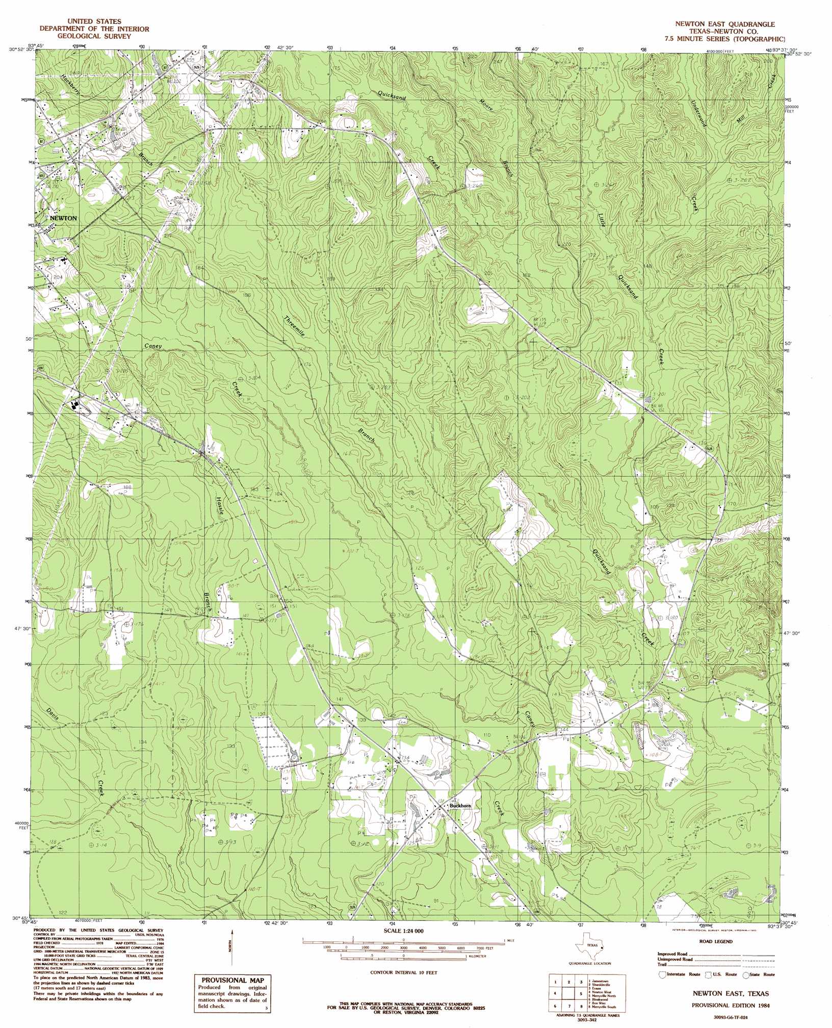
Newton East Topo Map Texas
To zoom in, hover over the map of Newton East
USGS Topo Quad 30093g6 - 1:24,000 scale
| Topo Map Name: | Newton East |
| USGS Topo Quad ID: | 30093g6 |
| Print Size: | ca. 21 1/4" wide x 27" high |
| Southeast Coordinates: | 30.75° N latitude / 93.625° W longitude |
| Map Center Coordinates: | 30.8125° N latitude / 93.6875° W longitude |
| U.S. State: | TX |
| Filename: | o30093g6.jpg |
| Download Map JPG Image: | Newton East topo map 1:24,000 scale |
| Map Type: | Topographic |
| Topo Series: | 7.5´ |
| Map Scale: | 1:24,000 |
| Source of Map Images: | United States Geological Survey (USGS) |
| Alternate Map Versions: |
Newton East TX 1984, updated 1985 Download PDF Buy paper map Newton East TX 2010 Download PDF Buy paper map Newton East TX 2012 Download PDF Buy paper map Newton East TX 2016 Download PDF Buy paper map |
1:24,000 Topo Quads surrounding Newton East
Harrisburg |
Weeks Settlement |
Wiergate |
Wiergate Se |
Burr Ferry |
Jasper East |
Jamestown |
Shankleville |
Evans |
Knight |
Roganville |
Newton West |
Newton East |
Merryville North |
Neale |
Kirbyville |
Bleakwood |
Bon Wier |
Merryville South |
Singer |
Call Junction |
Trout Creek |
Bancroft |
Fields |
Oretta |
> Back to 30093e1 at 1:100,000 scale
> Back to 30092a1 at 1:250,000 scale
> Back to U.S. Topo Maps home
Newton East topo map: Gazetteer
Newton East: Dams
Temple Eastex Dam elevation 37m 121′Newton East: Populated Places
Buckhorn elevation 40m 131′Newton East: Reservoirs
Temple Eastex Lake elevation 37m 121′Newton East: Streams
Hackberry Branch elevation 54m 177′Little Quicksand Creek elevation 27m 88′
Mill Creek elevation 42m 137′
Moore Branch elevation 41m 134′
Threemile Branch elevation 30m 98′
Underwood Creek elevation 36m 118′
Newton East digital topo map on disk
Buy this Newton East topo map showing relief, roads, GPS coordinates and other geographical features, as a high-resolution digital map file on DVD: