Daisetta Topo Map Texas
To zoom in, hover over the map of Daisetta
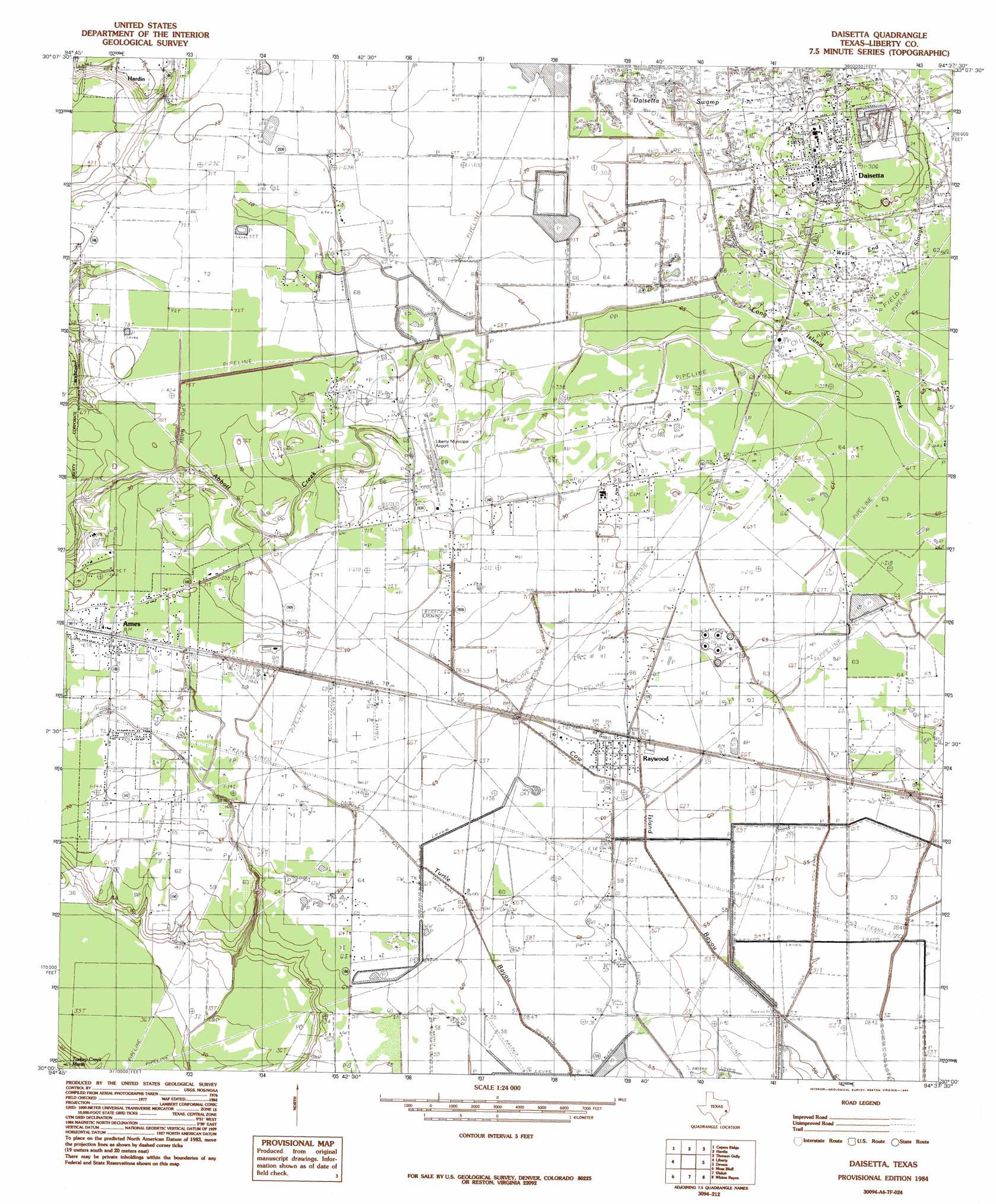
USGS Topo Quad 30094a6 - 1:24,000 scale
| Topo Map Name: | Daisetta |
| USGS Topo Quad ID: | 30094a6 |
| Print Size: | ca. 21 1/4" wide x 27" high |
| Southeast Coordinates: | 30° N latitude / 94.625° W longitude |
| Map Center Coordinates: | 30.0625° N latitude / 94.6875° W longitude |
| U.S. State: | TX |
| Filename: | o30094a6.jpg |
| Download Map JPG Image: | Daisetta topo map 1:24,000 scale |
| Map Type: | Topographic |
| Topo Series: | 7.5´ |
| Map Scale: | 1:24,000 |
| Source of Map Images: | United States Geological Survey (USGS) |
| Alternate Map Versions: |
Daisetta TX 1984, updated 1985 Download PDF Buy paper map Daisetta TX 2010 Download PDF Buy paper map Daisetta TX 2013 Download PDF Buy paper map Daisetta TX 2016 Download PDF Buy paper map |
1:24,000 Topo Quads surrounding Daisetta
Tarkington Prairie |
Davis Hill |
Arizona Creek |
Saratoga |
Kountze Sw |
Simmons Bottom |
Capers Ridge |
Hardin |
Thorson Gully |
Sour Lake |
Dayton |
Liberty |
Daisetta |
Devers |
Nome |
Sheeks |
Moss Bluff |
Shiloh |
Whites Bayou |
Winnie Nw |
Mont Belvieu |
Cove |
Anahuac |
Monroe City |
Stowell |
> Back to 30094a1 at 1:100,000 scale
> Back to 30094a1 at 1:250,000 scale
> Back to U.S. Topo Maps home
Daisetta topo map: Gazetteer
Daisetta: Airports
Darrell Airport elevation 21m 68′Davell Airport elevation 22m 72′
Liberty Municipal Airport elevation 21m 68′
Tri-County Air Service Airport elevation 21m 68′
Daisetta: Dams
George W Maxwell Levee elevation 15m 49′Daisetta: Populated Places
Ames elevation 22m 72′Cow Island elevation 17m 55′
Daisetta elevation 25m 82′
Frige Settlement elevation 22m 72′
Moore Settlement elevation 19m 62′
Raywood elevation 19m 62′
Rock Island elevation 22m 72′
Woodson elevation 21m 68′
Daisetta: Reservoirs
George W Maxwell Reservoir elevation 15m 49′Daisetta: Streams
Long Island Creek elevation 19m 62′Daisetta: Swamps
Daisetta Swamp elevation 21m 68′Daisetta digital topo map on disk
Buy this Daisetta topo map showing relief, roads, GPS coordinates and other geographical features, as a high-resolution digital map file on DVD: