Dayton Topo Map Texas
To zoom in, hover over the map of Dayton
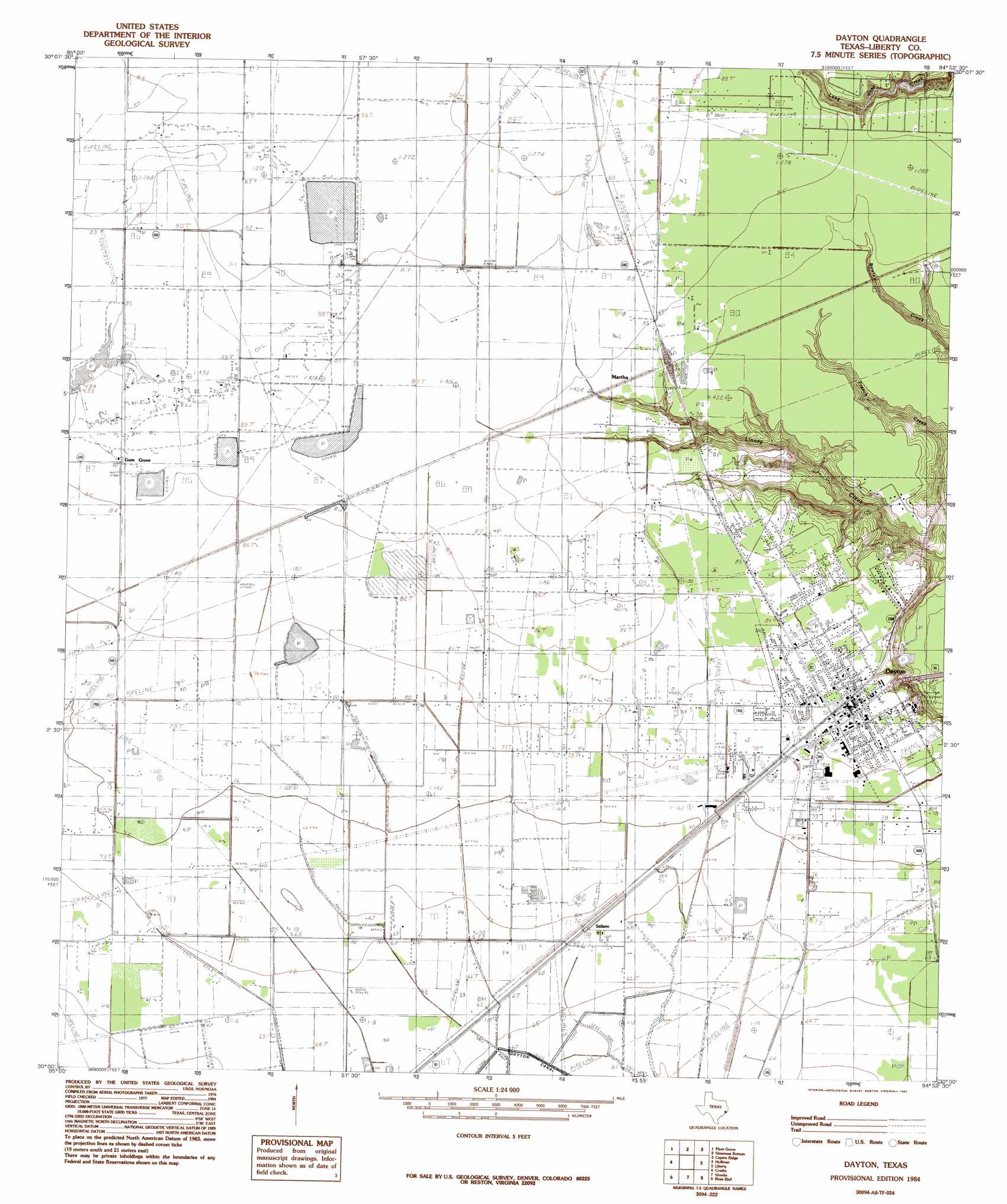
USGS Topo Quad 30094a8 - 1:24,000 scale
| Topo Map Name: | Dayton |
| USGS Topo Quad ID: | 30094a8 |
| Print Size: | ca. 21 1/4" wide x 27" high |
| Southeast Coordinates: | 30° N latitude / 94.875° W longitude |
| Map Center Coordinates: | 30.0625° N latitude / 94.9375° W longitude |
| U.S. State: | TX |
| Filename: | o30094a8.jpg |
| Download Map JPG Image: | Dayton topo map 1:24,000 scale |
| Map Type: | Topographic |
| Topo Series: | 7.5´ |
| Map Scale: | 1:24,000 |
| Source of Map Images: | United States Geological Survey (USGS) |
| Alternate Map Versions: |
Dayton TX 1984, updated 1985 Download PDF Buy paper map Dayton TX 1984, updated 1985 Download PDF Buy paper map Dayton TX 2010 Download PDF Buy paper map Dayton TX 2013 Download PDF Buy paper map Dayton TX 2016 Download PDF Buy paper map |
1:24,000 Topo Quads surrounding Dayton
Fostoria |
Cleveland |
Tarkington Prairie |
Davis Hill |
Arizona Creek |
Splendora |
Plum Grove |
Simmons Bottom |
Capers Ridge |
Hardin |
Moonshine Hill |
Huffman |
Dayton |
Liberty |
Daisetta |
Harmaston |
Crosby |
Sheeks |
Moss Bluff |
Shiloh |
Jacinto City |
Highlands |
Mont Belvieu |
Cove |
Anahuac |
> Back to 30094a1 at 1:100,000 scale
> Back to 30094a1 at 1:250,000 scale
> Back to U.S. Topo Maps home
Dayton topo map: Gazetteer
Dayton: Airports
Jamison Airstrip elevation 25m 82′Jet Ag Incorporated Airport elevation 20m 65′
Pavlat Airport elevation 21m 68′
Pinoak Airport elevation 28m 91′
Seaberg Ranch Airport elevation 20m 65′
Smesny Farms Airport elevation 23m 75′
Dayton: Dams
Winter Valley Estates Dam elevation 19m 62′Dayton: Oilfields
Martha Oil Field elevation 21m 68′North Dayton Oil Field elevation 27m 88′
Dayton: Parks
Dayton City Park elevation 26m 85′Dayton Stadium elevation 25m 82′
Dayton: Populated Places
Dayton elevation 25m 82′Fullerton elevation 23m 75′
Gum Grove elevation 26m 85′
Ladd elevation 25m 82′
Martha elevation 26m 85′
Stilson elevation 21m 68′
Wadley elevation 19m 62′
Dayton: Reservoirs
Winter Valley Estates Lake elevation 19m 62′Dayton digital topo map on disk
Buy this Dayton topo map showing relief, roads, GPS coordinates and other geographical features, as a high-resolution digital map file on DVD: