Kountze Sw Topo Map Texas
To zoom in, hover over the map of Kountze Sw
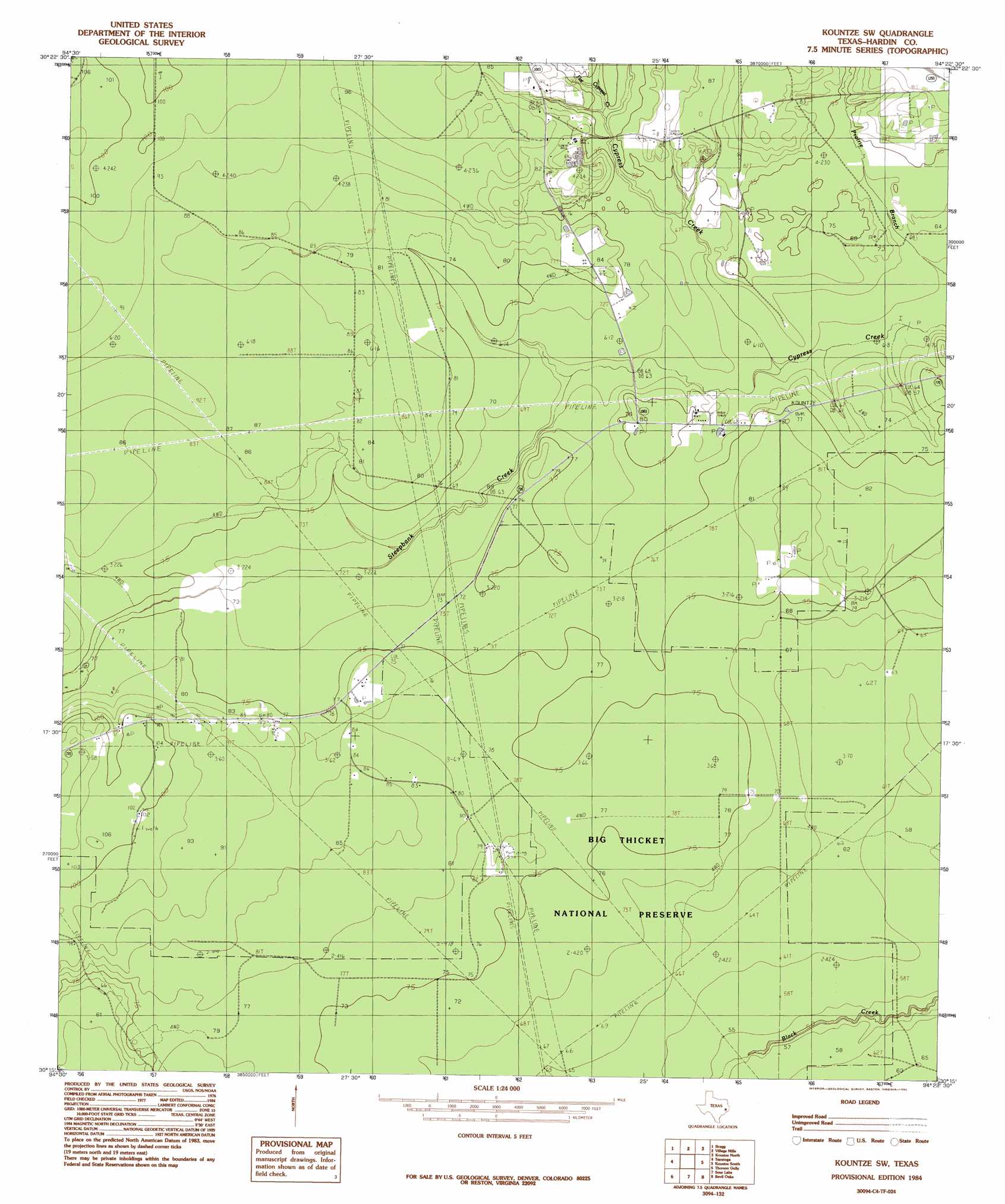
USGS Topo Quad 30094c4 - 1:24,000 scale
| Topo Map Name: | Kountze Sw |
| USGS Topo Quad ID: | 30094c4 |
| Print Size: | ca. 21 1/4" wide x 27" high |
| Southeast Coordinates: | 30.25° N latitude / 94.375° W longitude |
| Map Center Coordinates: | 30.3125° N latitude / 94.4375° W longitude |
| U.S. State: | TX |
| Filename: | o30094c4.jpg |
| Download Map JPG Image: | Kountze Sw topo map 1:24,000 scale |
| Map Type: | Topographic |
| Topo Series: | 7.5´ |
| Map Scale: | 1:24,000 |
| Source of Map Images: | United States Geological Survey (USGS) |
| Alternate Map Versions: |
Kountze SW TX 1984, updated 1985 Download PDF Buy paper map Kountze SW TX 2010 Download PDF Buy paper map Kountze SW TX 2013 Download PDF Buy paper map Kountze SW TX 2016 Download PDF Buy paper map |
1:24,000 Topo Quads surrounding Kountze Sw
Segno |
Jacks Creek South |
Warren |
Hicksbaugh |
Fred |
Votaw |
Bragg |
Village Mills |
Kountze North |
Deserter Baygall |
Arizona Creek |
Saratoga |
Kountze Sw |
Kountze South |
Silsbee |
Hardin |
Thorson Gully |
Sour Lake |
Bevil Oaks |
Voth |
Daisetta |
Devers |
Nome |
China |
Beaumont West |
> Back to 30094a1 at 1:100,000 scale
> Back to 30094a1 at 1:250,000 scale
> Back to U.S. Topo Maps home
Kountze Sw topo map: Gazetteer
Kountze Sw: Streams
Flat Cypress Creek elevation 21m 68′Steepbank Creek elevation 19m 62′
Kountze Sw: Woods
Cypress Brake elevation 21m 68′Kountze Sw digital topo map on disk
Buy this Kountze Sw topo map showing relief, roads, GPS coordinates and other geographical features, as a high-resolution digital map file on DVD: