Segno Topo Map Texas
To zoom in, hover over the map of Segno
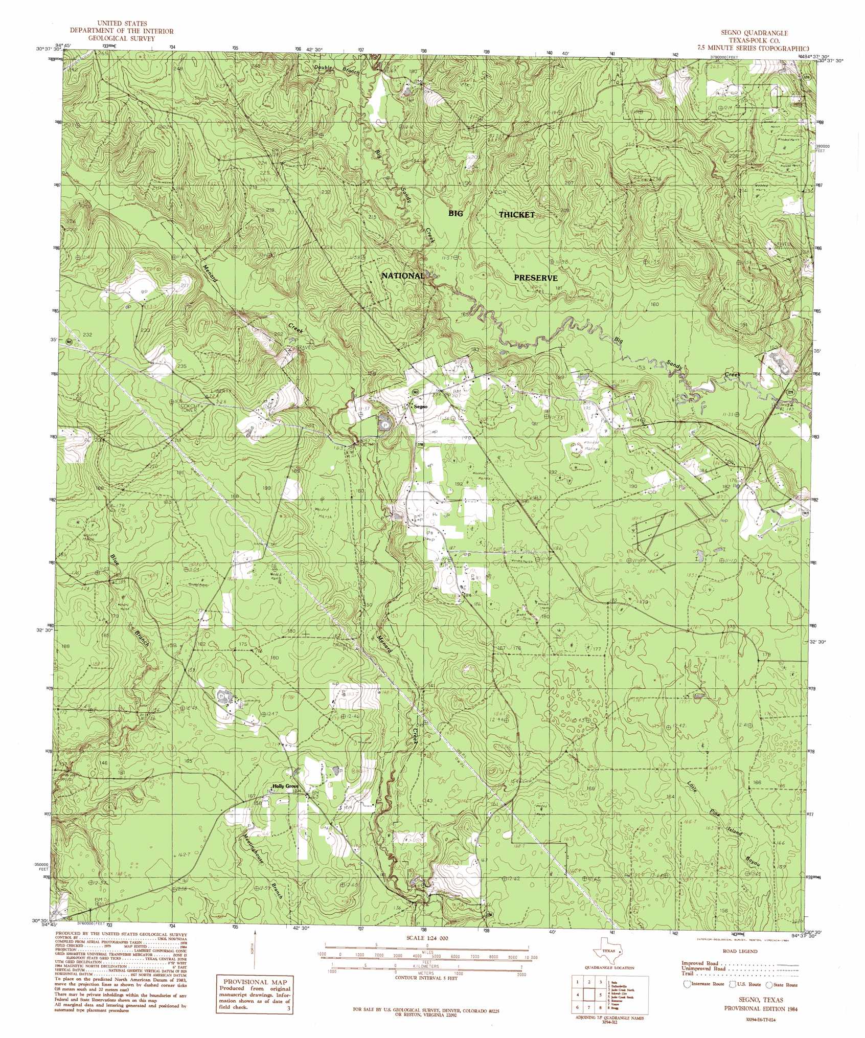
USGS Topo Quad 30094e6 - 1:24,000 scale
| Topo Map Name: | Segno |
| USGS Topo Quad ID: | 30094e6 |
| Print Size: | ca. 21 1/4" wide x 27" high |
| Southeast Coordinates: | 30.5° N latitude / 94.625° W longitude |
| Map Center Coordinates: | 30.5625° N latitude / 94.6875° W longitude |
| U.S. State: | TX |
| Filename: | o30094e6.jpg |
| Download Map JPG Image: | Segno topo map 1:24,000 scale |
| Map Type: | Topographic |
| Topo Series: | 7.5´ |
| Map Scale: | 1:24,000 |
| Source of Map Images: | United States Geological Survey (USGS) |
| Alternate Map Versions: |
Segno TX 1984, updated 1984 Download PDF Buy paper map Segno TX 2010 Download PDF Buy paper map Segno TX 2013 Download PDF Buy paper map Segno TX 2016 Download PDF Buy paper map |
1:24,000 Topo Quads surrounding Segno
New Willard |
Leggett |
Hortense |
Chambliss Hill |
Woodville |
Livingston |
Soda |
Dallardsville |
Jacks Creek North |
Hillister |
Goodrich |
Schwab City |
Segno |
Jacks Creek South |
Warren |
Rayburn |
Romayor |
Votaw |
Bragg |
Village Mills |
Tarkington Prairie |
Davis Hill |
Arizona Creek |
Saratoga |
Kountze Sw |
> Back to 30094e1 at 1:100,000 scale
> Back to 30094a1 at 1:250,000 scale
> Back to U.S. Topo Maps home
Segno topo map: Gazetteer
Segno: Populated Places
Holly Grove elevation 50m 164′Segno elevation 63m 206′
Segno: Streams
Double Branch elevation 52m 170′Segno: Trails
Big Thicket - Beaver Slide Trail elevation 47m 154′Big Thicket - Big Sandy Trail elevation 68m 223′
Segno digital topo map on disk
Buy this Segno topo map showing relief, roads, GPS coordinates and other geographical features, as a high-resolution digital map file on DVD: