Magnolia Springs Topo Map Texas
To zoom in, hover over the map of Magnolia Springs
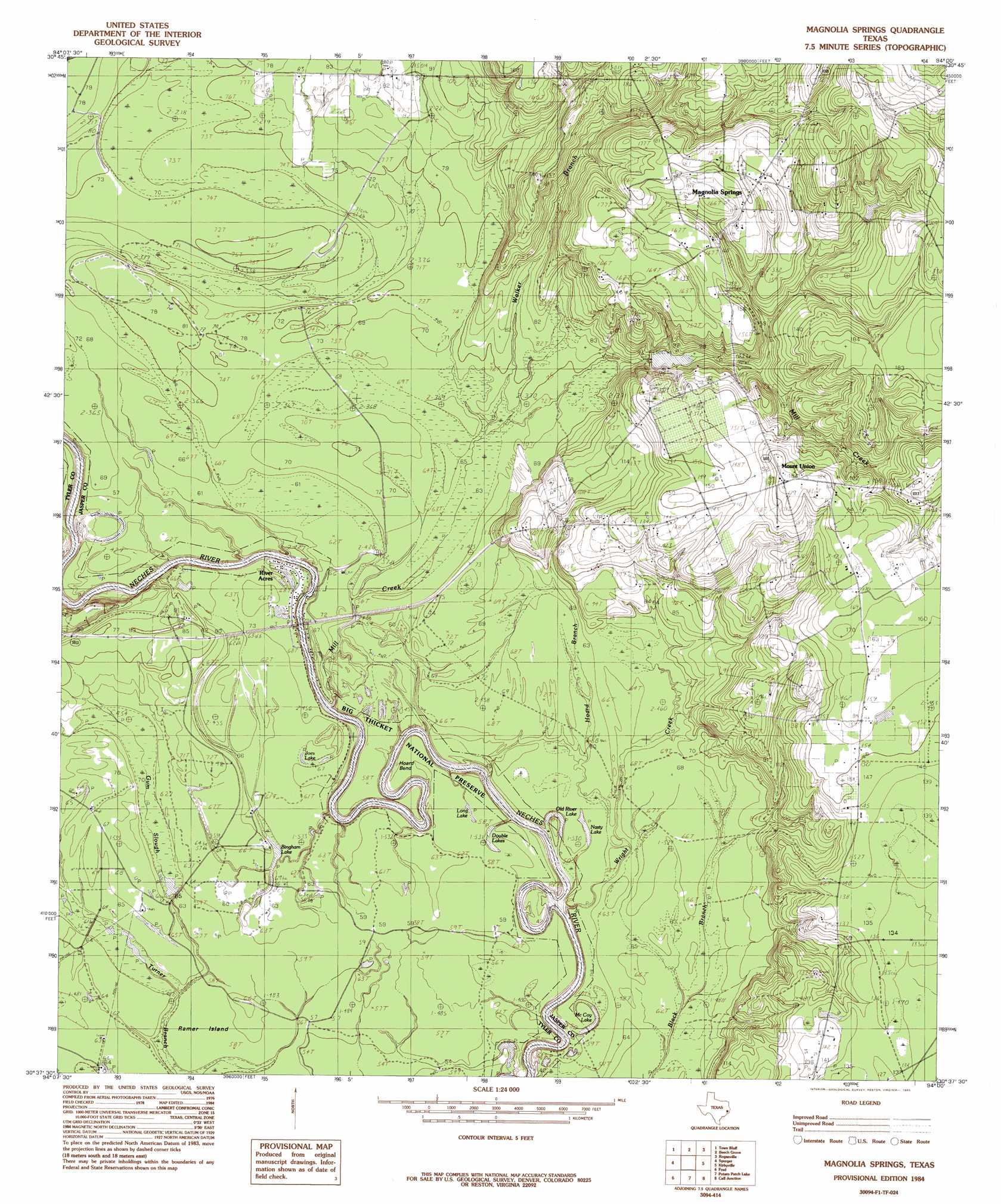
USGS Topo Quad 30094f1 - 1:24,000 scale
| Topo Map Name: | Magnolia Springs |
| USGS Topo Quad ID: | 30094f1 |
| Print Size: | ca. 21 1/4" wide x 27" high |
| Southeast Coordinates: | 30.625° N latitude / 94° W longitude |
| Map Center Coordinates: | 30.6875° N latitude / 94.0625° W longitude |
| U.S. State: | TX |
| Filename: | o30094f1.jpg |
| Download Map JPG Image: | Magnolia Springs topo map 1:24,000 scale |
| Map Type: | Topographic |
| Topo Series: | 7.5´ |
| Map Scale: | 1:24,000 |
| Source of Map Images: | United States Geological Survey (USGS) |
| Alternate Map Versions: |
Magnolia Springs TX 1984, updated 1985 Download PDF Buy paper map Magnolia Springs TX 2010 Download PDF Buy paper map Magnolia Springs TX 2013 Download PDF Buy paper map Magnolia Springs TX 2016 Download PDF Buy paper map |
1:24,000 Topo Quads surrounding Magnolia Springs
Boggy Lake |
Pace Hill |
Jasper West |
Jasper East |
Jamestown |
Birdwell Lake |
Town Bluff |
Beech Grove |
Roganville |
Newton West |
Kirkpatrick Lake |
Spurger |
Magnolia Springs |
Kirbyville |
Bleakwood |
Hicksbaugh |
Fred |
Potato Patch Lake |
Call Junction |
Trout Creek |
Kountze North |
Deserter Baygall |
Franklin Lake |
Buna |
Sudduth Bluff |
> Back to 30094e1 at 1:100,000 scale
> Back to 30094a1 at 1:250,000 scale
> Back to U.S. Topo Maps home
Magnolia Springs topo map: Gazetteer
Magnolia Springs: Dams
Magnolia Springs Dam elevation 38m 124′Magnolia Springs: Oilfields
Joes Lake Oil Field elevation 18m 59′Magnolia Springs: Populated Places
Magnolia Springs elevation 52m 170′Mount Union elevation 56m 183′
Magnolia Springs: Reservoirs
Magnolia Springs Lake elevation 38m 124′Magnolia Springs: Streams
Mill Creek elevation 14m 45′Walker Branch elevation 20m 65′
Magnolia Springs digital topo map on disk
Buy this Magnolia Springs topo map showing relief, roads, GPS coordinates and other geographical features, as a high-resolution digital map file on DVD: