New Willard Topo Map Texas
To zoom in, hover over the map of New Willard
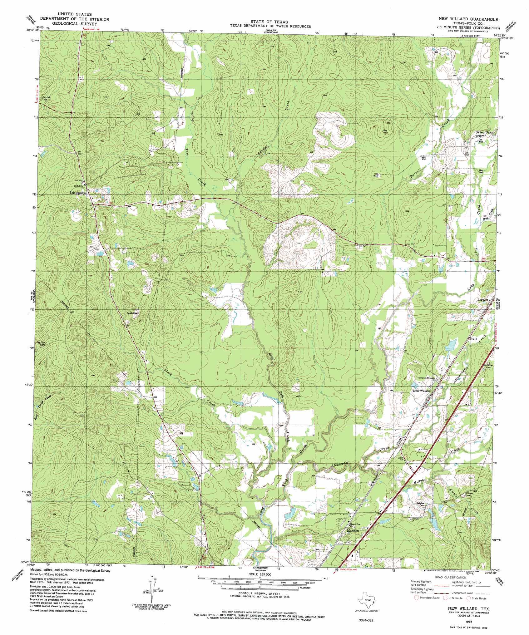
USGS Topo Quad 30094g8 - 1:24,000 scale
| Topo Map Name: | New Willard |
| USGS Topo Quad ID: | 30094g8 |
| Print Size: | ca. 21 1/4" wide x 27" high |
| Southeast Coordinates: | 30.75° N latitude / 94.875° W longitude |
| Map Center Coordinates: | 30.8125° N latitude / 94.9375° W longitude |
| U.S. State: | TX |
| Filename: | o30094g8.jpg |
| Download Map JPG Image: | New Willard topo map 1:24,000 scale |
| Map Type: | Topographic |
| Topo Series: | 7.5´ |
| Map Scale: | 1:24,000 |
| Source of Map Images: | United States Geological Survey (USGS) |
| Alternate Map Versions: |
New Willard TX 1984, updated 1984 Download PDF Buy paper map New Willard TX 2010 Download PDF Buy paper map New Willard TX 2013 Download PDF Buy paper map New Willard TX 2016 Download PDF Buy paper map |
1:24,000 Topo Quads surrounding New Willard
Groveton West |
Groveton East |
Trevat |
Wakefield |
Pluck |
Chita |
Colita |
Carmona |
Corrigan |
Camden |
Carlisle |
Onalaska |
New Willard |
Leggett |
Hortense |
Stephen Creek |
Blanchard |
Livingston |
Soda |
Dallardsville |
Coldspring |
Camilla |
Goodrich |
Schwab City |
Segno |
> Back to 30094e1 at 1:100,000 scale
> Back to 30094a1 at 1:250,000 scale
> Back to U.S. Topo Maps home
New Willard topo map: Gazetteer
New Willard: Dams
Myrtle Lake Dam elevation 75m 246′New Willard: Populated Places
Bold Springs elevation 116m 380′Marston elevation 61m 200′
New Willard elevation 72m 236′
New Willard: Springs
Bold Springs elevation 77m 252′Kokernot Spring elevation 102m 334′
New Willard: Streams
Alexander Creek elevation 45m 147′Barnett Creek elevation 52m 170′
Kibble Creek elevation 48m 157′
Long Tom Creek elevation 43m 141′
Milton Creek elevation 55m 180′
Mud Creek elevation 54m 177′
Sandy Creek elevation 57m 187′
New Willard digital topo map on disk
Buy this New Willard topo map showing relief, roads, GPS coordinates and other geographical features, as a high-resolution digital map file on DVD: