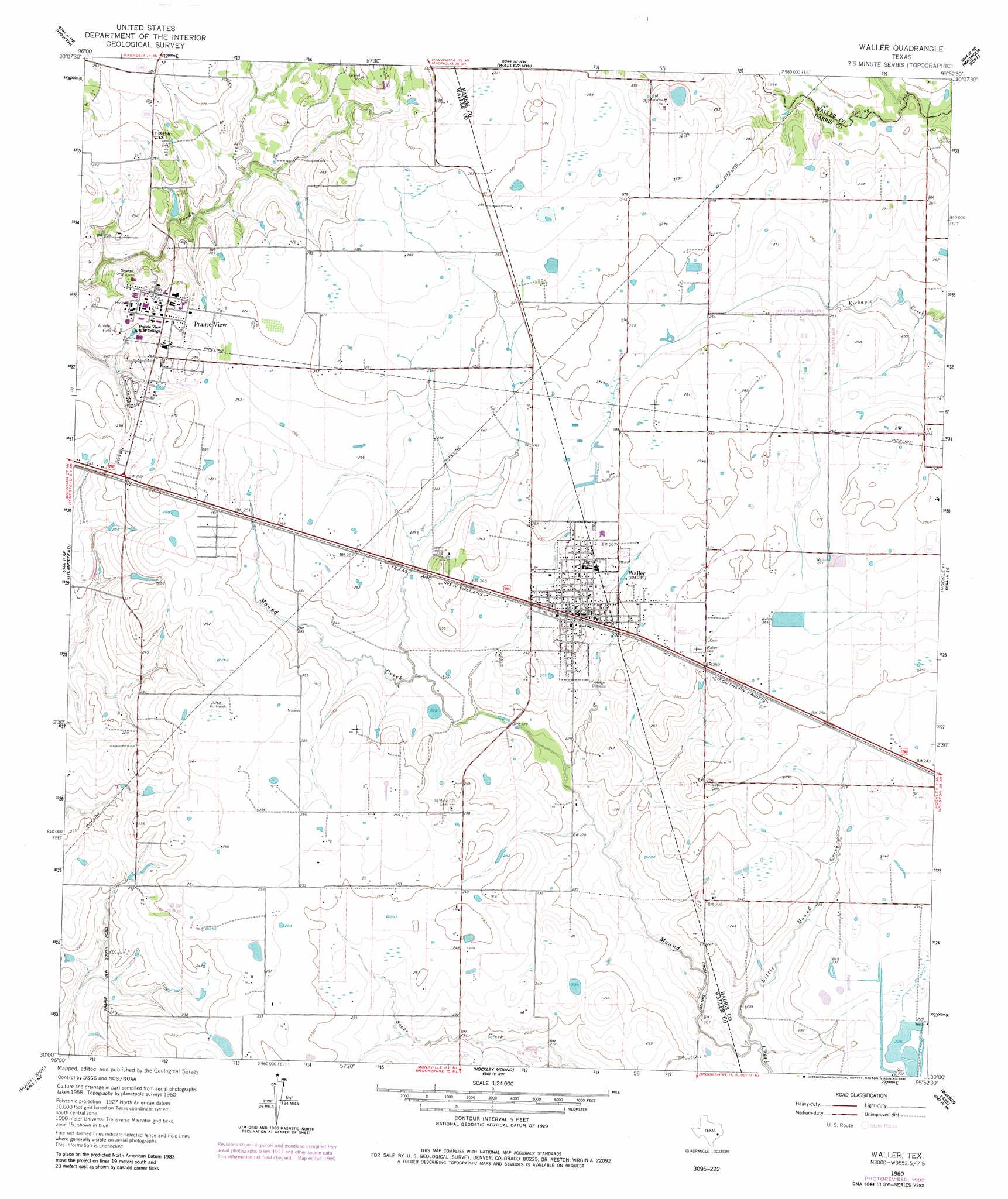
Waller Topo Map Texas
To zoom in, hover over the map of Waller
USGS Topo Quad 30095a8 - 1:24,000 scale
| Topo Map Name: | Waller |
| USGS Topo Quad ID: | 30095a8 |
| Print Size: | ca. 21 1/4" wide x 27" high |
| Southeast Coordinates: | 30° N latitude / 95.875° W longitude |
| Map Center Coordinates: | 30.0625° N latitude / 95.9375° W longitude |
| U.S. State: | TX |
| Filename: | o30095a8.jpg |
| Download Map JPG Image: | Waller topo map 1:24,000 scale |
| Map Type: | Topographic |
| Topo Series: | 7.5´ |
| Map Scale: | 1:24,000 |
| Source of Map Images: | United States Geological Survey (USGS) |
| Alternate Map Versions: |
Waller TX 1960, updated 1961 Download PDF Buy paper map Waller TX 1960, updated 1973 Download PDF Buy paper map Waller TX 1960, updated 1980 Download PDF Buy paper map Waller TX 1960, updated 1980 Download PDF Buy paper map Waller TX 2010 Download PDF Buy paper map Waller TX 2013 Download PDF Buy paper map Waller TX 2016 Download PDF Buy paper map |
1:24,000 Topo Quads surrounding Waller
Washington |
Courtney |
Stoneham |
Plantersville |
Keenan |
Daniels |
Howth |
Waller Nw |
Magnolia West |
Magnolia East |
Buckhorn |
Hempstead |
Waller |
Hockley |
Rose Hill |
Burleigh |
Sunny Side |
Hockley Mound |
Warren Lake |
Cypress |
Sealy |
San Felipe |
Brookshire |
Katy |
Addicks |
> Back to 30095a1 at 1:100,000 scale
> Back to 30094a1 at 1:250,000 scale
> Back to U.S. Topo Maps home
Waller topo map: Gazetteer
Waller: Dams
Adams Lake Dam elevation 83m 272′Dennison Lake Dam elevation 70m 229′
Waller: Populated Places
Prairie View elevation 82m 269′Waller elevation 76m 249′
Waller: Reservoirs
Adams Lake elevation 83m 272′Dennison Lake elevation 70m 229′
Waller: Streams
Little Mound Creek elevation 60m 196′Waller digital topo map on disk
Buy this Waller topo map showing relief, roads, GPS coordinates and other geographical features, as a high-resolution digital map file on DVD: