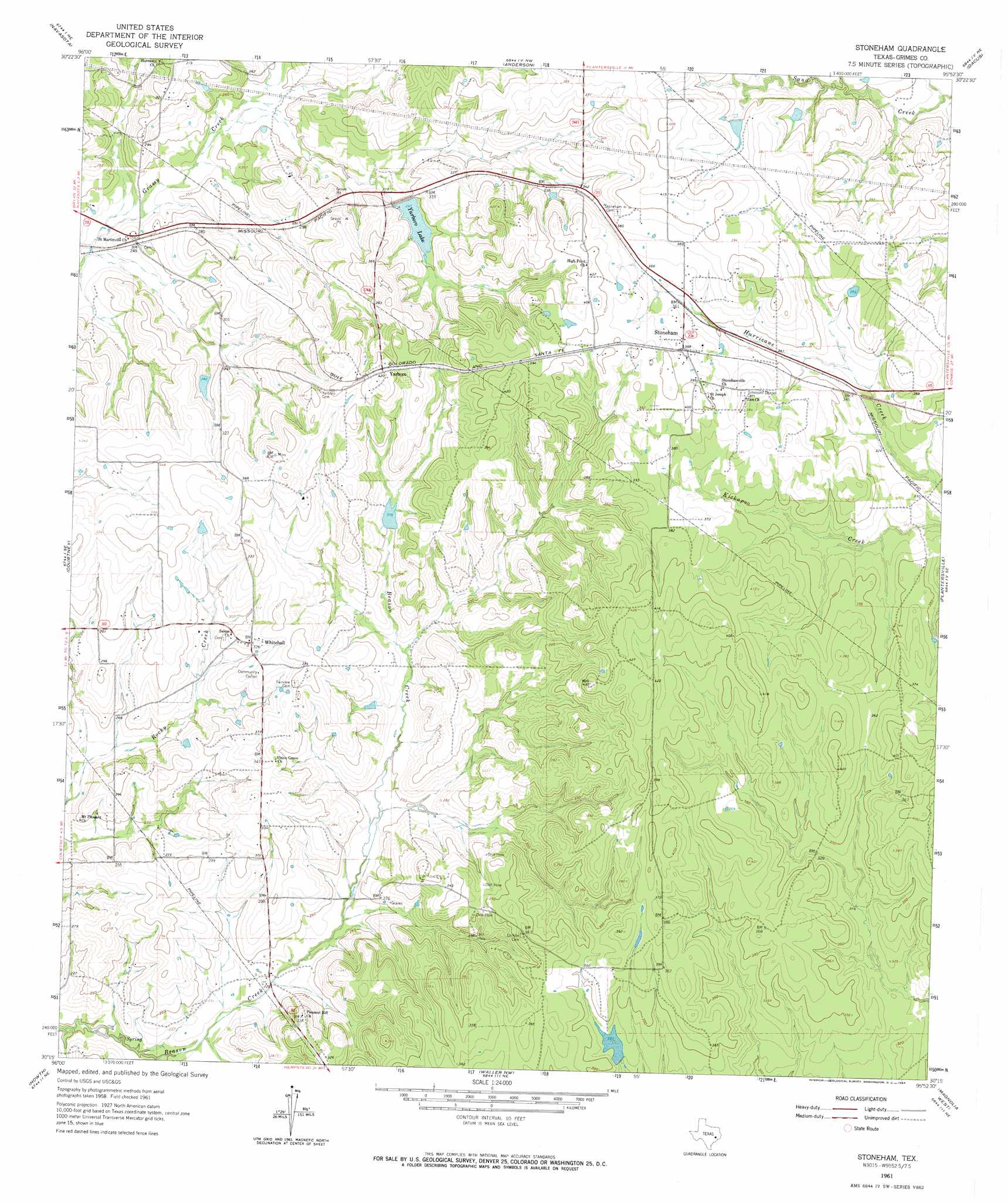
Stoneham Topo Map Texas
To zoom in, hover over the map of Stoneham
USGS Topo Quad 30095c8 - 1:24,000 scale
| Topo Map Name: | Stoneham |
| USGS Topo Quad ID: | 30095c8 |
| Print Size: | ca. 21 1/4" wide x 27" high |
| Southeast Coordinates: | 30.25° N latitude / 95.875° W longitude |
| Map Center Coordinates: | 30.3125° N latitude / 95.9375° W longitude |
| U.S. State: | TX |
| Filename: | o30095c8.jpg |
| Download Map JPG Image: | Stoneham topo map 1:24,000 scale |
| Map Type: | Topographic |
| Topo Series: | 7.5´ |
| Map Scale: | 1:24,000 |
| Source of Map Images: | United States Geological Survey (USGS) |
| Alternate Map Versions: |
Stoneham TX 1961, updated 1964 Download PDF Buy paper map Stoneham TX 2010 Download PDF Buy paper map Stoneham TX 2013 Download PDF Buy paper map Stoneham TX 2016 Download PDF Buy paper map |
1:24,000 Topo Quads surrounding Stoneham
Ferguson Crossing |
Carlos |
Roans Prairie |
Richards |
San Jacinto |
Millican |
Navasota |
Anderson |
Dacus |
Montgomery |
Washington |
Courtney |
Stoneham |
Plantersville |
Keenan |
Daniels |
Howth |
Waller Nw |
Magnolia West |
Magnolia East |
Buckhorn |
Hempstead |
Waller |
Hockley |
Rose Hill |
> Back to 30095a1 at 1:100,000 scale
> Back to 30094a1 at 1:250,000 scale
> Back to U.S. Topo Maps home
Stoneham topo map: Gazetteer
Stoneham: Dams
Koehl Lake Dam elevation 92m 301′Lake Winona Dam elevation 100m 328′
Ward-Haworth Lake Dam elevation 94m 308′
Yarboro Dam elevation 96m 314′
Stoneham: Populated Places
Stoneham elevation 115m 377′Whitehall elevation 99m 324′
Yarboro elevation 126m 413′
Stoneham: Reservoirs
Koehl Lake elevation 92m 301′Lake Winona elevation 100m 328′
Ward-Haworth Lake elevation 94m 308′
Yarboro Lake elevation 91m 298′
Stoneham digital topo map on disk
Buy this Stoneham topo map showing relief, roads, GPS coordinates and other geographical features, as a high-resolution digital map file on DVD: