Roans Prairie Topo Map Texas
To zoom in, hover over the map of Roans Prairie
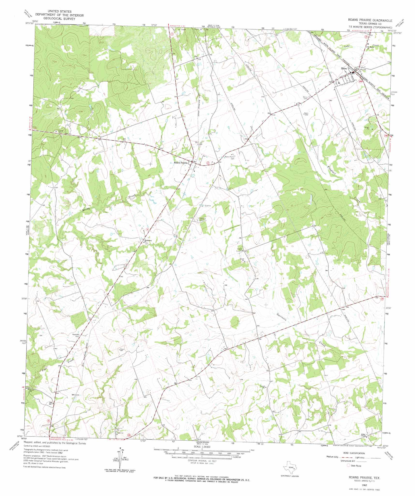
USGS Topo Quad 30095e8 - 1:24,000 scale
| Topo Map Name: | Roans Prairie |
| USGS Topo Quad ID: | 30095e8 |
| Print Size: | ca. 21 1/4" wide x 27" high |
| Southeast Coordinates: | 30.5° N latitude / 95.875° W longitude |
| Map Center Coordinates: | 30.5625° N latitude / 95.9375° W longitude |
| U.S. State: | TX |
| Filename: | o30095e8.jpg |
| Download Map JPG Image: | Roans Prairie topo map 1:24,000 scale |
| Map Type: | Topographic |
| Topo Series: | 7.5´ |
| Map Scale: | 1:24,000 |
| Source of Map Images: | United States Geological Survey (USGS) |
| Alternate Map Versions: |
Roans Prairie TX 1962, updated 1964 Download PDF Buy paper map Roans Prairie TX 2010 Download PDF Buy paper map Roans Prairie TX 2013 Download PDF Buy paper map Roans Prairie TX 2016 Download PDF Buy paper map |
1:24,000 Topo Quads surrounding Roans Prairie
Clear Lake |
Iola |
Bedias |
Steep Branch |
Crabbs Prairie |
Reliance |
Keith |
Singleton |
Loma |
Galilee |
Ferguson Crossing |
Carlos |
Roans Prairie |
Richards |
San Jacinto |
Millican |
Navasota |
Anderson |
Dacus |
Montgomery |
Washington |
Courtney |
Stoneham |
Plantersville |
Keenan |
> Back to 30095e1 at 1:100,000 scale
> Back to 30094a1 at 1:250,000 scale
> Back to U.S. Topo Maps home
Roans Prairie topo map: Gazetteer
Roans Prairie: Dams
Hideaway Hills Lake Dam elevation 103m 337′Roans Prairie: Populated Places
Roans Prairie elevation 111m 364′Shiro elevation 107m 351′
Roans Prairie: Reservoirs
Hideaway Lake elevation 103m 337′Roans Prairie: Springs
Gibbons Spring elevation 97m 318′Roans Prairie digital topo map on disk
Buy this Roans Prairie topo map showing relief, roads, GPS coordinates and other geographical features, as a high-resolution digital map file on DVD: