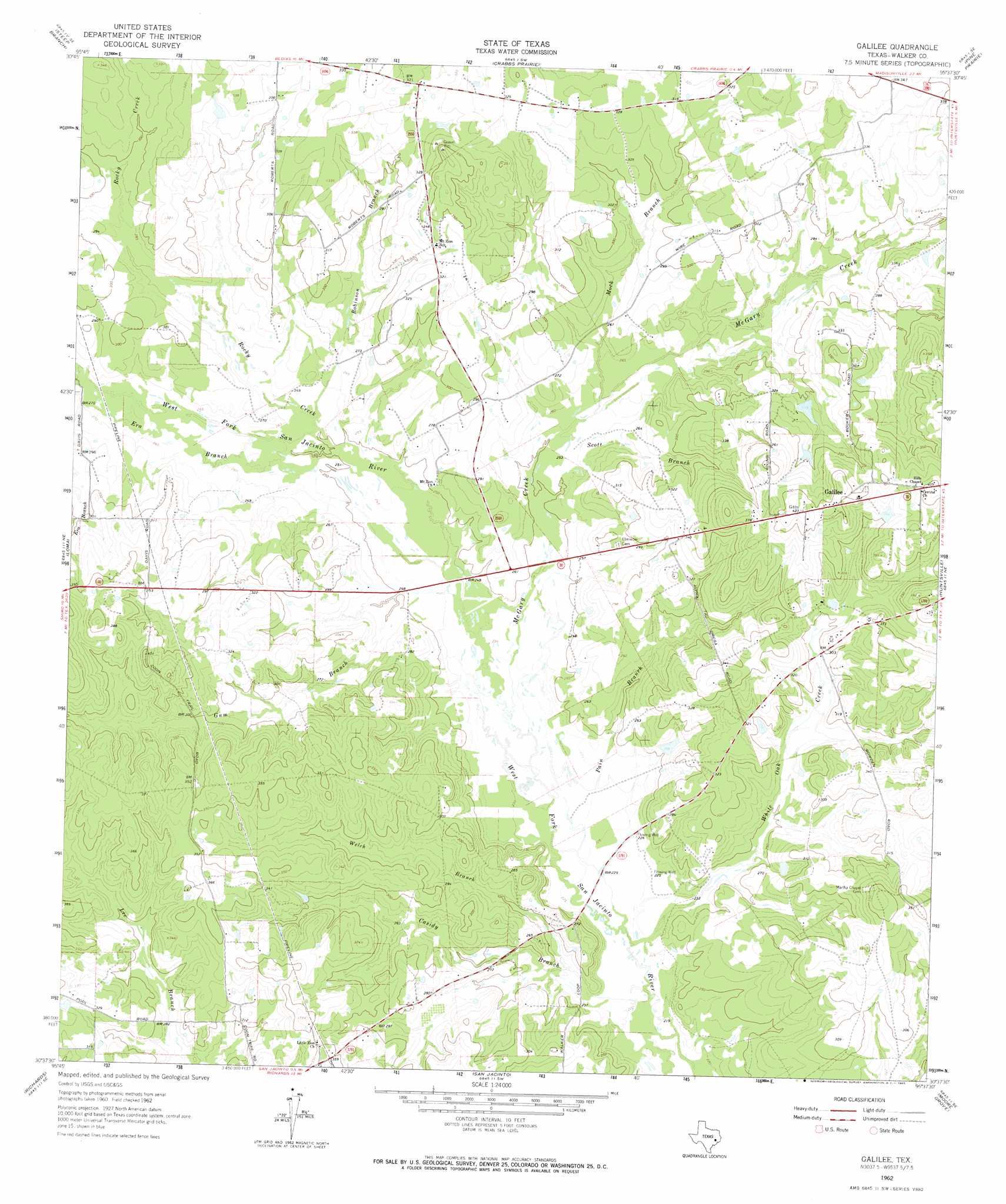
Galilee Topo Map Texas
To zoom in, hover over the map of Galilee
USGS Topo Quad 30095f6 - 1:24,000 scale
| Topo Map Name: | Galilee |
| USGS Topo Quad ID: | 30095f6 |
| Print Size: | ca. 21 1/4" wide x 27" high |
| Southeast Coordinates: | 30.625° N latitude / 95.625° W longitude |
| Map Center Coordinates: | 30.6875° N latitude / 95.6875° W longitude |
| U.S. State: | TX |
| Filename: | o30095f6.jpg |
| Download Map JPG Image: | Galilee topo map 1:24,000 scale |
| Map Type: | Topographic |
| Topo Series: | 7.5´ |
| Map Scale: | 1:24,000 |
| Source of Map Images: | United States Geological Survey (USGS) |
| Alternate Map Versions: |
Galilee TX 1962, updated 1965 Download PDF Buy paper map Galilee TX 2010 Download PDF Buy paper map Galilee TX 2013 Download PDF Buy paper map Galilee TX 2016 Download PDF Buy paper map |
1:24,000 Topo Quads surrounding Galilee
Madisonville |
Connor |
Baker Lake |
Wyser Bottom |
Trinity West |
Bedias |
Steep Branch |
Crabbs Prairie |
Pine Prairie |
Riverside |
Singleton |
Loma |
Galilee |
Huntsville |
Phelps |
Roans Prairie |
Richards |
San Jacinto |
Moore Grove |
New Waverly |
Anderson |
Dacus |
Montgomery |
Shepard Hill |
Willis |
> Back to 30095e1 at 1:100,000 scale
> Back to 30094a1 at 1:250,000 scale
> Back to U.S. Topo Maps home
Galilee topo map: Gazetteer
Galilee: Dams
Hendricks Lake Dam elevation 91m 298′Muecke Dam elevation 90m 295′
Galilee: Populated Places
Galilee elevation 123m 403′Galilee: Reservoirs
Hendricks Lake elevation 91m 298′Muecke Lake elevation 90m 295′
Galilee: Streams
Casidy Branch elevation 67m 219′Era Branch elevation 78m 255′
Gum Branch elevation 72m 236′
McGary Creek elevation 70m 229′
Mock Branch elevation 79m 259′
Pain Branch elevation 68m 223′
Robinson Branch elevation 76m 249′
Rocky Creek elevation 76m 249′
Scott Branch elevation 74m 242′
Welch Branch elevation 70m 229′
White Oak Creek elevation 67m 219′
Galilee digital topo map on disk
Buy this Galilee topo map showing relief, roads, GPS coordinates and other geographical features, as a high-resolution digital map file on DVD: