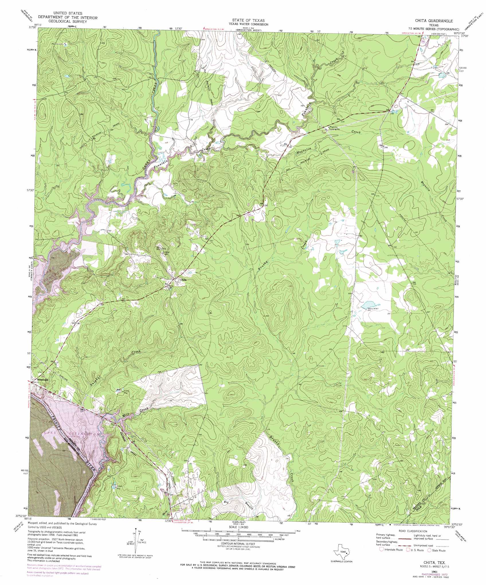
Chita Topo Map Texas
To zoom in, hover over the map of Chita
USGS Topo Quad 30095h2 - 1:24,000 scale
| Topo Map Name: | Chita |
| USGS Topo Quad ID: | 30095h2 |
| Print Size: | ca. 21 1/4" wide x 27" high |
| Southeast Coordinates: | 30.875° N latitude / 95.125° W longitude |
| Map Center Coordinates: | 30.9375° N latitude / 95.1875° W longitude |
| U.S. State: | TX |
| Filename: | o30095h2.jpg |
| Download Map JPG Image: | Chita topo map 1:24,000 scale |
| Map Type: | Topographic |
| Topo Series: | 7.5´ |
| Map Scale: | 1:24,000 |
| Source of Map Images: | United States Geological Survey (USGS) |
| Alternate Map Versions: |
Chita TX 2010 Download PDF Buy paper map Chita TX 2013 Download PDF Buy paper map Chita TX 2016 Download PDF Buy paper map |
1:24,000 Topo Quads surrounding Chita
Lovelady North |
Fodice |
Pennington |
Crecy |
Apple Springs |
Lovelady South |
Glendale |
Groveton West |
Groveton East |
Trevat |
Trinity West |
Trinity East |
Chita |
Colita |
Carmona |
Riverside |
Staley |
Carlisle |
Onalaska |
New Willard |
Phelps |
Oakhurst |
Stephen Creek |
Blanchard |
Livingston |
> Back to 30095e1 at 1:100,000 scale
> Back to 30094a1 at 1:250,000 scale
> Back to U.S. Topo Maps home
Chita topo map: Gazetteer
Chita: Dams
Haynes Lake Dam elevation 68m 223′Chita: Populated Places
Chita elevation 91m 298′Sebastopol elevation 48m 157′
Chita: Reservoirs
Haynes Lake elevation 68m 223′Chita: Streams
Fountain Creek elevation 40m 131′Magnolia Creek elevation 44m 144′
Mill Creek elevation 40m 131′
Sulphur Creek elevation 40m 131′
Chita digital topo map on disk
Buy this Chita topo map showing relief, roads, GPS coordinates and other geographical features, as a high-resolution digital map file on DVD: