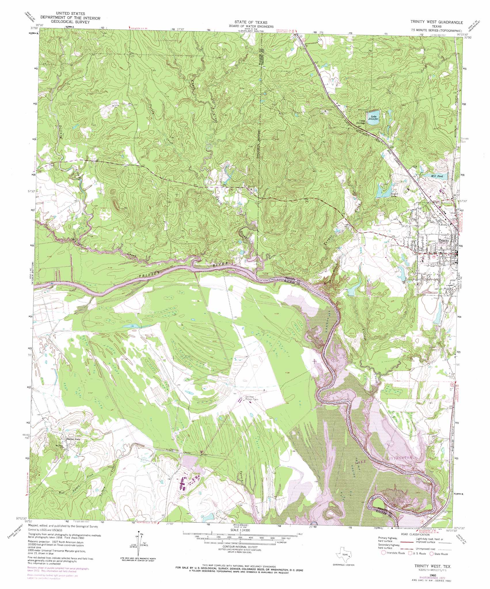
Trinity West Topo Map Texas
To zoom in, hover over the map of Trinity West
USGS Topo Quad 30095h4 - 1:24,000 scale
| Topo Map Name: | Trinity West |
| USGS Topo Quad ID: | 30095h4 |
| Print Size: | ca. 21 1/4" wide x 27" high |
| Southeast Coordinates: | 30.875° N latitude / 95.375° W longitude |
| Map Center Coordinates: | 30.9375° N latitude / 95.4375° W longitude |
| U.S. State: | TX |
| Filename: | o30095h4.jpg |
| Download Map JPG Image: | Trinity West topo map 1:24,000 scale |
| Map Type: | Topographic |
| Topo Series: | 7.5´ |
| Map Scale: | 1:24,000 |
| Source of Map Images: | United States Geological Survey (USGS) |
| Alternate Map Versions: |
Trinity West TX 1960, updated 1962 Download PDF Buy paper map Trinity West TX 1960, updated 1974 Download PDF Buy paper map Trinity West TX 1960, updated 1974 Download PDF Buy paper map Trinity West TX 2010 Download PDF Buy paper map Trinity West TX 2013 Download PDF Buy paper map Trinity West TX 2016 Download PDF Buy paper map |
1:24,000 Topo Quads surrounding Trinity West
Austonio |
Pearsons Chapel |
Lovelady North |
Fodice |
Pennington |
Sand Ridge |
Weldon |
Lovelady South |
Glendale |
Groveton West |
Baker Lake |
Wyser Bottom |
Trinity West |
Trinity East |
Chita |
Crabbs Prairie |
Pine Prairie |
Riverside |
Staley |
Carlisle |
Galilee |
Huntsville |
Phelps |
Oakhurst |
Stephen Creek |
> Back to 30095e1 at 1:100,000 scale
> Back to 30094a1 at 1:250,000 scale
> Back to U.S. Topo Maps home
Trinity West topo map: Gazetteer
Trinity West: Canals
Turkey Creek Ditch elevation 43m 141′Trinity West: Dams
Eastham and Thomason Ranches Lake Dam elevation 53m 173′Ellis Reservoir Dam elevation 45m 147′
Haraldson Lake Dam elevation 56m 183′
Lake Jennifer Dam elevation 75m 246′
Mill Pond Dam elevation 71m 232′
Sentell Lake Dam elevation 67m 219′
Thornton Lake Dam elevation 61m 200′
Trinity West: Parks
Stewart Memorial Park elevation 65m 213′Trinity West: Populated Places
Kittrell elevation 49m 160′Trinity elevation 71m 232′
Trinity West: Reservoirs
Eastham and Thomason Ranches Lake elevation 53m 173′Ellis Reservoir elevation 45m 147′
Haraldson Lake elevation 56m 183′
Lake Jennifer elevation 75m 246′
Mill Pond elevation 72m 236′
Sentell Lake elevation 71m 232′
Thornton Lake elevation 61m 200′
Trinity West: Streams
Baggy Branch elevation 40m 131′Chalk Creek elevation 40m 131′
Dillard Creek elevation 40m 131′
Turkey Creek elevation 44m 144′
Turner Creek elevation 40m 131′
Village Creek elevation 40m 131′
West Turkey Creek elevation 46m 150′
Whites Creek elevation 40m 131′
Trinity West digital topo map on disk
Buy this Trinity West topo map showing relief, roads, GPS coordinates and other geographical features, as a high-resolution digital map file on DVD: