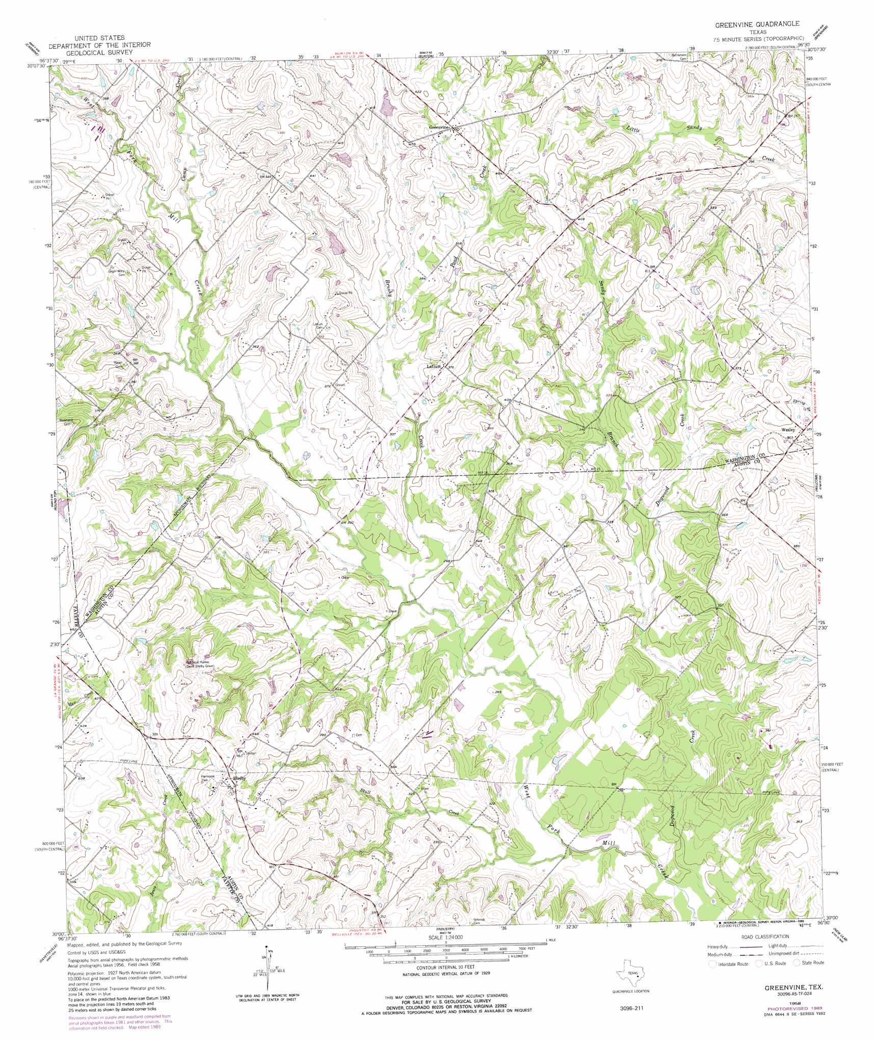
Greenvine Topo Map Texas
To zoom in, hover over the map of Greenvine
USGS Topo Quad 30096a5 - 1:24,000 scale
| Topo Map Name: | Greenvine |
| USGS Topo Quad ID: | 30096a5 |
| Print Size: | ca. 21 1/4" wide x 27" high |
| Southeast Coordinates: | 30° N latitude / 96.5° W longitude |
| Map Center Coordinates: | 30.0625° N latitude / 96.5625° W longitude |
| U.S. State: | TX |
| Filename: | o30096a5.jpg |
| Download Map JPG Image: | Greenvine topo map 1:24,000 scale |
| Map Type: | Topographic |
| Topo Series: | 7.5´ |
| Map Scale: | 1:24,000 |
| Source of Map Images: | United States Geological Survey (USGS) |
| Alternate Map Versions: |
Greenvine TX 1958, updated 1959 Download PDF Buy paper map Greenvine TX 1958, updated 1989 Download PDF Buy paper map Greenvine TX 2010 Download PDF Buy paper map Greenvine TX 2013 Download PDF Buy paper map Greenvine TX 2016 Download PDF Buy paper map |
1:24,000 Topo Quads surrounding Greenvine
Dime Box |
Flag Pond |
Somerville |
Gay Hill |
Independence |
Ledbetter |
Carmine |
Burton |
Brenham |
Chappell Hill |
Nechanitz |
Round Top |
Greenvine |
Welcome |
Kenney |
La Grange East |
Fayetteville |
Industry |
New Ulm |
Bellville |
Ammannsville |
Ellinger |
Frelsburg |
Bernardo |
Cat Spring |
> Back to 30096a1 at 1:100,000 scale
> Back to 30096a1 at 1:250,000 scale
> Back to U.S. Topo Maps home
Greenvine topo map: Gazetteer
Greenvine: Dams
Loftin Lake Dam elevation 114m 374′Greenvine: Parks
Harmonie Park elevation 133m 436′Historical Marker elevation 129m 423′
Greenvine: Populated Places
Greenvine elevation 134m 439′Latium elevation 115m 377′
Shelby elevation 138m 452′
Wesley elevation 113m 370′
Greenvine: Reservoirs
Loftin Lake elevation 114m 374′Greenvine: Streams
Brushy Creek elevation 85m 278′Camp Creek elevation 96m 314′
Pond Creek elevation 91m 298′
Sandy Branch elevation 87m 285′
Skull Creek elevation 77m 252′
Greenvine digital topo map on disk
Buy this Greenvine topo map showing relief, roads, GPS coordinates and other geographical features, as a high-resolution digital map file on DVD: