Nechanitz Topo Map Texas
To zoom in, hover over the map of Nechanitz
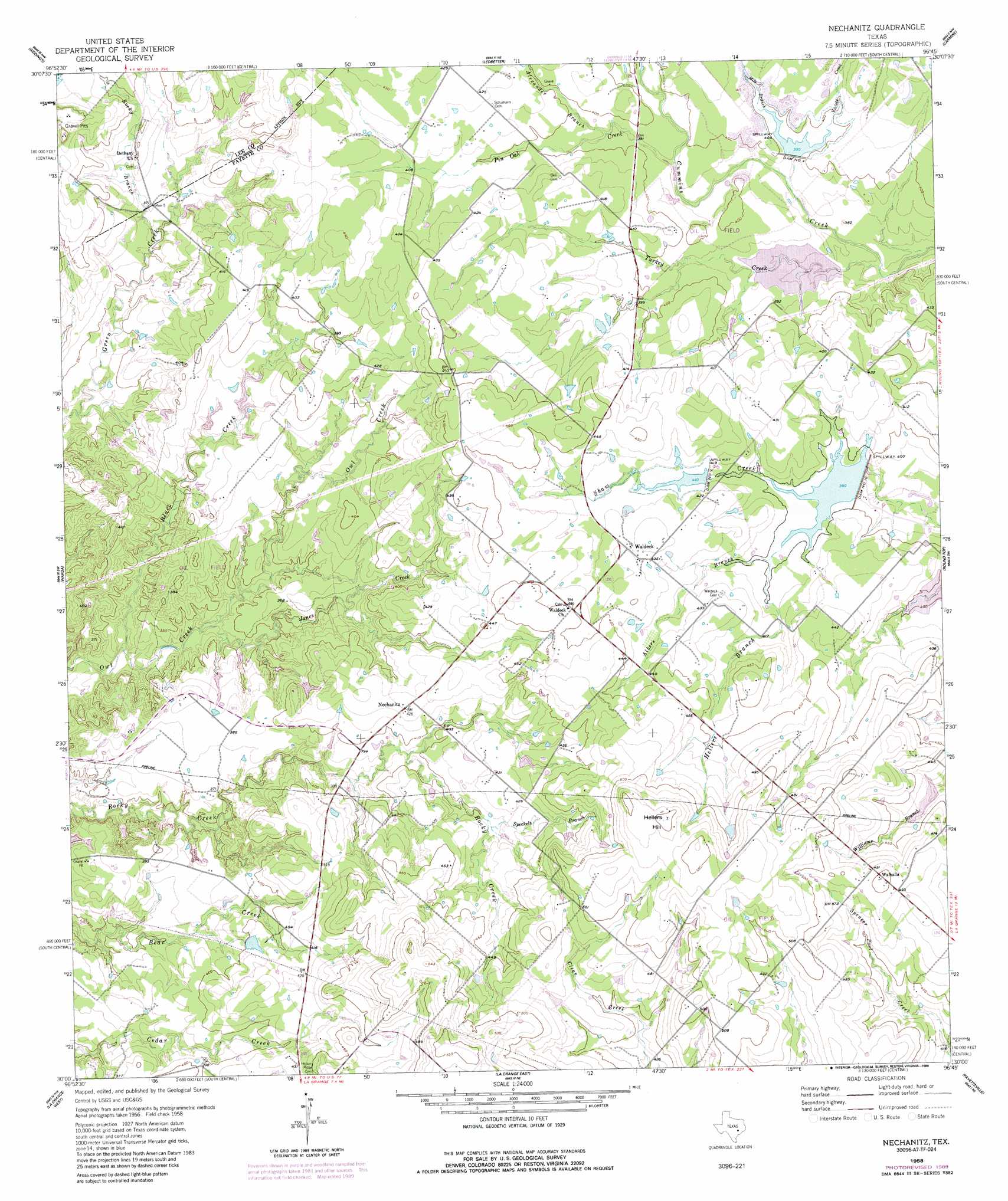
USGS Topo Quad 30096a7 - 1:24,000 scale
| Topo Map Name: | Nechanitz |
| USGS Topo Quad ID: | 30096a7 |
| Print Size: | ca. 21 1/4" wide x 27" high |
| Southeast Coordinates: | 30° N latitude / 96.75° W longitude |
| Map Center Coordinates: | 30.0625° N latitude / 96.8125° W longitude |
| U.S. State: | TX |
| Filename: | o30096a7.jpg |
| Download Map JPG Image: | Nechanitz topo map 1:24,000 scale |
| Map Type: | Topographic |
| Topo Series: | 7.5´ |
| Map Scale: | 1:24,000 |
| Source of Map Images: | United States Geological Survey (USGS) |
| Alternate Map Versions: |
Nechanitz TX 1958, updated 1959 Download PDF Buy paper map Nechanitz TX 1958, updated 1989 Download PDF Buy paper map Nechanitz TX 2010 Download PDF Buy paper map Nechanitz TX 2013 Download PDF Buy paper map Nechanitz TX 2016 Download PDF Buy paper map |
1:24,000 Topo Quads surrounding Nechanitz
Fedor |
Lincoln |
Dime Box |
Flag Pond |
Somerville |
Paige |
Giddings |
Ledbetter |
Carmine |
Burton |
Winchester |
Warda |
Nechanitz |
Round Top |
Greenvine |
West Point |
La Grange West |
La Grange East |
Fayetteville |
Industry |
Muldoon |
Swiss Alp |
Ammannsville |
Ellinger |
Frelsburg |
> Back to 30096a1 at 1:100,000 scale
> Back to 30096a1 at 1:250,000 scale
> Back to U.S. Topo Maps home
Nechanitz topo map: Gazetteer
Nechanitz: Airports
Anchorage Farm Field elevation 132m 433′Ullrich Airport elevation 125m 410′
Nechanitz: Dams
Dam Number 10 elevation 121m 396′Dam Number 9 elevation 128m 419′
Greenbriar Lake Dam elevation 149m 488′
Soil Conservation Service Site 10 Dam elevation 122m 400′
Soil Conservation Service Site 4 Dam elevation 116m 380′
Soil Conservation Service Site 5 Dam elevation 114m 374′
Soil Conservation Service Site 9 Dam elevation 125m 410′
Nechanitz: Populated Places
Nechanitz elevation 129m 423′Waldeck elevation 134m 439′
Walhalla elevation 153m 501′
Nechanitz: Reservoirs
Greenbriar Lake elevation 149m 488′Soil Conservation Service Site 10 Reservoir elevation 122m 400′
Soil Conservation Service Site 4 Reservoir elevation 116m 380′
Soil Conservation Service Site 5 Reservoir elevation 114m 374′
Soil Conservation Service Site 9 Reservoir elevation 125m 410′
Nechanitz: Streams
Albers Branch elevation 119m 390′Alexander Branch elevation 119m 390′
Blair Creek elevation 94m 308′
Hellers Branch elevation 122m 400′
Jones Creek elevation 98m 321′
Mile Branch elevation 119m 390′
Pin Oak Creek elevation 116m 380′
Rocky Branch elevation 106m 347′
Speckels Branch elevation 123m 403′
Turkey Creek elevation 111m 364′
Violets Creek elevation 121m 396′
Nechanitz: Summits
Hellers Hill elevation 168m 551′Nechanitz digital topo map on disk
Buy this Nechanitz topo map showing relief, roads, GPS coordinates and other geographical features, as a high-resolution digital map file on DVD: