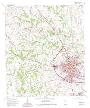
Brenham Topo Map Texas
To zoom in, hover over the map of Brenham
USGS Topo Quad 30096b4 - 1:24,000 scale
| Topo Map Name: | Brenham |
| USGS Topo Quad ID: | 30096b4 |
| Print Size: | ca. 21 1/4" wide x 27" high |
| Southeast Coordinates: | 30.125° N latitude / 96.375° W longitude |
| Map Center Coordinates: | 30.1875° N latitude / 96.4375° W longitude |
| U.S. State: | TX |
| Filename: | o30096b4.jpg |
| Download Map JPG Image: | Brenham topo map 1:24,000 scale |
| Map Type: | Topographic |
| Topo Series: | 7.5´ |
| Map Scale: | 1:24,000 |
| Source of Map Images: | United States Geological Survey (USGS) |
| Alternate Map Versions: |
Brenham TX 1963, updated 1966 Download PDF Buy paper map Brenham TX 1963, updated 1984 Download PDF Buy paper map Brenham TX 1963, updated 1989 Download PDF Buy paper map Brenham TX 2010 Download PDF Buy paper map Brenham TX 2013 Download PDF Buy paper map Brenham TX 2016 Download PDF Buy paper map |
1:24,000 Topo Quads surrounding Brenham
> Back to 30096a1 at 1:100,000 scale
> Back to 30096a1 at 1:250,000 scale
> Back to U.S. Topo Maps home
Brenham topo map: Gazetteer
Brenham: Dams
Lange Dam elevation 98m 321′McNees Lake Dam elevation 95m 311′
Railroad Lake Dam elevation 87m 285′
Brenham: Flats
North End Park elevation 80m 262′Brenham: Lakes
Lange Lake elevation 98m 321′Seekeks Lake elevation 84m 275′
Brenham: Parks
Brenham Sports Complex elevation 88m 288′Firemans Park elevation 86m 282′
Hattie Powers Park elevation 89m 291′
Jackson Park elevation 104m 341′
Brenham: Populated Places
Berlin elevation 126m 413′Brenham elevation 104m 341′
Mill Creek elevation 91m 298′
Prairie Hill elevation 111m 364′
Zionville elevation 122m 400′
Brenham: Post Offices
US Post Office and Federal Building elevation 110m 360′Brenham: Reservoirs
McNees Lake elevation 95m 311′Railroad Lake elevation 87m 285′
Brenham: Streams
Indian Creek elevation 79m 259′Thomas Creek elevation 80m 262′
Tommelson Creek elevation 69m 226′
Brenham digital topo map on disk
Buy this Brenham topo map showing relief, roads, GPS coordinates and other geographical features, as a high-resolution digital map file on DVD:


