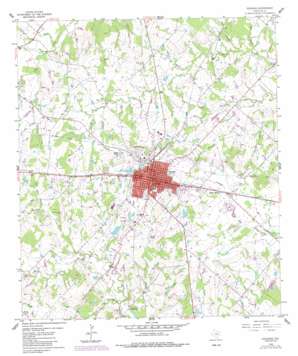
Giddings Topo Map Texas
To zoom in, hover over the map of Giddings
USGS Topo Quad 30096b8 - 1:24,000 scale
| Topo Map Name: | Giddings |
| USGS Topo Quad ID: | 30096b8 |
| Print Size: | ca. 21 1/4" wide x 27" high |
| Southeast Coordinates: | 30.125° N latitude / 96.875° W longitude |
| Map Center Coordinates: | 30.1875° N latitude / 96.9375° W longitude |
| U.S. State: | TX |
| Filename: | o30096b8.jpg |
| Download Map JPG Image: | Giddings topo map 1:24,000 scale |
| Map Type: | Topographic |
| Topo Series: | 7.5´ |
| Map Scale: | 1:24,000 |
| Source of Map Images: | United States Geological Survey (USGS) |
| Alternate Map Versions: |
Giddings TX 1958, updated 1979 Download PDF Buy paper map Giddings TX 1958, updated 1989 Download PDF Buy paper map Giddings TX 2010 Download PDF Buy paper map Giddings TX 2013 Download PDF Buy paper map Giddings TX 2016 Download PDF Buy paper map |
1:24,000 Topo Quads surrounding Giddings
> Back to 30096a1 at 1:100,000 scale
> Back to 30096a1 at 1:250,000 scale
> Back to U.S. Topo Maps home
Giddings topo map: Gazetteer
Giddings: Airports
Giddings-Lee County Airport elevation 140m 459′Giddings: Dams
Kasper Estate Lake Dam elevation 130m 426′Mantzel Dam elevation 142m 465′
Powell Lake Dam elevation 123m 403′
Sievert Lake Dam elevation 146m 479′
Star of Hope Mission Lake Dam elevation 139m 456′
Walter Droemer Lake Dam elevation 125m 410′
Giddings: Lakes
Seales Lakes elevation 131m 429′Giddings: Populated Places
Giddings elevation 154m 505′Serbin elevation 136m 446′
Giddings: Reservoirs
Kasper Estate Lake elevation 130m 426′Mantzel Lake elevation 142m 465′
Powell Lake elevation 123m 403′
Sievert Lake elevation 146m 479′
Star of Hope Mission Lake elevation 139m 456′
Walter Droemer Lake elevation 125m 410′
Giddings: Streams
Big Branch elevation 104m 341′Bullfrog Creek elevation 122m 400′
Hockel Branch elevation 122m 400′
Hog Branch elevation 113m 370′
Little Bullfrog Creek elevation 134m 439′
Little Hickory Creek elevation 110m 360′
Long Branch elevation 117m 383′
Meier Branch elevation 113m 370′
Oil Branch elevation 115m 377′
Schilling Branch elevation 119m 390′
Willow Branch elevation 105m 344′
Willy Branch elevation 113m 370′
Wolf Branch elevation 119m 390′
Giddings digital topo map on disk
Buy this Giddings topo map showing relief, roads, GPS coordinates and other geographical features, as a high-resolution digital map file on DVD:


