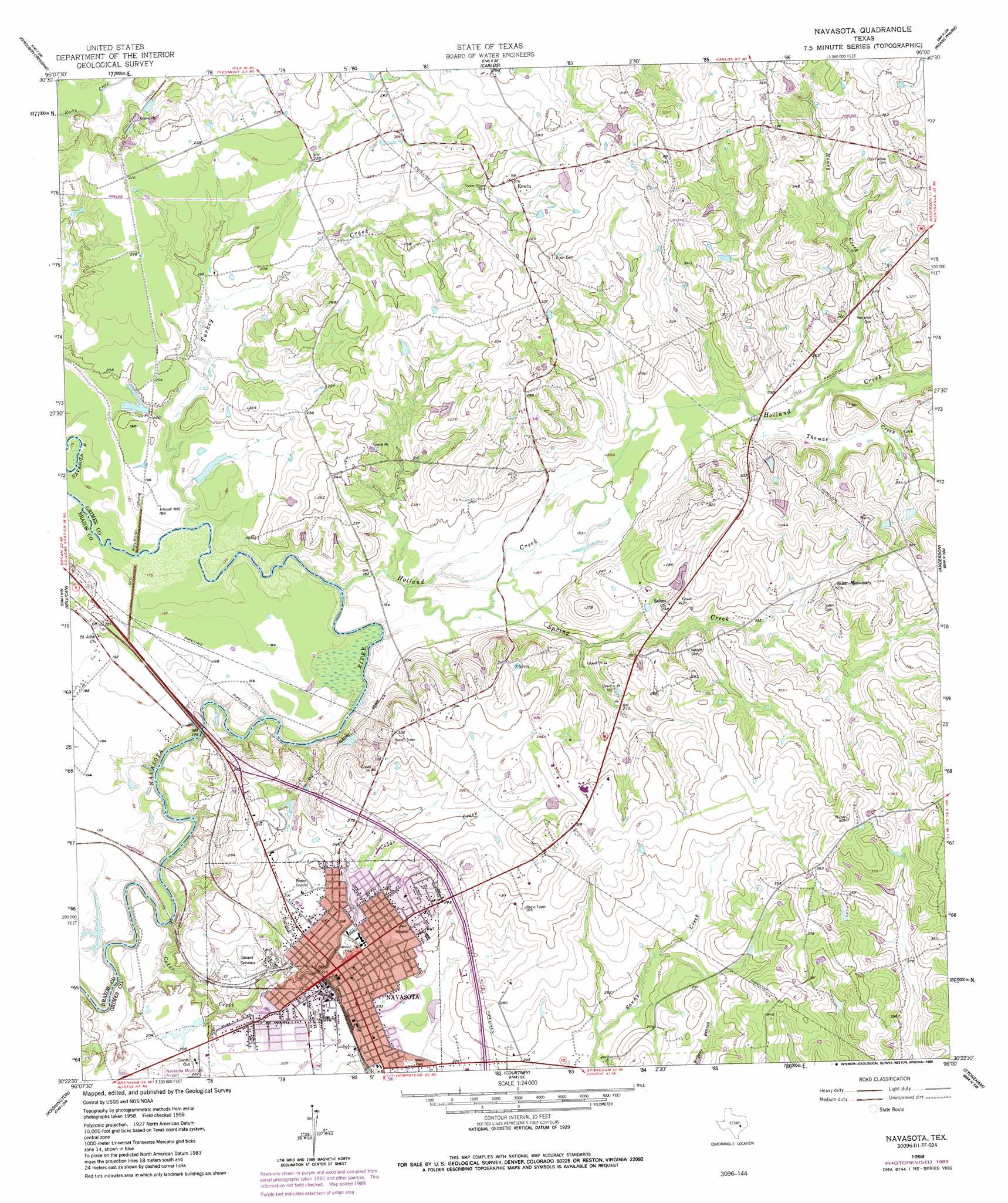
Navasota Topo Map Texas
To zoom in, hover over the map of Navasota
USGS Topo Quad 30096d1 - 1:24,000 scale
| Topo Map Name: | Navasota |
| USGS Topo Quad ID: | 30096d1 |
| Print Size: | ca. 21 1/4" wide x 27" high |
| Southeast Coordinates: | 30.375° N latitude / 96° W longitude |
| Map Center Coordinates: | 30.4375° N latitude / 96.0625° W longitude |
| U.S. State: | TX |
| Filename: | o30096d1.jpg |
| Download Map JPG Image: | Navasota topo map 1:24,000 scale |
| Map Type: | Topographic |
| Topo Series: | 7.5´ |
| Map Scale: | 1:24,000 |
| Source of Map Images: | United States Geological Survey (USGS) |
| Alternate Map Versions: |
Navasota TX 1958, updated 1960 Download PDF Buy paper map Navasota TX 1958, updated 1974 Download PDF Buy paper map Navasota TX 1958, updated 1989 Download PDF Buy paper map Navasota TX 2010 Download PDF Buy paper map Navasota TX 2013 Download PDF Buy paper map Navasota TX 2016 Download PDF Buy paper map |
1:24,000 Topo Quads surrounding Navasota
Bryan East |
Reliance |
Keith |
Singleton |
Loma |
Wellborn |
Ferguson Crossing |
Carlos |
Roans Prairie |
Richards |
Clay |
Millican |
Navasota |
Anderson |
Dacus |
Independence |
Washington |
Courtney |
Stoneham |
Plantersville |
Chappell Hill |
Daniels |
Howth |
Waller Nw |
Magnolia West |
> Back to 30096a1 at 1:100,000 scale
> Back to 30096a1 at 1:250,000 scale
> Back to U.S. Topo Maps home
Navasota topo map: Gazetteer
Navasota: Airports
Bridle Ridge Airport elevation 97m 318′Navasota Regional Hospital Heliport elevation 79m 259′
Navasota: Dams
Prescott Lake Dam elevation 69m 226′Navasota: Populated Places
Erwin elevation 85m 278′Navasota elevation 66m 216′
Navasota: Reservoirs
Prescott Lake elevation 69m 226′Navasota: Streams
Cedar Creek elevation 49m 160′Holland Creek elevation 52m 170′
Honey Creek elevation 67m 219′
Spring Creek elevation 56m 183′
Thomas Creek elevation 64m 209′
Turkey Creek elevation 55m 180′
Navasota digital topo map on disk
Buy this Navasota topo map showing relief, roads, GPS coordinates and other geographical features, as a high-resolution digital map file on DVD: