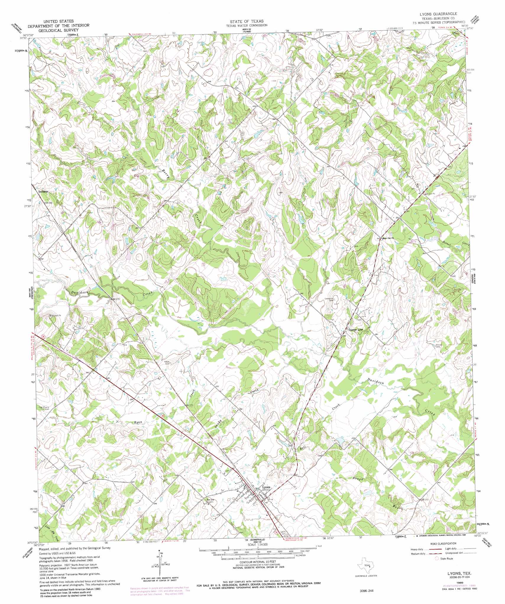
Lyons Topo Map Texas
To zoom in, hover over the map of Lyons
USGS Topo Quad 30096d5 - 1:24,000 scale
| Topo Map Name: | Lyons |
| USGS Topo Quad ID: | 30096d5 |
| Print Size: | ca. 21 1/4" wide x 27" high |
| Southeast Coordinates: | 30.375° N latitude / 96.5° W longitude |
| Map Center Coordinates: | 30.4375° N latitude / 96.5625° W longitude |
| U.S. State: | TX |
| Filename: | o30096d5.jpg |
| Download Map JPG Image: | Lyons topo map 1:24,000 scale |
| Map Type: | Topographic |
| Topo Series: | 7.5´ |
| Map Scale: | 1:24,000 |
| Source of Map Images: | United States Geological Survey (USGS) |
| Alternate Map Versions: |
Lyons TX 1960, updated 1962 Download PDF Buy paper map Lyons TX 1960, updated 1989 Download PDF Buy paper map Lyons TX 2010 Download PDF Buy paper map Lyons TX 2013 Download PDF Buy paper map Lyons TX 2016 Download PDF Buy paper map |
1:24,000 Topo Quads surrounding Lyons
Milano |
Goodwill |
Mumford |
Bryan West |
Bryan East |
Chriesman |
Caldwell |
Tunis |
Chances Store |
Wellborn |
Deanville |
Frenstat |
Lyons |
Snook |
Clay |
Dime Box |
Flag Pond |
Somerville |
Gay Hill |
Independence |
Ledbetter |
Carmine |
Burton |
Brenham |
Chappell Hill |
> Back to 30096a1 at 1:100,000 scale
> Back to 30096a1 at 1:250,000 scale
> Back to U.S. Topo Maps home
Lyons topo map: Gazetteer
Lyons: Dams
Beaver Creek Development Dam Number 1 elevation 87m 285′Beaver Creek Development Dam Number 3 elevation 94m 308′
Lyons: Populated Places
Center Line elevation 82m 269′Lyons elevation 104m 341′
Lyons: Reservoirs
Beaver Lake elevation 87m 285′Mallard Lake elevation 94m 308′
Lyons: Streams
Bell Creek elevation 67m 219′Berry Creek elevation 73m 239′
Ryan Creek elevation 70m 229′
Sandy Creek elevation 73m 239′
Lyons digital topo map on disk
Buy this Lyons topo map showing relief, roads, GPS coordinates and other geographical features, as a high-resolution digital map file on DVD: