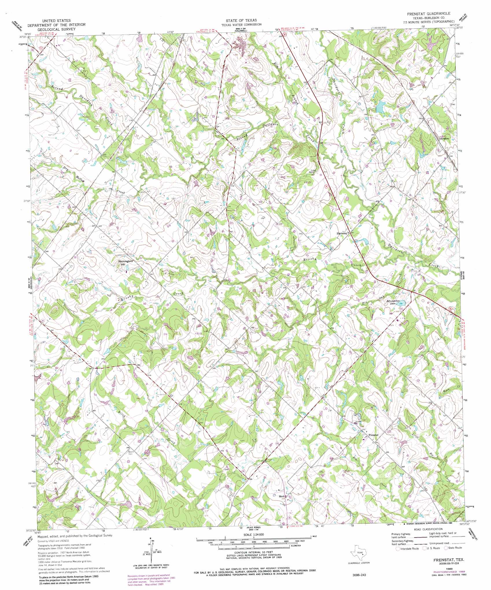
Frenstat Topo Map Texas
To zoom in, hover over the map of Frenstat
USGS Topo Quad 30096d6 - 1:24,000 scale
| Topo Map Name: | Frenstat |
| USGS Topo Quad ID: | 30096d6 |
| Print Size: | ca. 21 1/4" wide x 27" high |
| Southeast Coordinates: | 30.375° N latitude / 96.625° W longitude |
| Map Center Coordinates: | 30.4375° N latitude / 96.6875° W longitude |
| U.S. State: | TX |
| Filename: | o30096d6.jpg |
| Download Map JPG Image: | Frenstat topo map 1:24,000 scale |
| Map Type: | Topographic |
| Topo Series: | 7.5´ |
| Map Scale: | 1:24,000 |
| Source of Map Images: | United States Geological Survey (USGS) |
| Alternate Map Versions: |
Frenstat TX 1960, updated 1963 Download PDF Buy paper map Frenstat TX 1960, updated 1989 Download PDF Buy paper map Frenstat TX 2010 Download PDF Buy paper map Frenstat TX 2013 Download PDF Buy paper map Frenstat TX 2016 Download PDF Buy paper map |
1:24,000 Topo Quads surrounding Frenstat
Rockdale East |
Milano |
Goodwill |
Mumford |
Bryan West |
Hicks |
Chriesman |
Caldwell |
Tunis |
Chances Store |
Tanglewood |
Deanville |
Frenstat |
Lyons |
Snook |
Lincoln |
Dime Box |
Flag Pond |
Somerville |
Gay Hill |
Giddings |
Ledbetter |
Carmine |
Burton |
Brenham |
> Back to 30096a1 at 1:100,000 scale
> Back to 30096a1 at 1:250,000 scale
> Back to U.S. Topo Maps home
Frenstat topo map: Gazetteer
Frenstat: Dams
Glover Lake Dam elevation 104m 341′Matcek Lake Dam elevation 94m 308′
Sanders Lake Dam elevation 97m 318′
Schumacher Lake Dam elevation 85m 278′
Frenstat: Lakes
Schumacher Lake elevation 88m 288′Frenstat: Populated Places
Birch elevation 109m 357′Davidson elevation 108m 354′
Frenstat elevation 116m 380′
Harmony elevation 89m 291′
Frenstat: Reservoirs
Glover Lake elevation 104m 341′Matcek Lake elevation 94m 308′
Sanders Lake elevation 97m 318′
Schumacher Lake elevation 85m 278′
Frenstat: Streams
Brushy Creek elevation 79m 259′Dry Hollow Creek elevation 95m 311′
Elm Branch elevation 85m 278′
Pin Oak Creek elevation 79m 259′
Second Davidson Creek elevation 82m 269′
Frenstat: Summits
Mockingbird Hill elevation 128m 419′Frenstat digital topo map on disk
Buy this Frenstat topo map showing relief, roads, GPS coordinates and other geographical features, as a high-resolution digital map file on DVD: