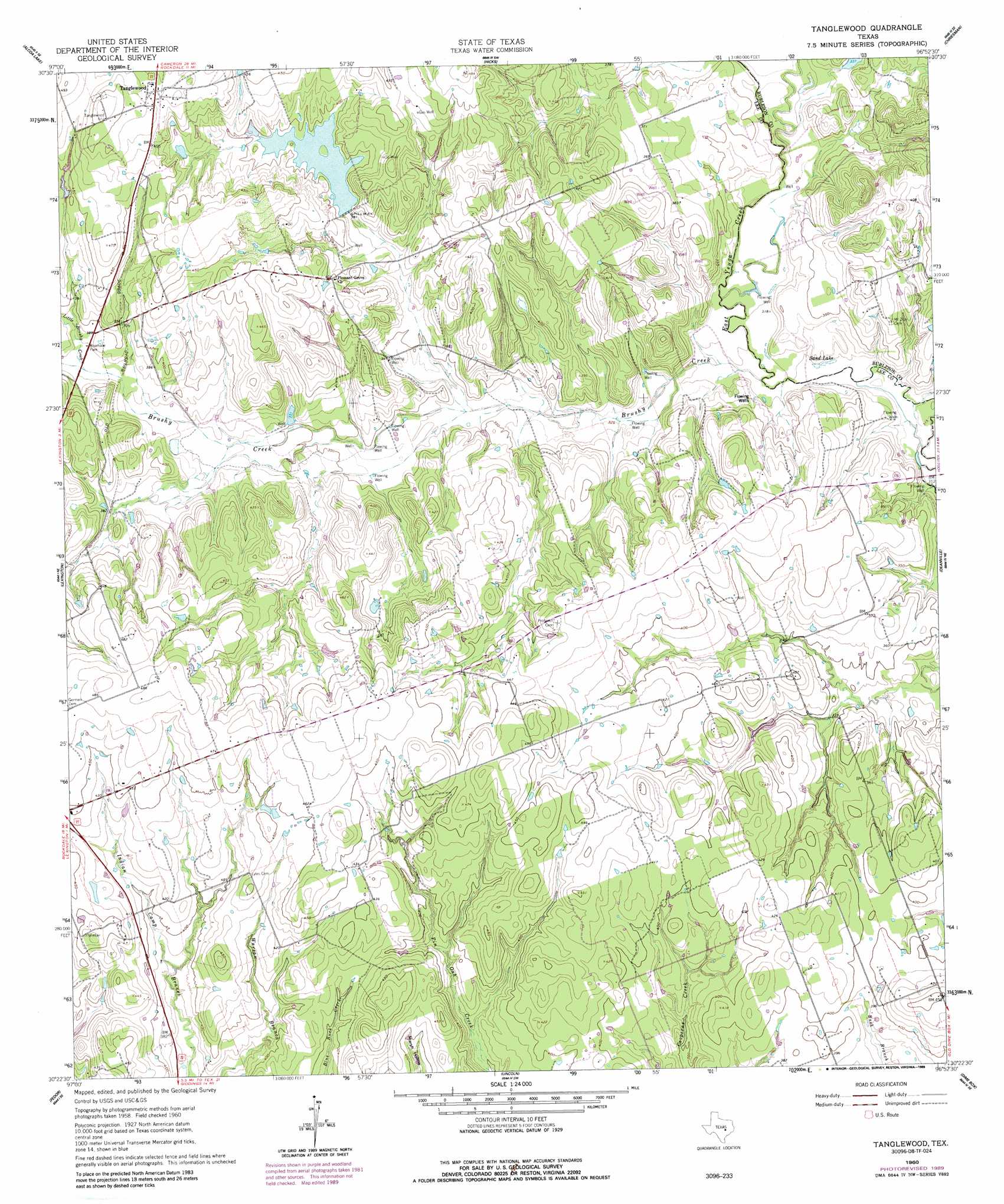
Tanglewood Topo Map Texas
To zoom in, hover over the map of Tanglewood
USGS Topo Quad 30096d8 - 1:24,000 scale
| Topo Map Name: | Tanglewood |
| USGS Topo Quad ID: | 30096d8 |
| Print Size: | ca. 21 1/4" wide x 27" high |
| Southeast Coordinates: | 30.375° N latitude / 96.875° W longitude |
| Map Center Coordinates: | 30.4375° N latitude / 96.9375° W longitude |
| U.S. State: | TX |
| Filename: | o30096d8.jpg |
| Download Map JPG Image: | Tanglewood topo map 1:24,000 scale |
| Map Type: | Topographic |
| Topo Series: | 7.5´ |
| Map Scale: | 1:24,000 |
| Source of Map Images: | United States Geological Survey (USGS) |
| Alternate Map Versions: |
Tanglewood TX 1960, updated 1962 Download PDF Buy paper map Tanglewood TX 1960, updated 1962 Download PDF Buy paper map Tanglewood TX 1960, updated 1989 Download PDF Buy paper map Tanglewood TX 2010 Download PDF Buy paper map Tanglewood TX 2013 Download PDF Buy paper map Tanglewood TX 2016 Download PDF Buy paper map |
1:24,000 Topo Quads surrounding Tanglewood
San Gabriel |
Rockdale West |
Rockdale East |
Milano |
Goodwill |
Thorndale |
Alcoa Lake |
Hicks |
Chriesman |
Caldwell |
Beaukiss |
Lexington |
Tanglewood |
Deanville |
Frenstat |
Mcdade |
Fedor |
Lincoln |
Dime Box |
Flag Pond |
Smithville Nw |
Paige |
Giddings |
Ledbetter |
Carmine |
> Back to 30096a1 at 1:100,000 scale
> Back to 30096a1 at 1:250,000 scale
> Back to U.S. Topo Maps home
Tanglewood topo map: Gazetteer
Tanglewood: Dams
Phinney Lake Dam elevation 115m 377′Tanglewood: Lakes
Sand Lake elevation 97m 318′Tanglewood: Populated Places
Tanglewood elevation 145m 475′Tanglewood: Reservoirs
Footprints Lake elevation 115m 377′Tanglewood: Streams
Brushy Creek elevation 96m 314′Little Brushy Creek elevation 115m 377′
Tanglewood digital topo map on disk
Buy this Tanglewood topo map showing relief, roads, GPS coordinates and other geographical features, as a high-resolution digital map file on DVD: