Chriesman Topo Map Texas
To zoom in, hover over the map of Chriesman
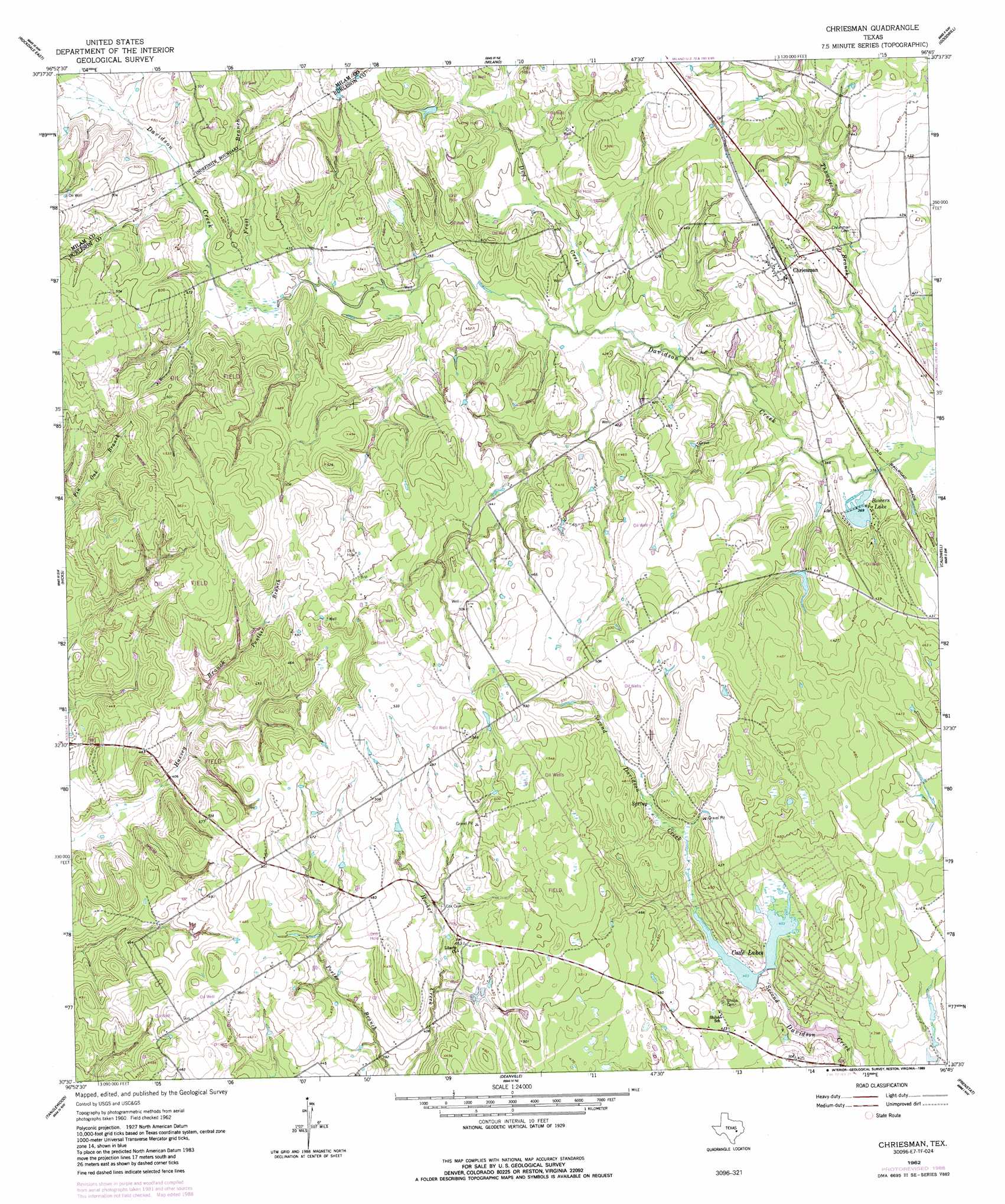
USGS Topo Quad 30096e7 - 1:24,000 scale
| Topo Map Name: | Chriesman |
| USGS Topo Quad ID: | 30096e7 |
| Print Size: | ca. 21 1/4" wide x 27" high |
| Southeast Coordinates: | 30.5° N latitude / 96.75° W longitude |
| Map Center Coordinates: | 30.5625° N latitude / 96.8125° W longitude |
| U.S. State: | TX |
| Filename: | o30096e7.jpg |
| Download Map JPG Image: | Chriesman topo map 1:24,000 scale |
| Map Type: | Topographic |
| Topo Series: | 7.5´ |
| Map Scale: | 1:24,000 |
| Source of Map Images: | United States Geological Survey (USGS) |
| Alternate Map Versions: |
Chriesman TX 1962, updated 1964 Download PDF Buy paper map Chriesman TX 1962, updated 1980 Download PDF Buy paper map Chriesman TX 1962, updated 1989 Download PDF Buy paper map Chriesman TX 2010 Download PDF Buy paper map Chriesman TX 2013 Download PDF Buy paper map Chriesman TX 2016 Download PDF Buy paper map |
1:24,000 Topo Quads surrounding Chriesman
Pettibone |
Cameron |
Hanover |
Gause |
Hearne South |
Rockdale West |
Rockdale East |
Milano |
Goodwill |
Mumford |
Alcoa Lake |
Hicks |
Chriesman |
Caldwell |
Tunis |
Lexington |
Tanglewood |
Deanville |
Frenstat |
Lyons |
Fedor |
Lincoln |
Dime Box |
Flag Pond |
Somerville |
> Back to 30096e1 at 1:100,000 scale
> Back to 30096a1 at 1:250,000 scale
> Back to U.S. Topo Maps home
Chriesman topo map: Gazetteer
Chriesman: Dams
Bowers Lake Dam elevation 111m 364′Cade Dam Number 3 elevation 116m 380′
East-West Lake Dam elevation 121m 396′
Williams Lake Dam elevation 123m 403′
Chriesman: Populated Places
Chriesman elevation 136m 446′Chriesman: Reservoirs
Bowers Lake elevation 111m 364′Cade Lake Number 3 elevation 116m 380′
Cade Lakes elevation 123m 403′
East-West Lake elevation 121m 396′
Williams Lake elevation 123m 403′
Chriesman: Springs
Spring Lake elevation 111m 364′Chriesman: Streams
Dry Creek elevation 116m 380′Frost Branch elevation 122m 400′
Panther Branch elevation 130m 426′
Thompson Branch elevation 109m 357′
Chriesman digital topo map on disk
Buy this Chriesman topo map showing relief, roads, GPS coordinates and other geographical features, as a high-resolution digital map file on DVD: