Kurten Topo Map Texas
To zoom in, hover over the map of Kurten
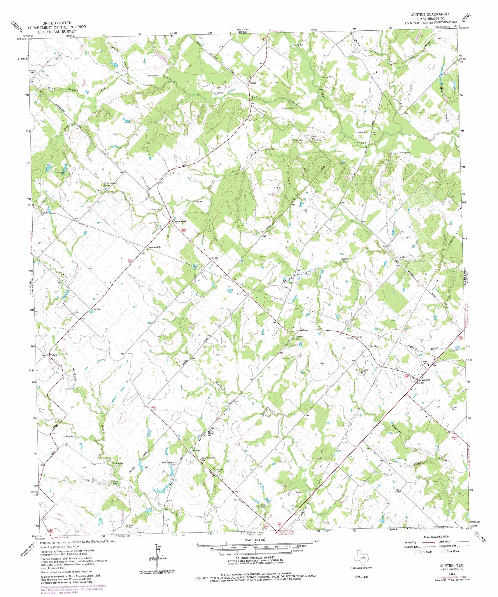
USGS Topo Quad 30096g3 - 1:24,000 scale
| Topo Map Name: | Kurten |
| USGS Topo Quad ID: | 30096g3 |
| Print Size: | ca. 21 1/4" wide x 27" high |
| Southeast Coordinates: | 30.75° N latitude / 96.25° W longitude |
| Map Center Coordinates: | 30.8125° N latitude / 96.3125° W longitude |
| U.S. State: | TX |
| Filename: | o30096g3.jpg |
| Download Map JPG Image: | Kurten topo map 1:24,000 scale |
| Map Type: | Topographic |
| Topo Series: | 7.5´ |
| Map Scale: | 1:24,000 |
| Source of Map Images: | United States Geological Survey (USGS) |
| Alternate Map Versions: |
Kurten TX 1963, updated 1964 Download PDF Buy paper map Kurten TX 1963, updated 1980 Download PDF Buy paper map Kurten TX 2010 Download PDF Buy paper map Kurten TX 2013 Download PDF Buy paper map Kurten TX 2016 Download PDF Buy paper map |
1:24,000 Topo Quads surrounding Kurten
Owensville |
Franklin |
Camp Creek Lake |
Hilltop Lakes |
Normangee |
Hearne North |
Wheelock |
Edge |
Canary |
North Zulch |
Hearne South |
Dunn Creek |
Kurten |
Clear Lake |
Iola |
Mumford |
Bryan West |
Bryan East |
Reliance |
Keith |
Tunis |
Chances Store |
Wellborn |
Ferguson Crossing |
Carlos |
> Back to 30096e1 at 1:100,000 scale
> Back to 30096a1 at 1:250,000 scale
> Back to U.S. Topo Maps home
Kurten topo map: Gazetteer
Kurten: Flats
String Prairie elevation 101m 331′Kurten: Populated Places
Cottonwood elevation 103m 337′Kurten elevation 106m 347′
Moore elevation 102m 334′
Tabor elevation 104m 341′
Union elevation 93m 305′
Wixon Valley elevation 102m 334′
Kurten: Streams
Bee Creek elevation 84m 275′Ferrill Branch elevation 83m 272′
Hog Creek elevation 77m 252′
Iron Creek elevation 85m 278′
Jack Creek elevation 79m 259′
Rocky Creek elevation 88m 288′
Sparks Branch elevation 96m 314′
Tiger Branch elevation 101m 331′
Town Branch elevation 97m 318′
Kurten digital topo map on disk
Buy this Kurten topo map showing relief, roads, GPS coordinates and other geographical features, as a high-resolution digital map file on DVD: