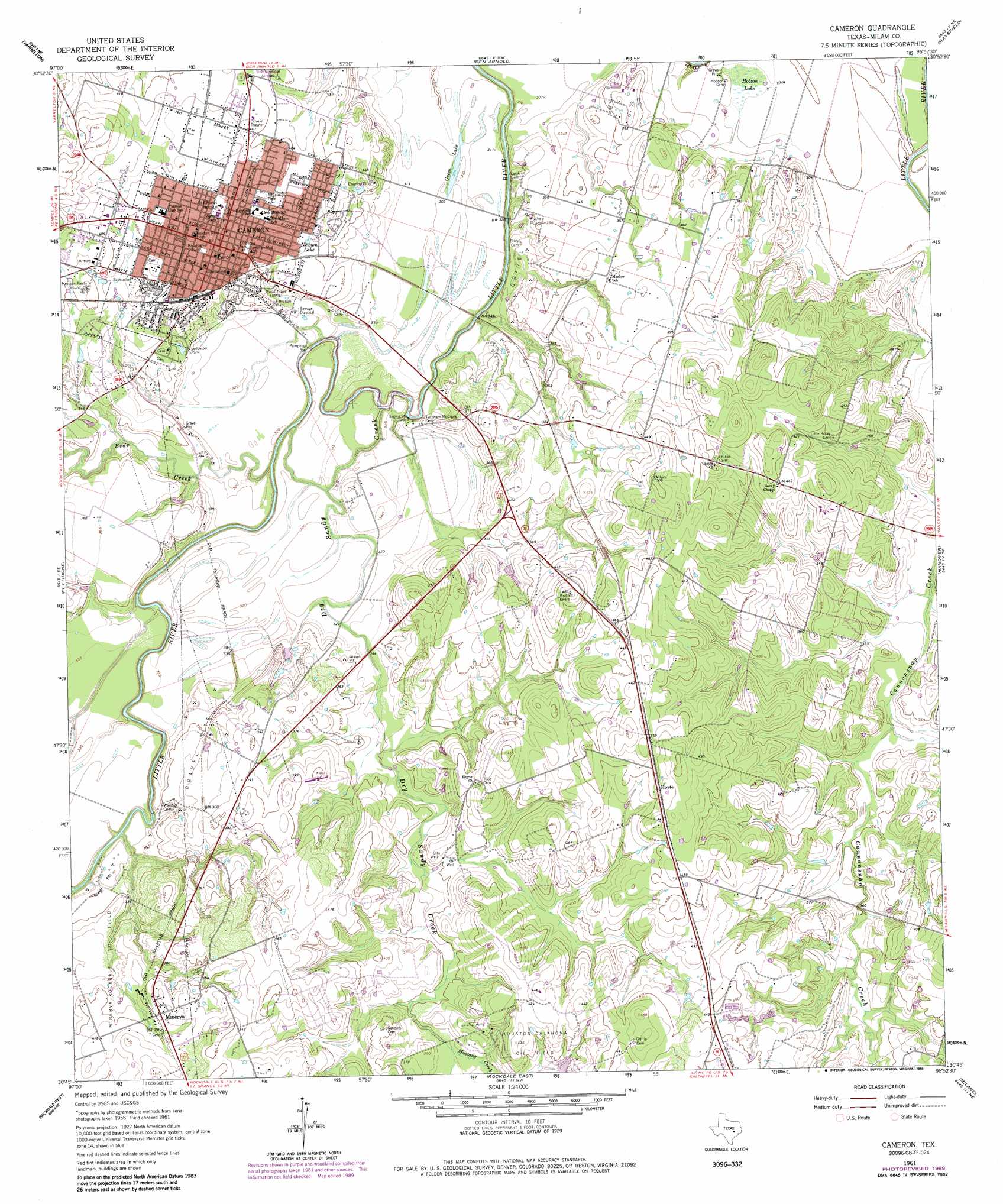
Cameron Topo Map Texas
To zoom in, hover over the map of Cameron
USGS Topo Quad 30096g8 - 1:24,000 scale
| Topo Map Name: | Cameron |
| USGS Topo Quad ID: | 30096g8 |
| Print Size: | ca. 21 1/4" wide x 27" high |
| Southeast Coordinates: | 30.75° N latitude / 96.875° W longitude |
| Map Center Coordinates: | 30.8125° N latitude / 96.9375° W longitude |
| U.S. State: | TX |
| Filename: | o30096g8.jpg |
| Download Map JPG Image: | Cameron topo map 1:24,000 scale |
| Map Type: | Topographic |
| Topo Series: | 7.5´ |
| Map Scale: | 1:24,000 |
| Source of Map Images: | United States Geological Survey (USGS) |
| Alternate Map Versions: |
Cameron TX 1961, updated 1964 Download PDF Buy paper map Cameron TX 1961, updated 1983 Download PDF Buy paper map Cameron TX 1961, updated 1989 Download PDF Buy paper map Cameron TX 2010 Download PDF Buy paper map Cameron TX 2013 Download PDF Buy paper map Cameron TX 2016 Download PDF Buy paper map |
1:24,000 Topo Quads surrounding Cameron
Seaton |
Westphalia |
Rosebud |
Baileyville |
Hammond |
Rogers |
Yarrelton |
Ben Arnold |
Maysfield |
Calvert |
Sharp |
Pettibone |
Cameron |
Hanover |
Gause |
San Gabriel |
Rockdale West |
Rockdale East |
Milano |
Goodwill |
Thorndale |
Alcoa Lake |
Hicks |
Chriesman |
Caldwell |
> Back to 30096e1 at 1:100,000 scale
> Back to 30096a1 at 1:250,000 scale
> Back to U.S. Topo Maps home
Cameron topo map: Gazetteer
Cameron: Lakes
Green Lake elevation 95m 311′Newton Lake elevation 113m 370′
Cameron: Oilfields
Minerva-Rockdale Oil Field elevation 115m 377′Cameron: Parks
Cameron Community Center elevation 127m 416′Ledbetter Park elevation 106m 347′
Cameron: Populated Places
Cameron elevation 122m 400′Hoyte elevation 144m 472′
Marlow elevation 113m 370′
Minerva elevation 123m 403′
Cameron: Streams
Bear Creek elevation 89m 291′Mustang Creek elevation 109m 357′
Sandy Creek elevation 90m 295′
Cameron: Swamps
Hobson Lake elevation 93m 305′Cameron digital topo map on disk
Buy this Cameron topo map showing relief, roads, GPS coordinates and other geographical features, as a high-resolution digital map file on DVD: