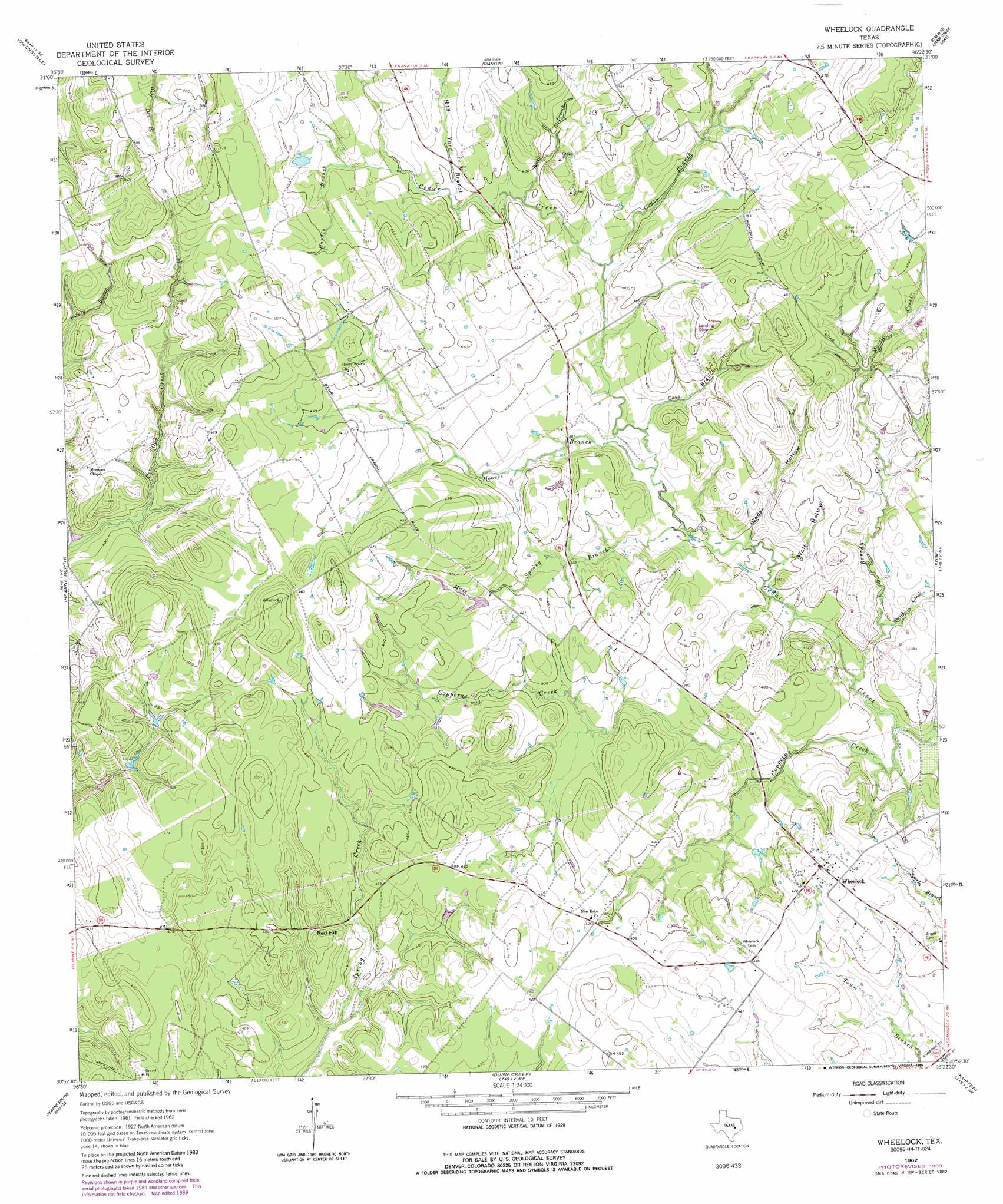
Wheelock Topo Map Texas
To zoom in, hover over the map of Wheelock
USGS Topo Quad 30096h4 - 1:24,000 scale
| Topo Map Name: | Wheelock |
| USGS Topo Quad ID: | 30096h4 |
| Print Size: | ca. 21 1/4" wide x 27" high |
| Southeast Coordinates: | 30.875° N latitude / 96.375° W longitude |
| Map Center Coordinates: | 30.9375° N latitude / 96.4375° W longitude |
| U.S. State: | TX |
| Filename: | o30096h4.jpg |
| Download Map JPG Image: | Wheelock topo map 1:24,000 scale |
| Map Type: | Topographic |
| Topo Series: | 7.5´ |
| Map Scale: | 1:24,000 |
| Source of Map Images: | United States Geological Survey (USGS) |
| Alternate Map Versions: |
Wheelock TX 1962, updated 1964 Download PDF Buy paper map Wheelock TX 1962, updated 1985 Download PDF Buy paper map Wheelock TX 1962, updated 1989 Download PDF Buy paper map Wheelock TX 2010 Download PDF Buy paper map Wheelock TX 2013 Download PDF Buy paper map Wheelock TX 2016 Download PDF Buy paper map |
1:24,000 Topo Quads surrounding Wheelock
Bremond |
Petteway |
Bald Prairie |
Marquez |
Margie |
Hammond |
Owensville |
Franklin |
Camp Creek Lake |
Hilltop Lakes |
Calvert |
Hearne North |
Wheelock |
Edge |
Canary |
Gause |
Hearne South |
Dunn Creek |
Kurten |
Clear Lake |
Goodwill |
Mumford |
Bryan West |
Bryan East |
Reliance |
> Back to 30096e1 at 1:100,000 scale
> Back to 30096a1 at 1:250,000 scale
> Back to U.S. Topo Maps home
Wheelock topo map: Gazetteer
Wheelock: Populated Places
Wheelock elevation 133m 436′Wheelock: Streams
Brushy Creek elevation 101m 331′Cook Branch elevation 110m 360′
Copperas Creek elevation 99m 324′
Crazy Branch elevation 113m 370′
Hardin Branch elevation 122m 400′
Hay Yard Branch elevation 119m 390′
Moores Branch elevation 108m 354′
Moss Spring Branch elevation 106m 347′
Myrtle Creek elevation 118m 387′
Rocky Branch elevation 116m 380′
Smith Creek elevation 104m 341′
Wheelock: Summits
Red Hill elevation 143m 469′Wheelock: Valleys
Cedar Hollow elevation 104m 341′Wolf Hollow elevation 104m 341′
Wheelock digital topo map on disk
Buy this Wheelock topo map showing relief, roads, GPS coordinates and other geographical features, as a high-resolution digital map file on DVD: