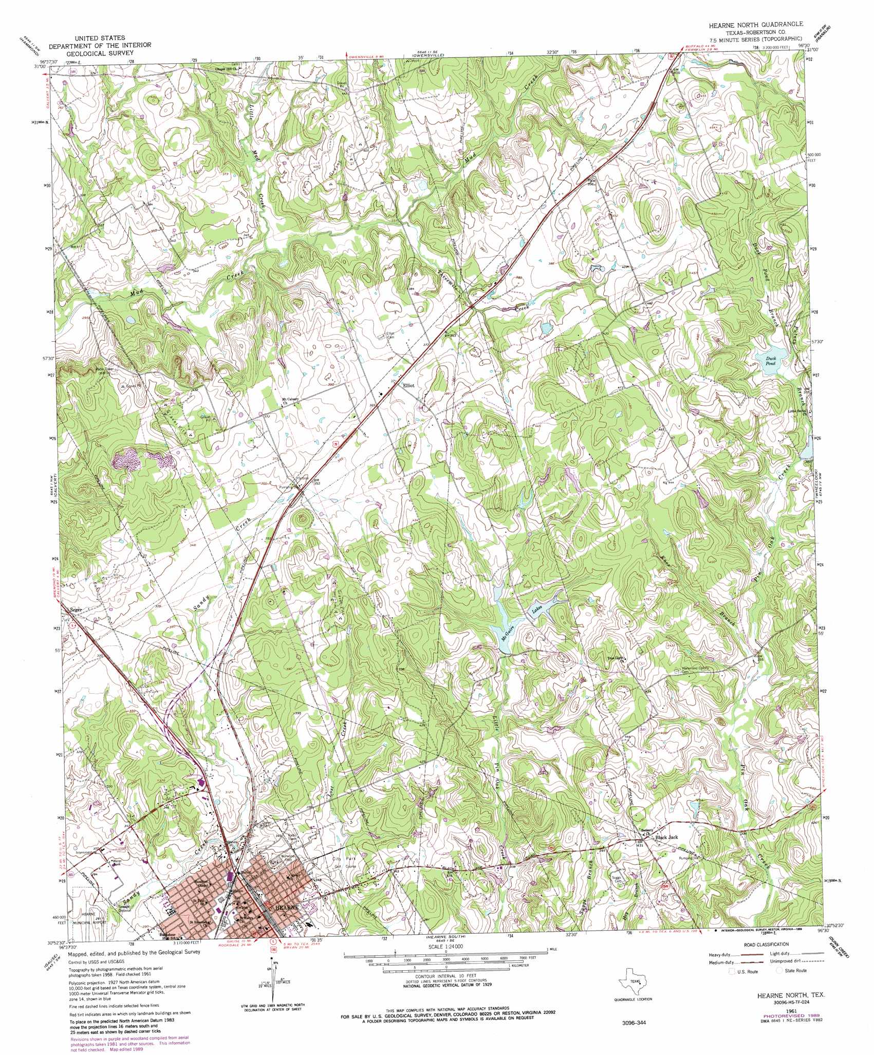
Hearne North Topo Map Texas
To zoom in, hover over the map of Hearne North
USGS Topo Quad 30096h5 - 1:24,000 scale
| Topo Map Name: | Hearne North |
| USGS Topo Quad ID: | 30096h5 |
| Print Size: | ca. 21 1/4" wide x 27" high |
| Southeast Coordinates: | 30.875° N latitude / 96.5° W longitude |
| Map Center Coordinates: | 30.9375° N latitude / 96.5625° W longitude |
| U.S. State: | TX |
| Filename: | o30096h5.jpg |
| Download Map JPG Image: | Hearne North topo map 1:24,000 scale |
| Map Type: | Topographic |
| Topo Series: | 7.5´ |
| Map Scale: | 1:24,000 |
| Source of Map Images: | United States Geological Survey (USGS) |
| Alternate Map Versions: |
Hearne North TX 1961, updated 1964 Download PDF Buy paper map Hearne North TX 1961, updated 1989 Download PDF Buy paper map Hearne North TX 2010 Download PDF Buy paper map Hearne North TX 2013 Download PDF Buy paper map Hearne North TX 2016 Download PDF Buy paper map |
1:24,000 Topo Quads surrounding Hearne North
Reagan |
Bremond |
Petteway |
Bald Prairie |
Marquez |
Baileyville |
Hammond |
Owensville |
Franklin |
Camp Creek Lake |
Maysfield |
Calvert |
Hearne North |
Wheelock |
Edge |
Hanover |
Gause |
Hearne South |
Dunn Creek |
Kurten |
Milano |
Goodwill |
Mumford |
Bryan West |
Bryan East |
> Back to 30096e1 at 1:100,000 scale
> Back to 30096a1 at 1:250,000 scale
> Back to U.S. Topo Maps home
Hearne North topo map: Gazetteer
Hearne North: Dams
McGuire Lakes Number 1 Dam elevation 111m 364′McGuire Lakes Number 2 Dam elevation 108m 354′
Hearne North: Lakes
Duck Pond elevation 118m 387′Hearne North: Parks
Eastside Park elevation 102m 334′Hearne North: Populated Places
Black Jack elevation 132m 433′Elliot elevation 113m 370′
Hearne elevation 90m 295′
Seger elevation 111m 364′
Hearne North: Reservoirs
McGuire Lake elevation 104m 341′McGuire Lakes Number 1 elevation 111m 364′
McGuire Lakes Number 2 elevation 108m 354′
Hearne North: Streams
Duck Pond Branch elevation 119m 390′Knox Branch elevation 104m 341′
Little Mud Creek elevation 96m 314′
Putney Branch elevation 115m 377′
Threemile Creek elevation 100m 328′
Hearne North digital topo map on disk
Buy this Hearne North topo map showing relief, roads, GPS coordinates and other geographical features, as a high-resolution digital map file on DVD: