Lytton Springs Topo Map Texas
To zoom in, hover over the map of Lytton Springs
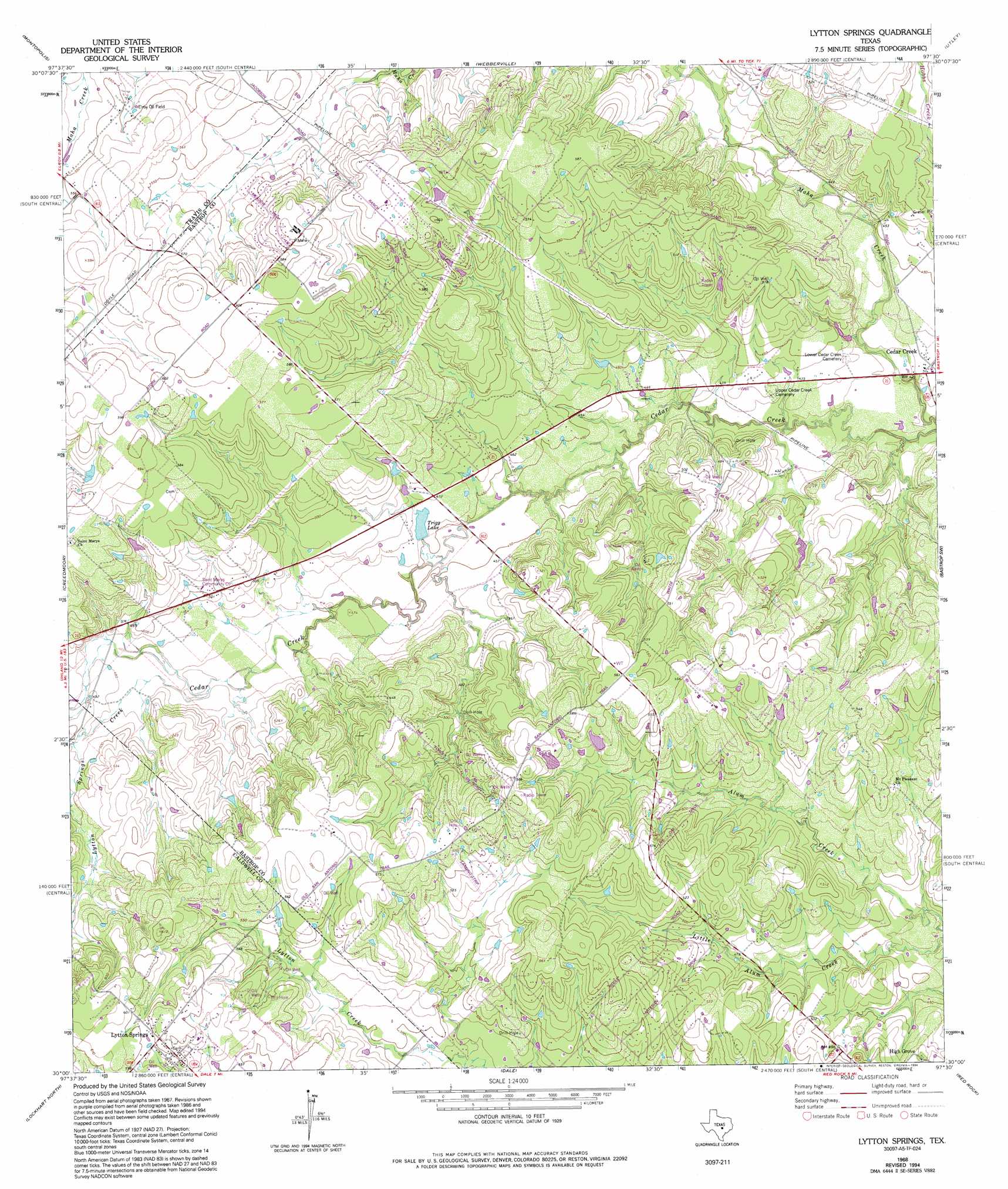
USGS Topo Quad 30097a5 - 1:24,000 scale
| Topo Map Name: | Lytton Springs |
| USGS Topo Quad ID: | 30097a5 |
| Print Size: | ca. 21 1/4" wide x 27" high |
| Southeast Coordinates: | 30° N latitude / 97.5° W longitude |
| Map Center Coordinates: | 30.0625° N latitude / 97.5625° W longitude |
| U.S. State: | TX |
| Filename: | o30097a5.jpg |
| Download Map JPG Image: | Lytton Springs topo map 1:24,000 scale |
| Map Type: | Topographic |
| Topo Series: | 7.5´ |
| Map Scale: | 1:24,000 |
| Source of Map Images: | United States Geological Survey (USGS) |
| Alternate Map Versions: |
Lytton Springs TX 1968, updated 1971 Download PDF Buy paper map Lytton Springs TX 1968, updated 1975 Download PDF Buy paper map Lytton Springs TX 1968, updated 1994 Download PDF Buy paper map Lytton Springs TX 2010 Download PDF Buy paper map Lytton Springs TX 2012 Download PDF Buy paper map Lytton Springs TX 2016 Download PDF Buy paper map |
1:24,000 Topo Quads surrounding Lytton Springs
Austin West |
Austin East |
Manor |
Elgin West |
Elgin East |
Oak Hill |
Montopolis |
Webberville |
Utley |
Lake Bastrop |
Buda |
Creedmoor |
Lytton Springs |
Bastrop Sw |
Bastrap |
Uhland |
Lockhart North |
Dale |
Red Rock |
Rosanky |
Martindale |
Lockhart South |
Mcmahan |
Delhi |
Jeddo |
> Back to 30097a1 at 1:100,000 scale
> Back to 30096a1 at 1:250,000 scale
> Back to U.S. Topo Maps home
Lytton Springs topo map: Gazetteer
Lytton Springs: Dams
Texas No Name Number 52 Dam elevation 165m 541′Trigg Lake Dam elevation 135m 442′
Lytton Springs: Oilfields
Elroy Oil Field elevation 165m 541′Lytton Springs: Populated Places
Cedar Creek elevation 132m 433′Lytton Springs elevation 187m 613′
Lytton Springs: Reservoirs
Trigg Lake elevation 139m 456′Lytton Springs: Streams
Lytton Springs Creek elevation 144m 472′Lytton Springs digital topo map on disk
Buy this Lytton Springs topo map showing relief, roads, GPS coordinates and other geographical features, as a high-resolution digital map file on DVD: