Smithville Nw Topo Map Texas
To zoom in, hover over the map of Smithville Nw
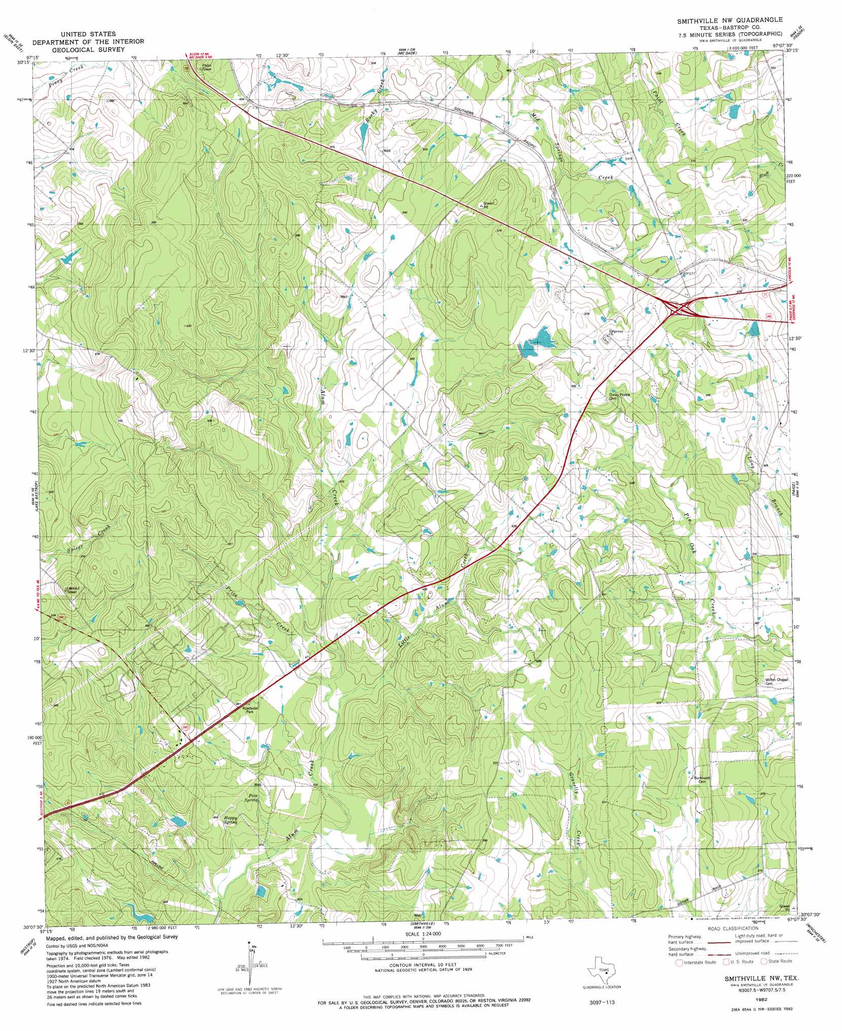
USGS Topo Quad 30097b2 - 1:24,000 scale
| Topo Map Name: | Smithville Nw |
| USGS Topo Quad ID: | 30097b2 |
| Print Size: | ca. 21 1/4" wide x 27" high |
| Southeast Coordinates: | 30.125° N latitude / 97.125° W longitude |
| Map Center Coordinates: | 30.1875° N latitude / 97.1875° W longitude |
| U.S. State: | TX |
| Filename: | o30097b2.jpg |
| Download Map JPG Image: | Smithville Nw topo map 1:24,000 scale |
| Map Type: | Topographic |
| Topo Series: | 7.5´ |
| Map Scale: | 1:24,000 |
| Source of Map Images: | United States Geological Survey (USGS) |
| Alternate Map Versions: |
Smithville NW TX 1982, updated 1982 Download PDF Buy paper map Smithville NW TX 1982, updated 1982 Download PDF Buy paper map Smithville NW TX 2010 Download PDF Buy paper map Smithville NW TX 2012 Download PDF Buy paper map Smithville NW TX 2016 Download PDF Buy paper map |
1:24,000 Topo Quads surrounding Smithville Nw
Coupland |
Structure |
Beaukiss |
Lexington |
Tanglewood |
Elgin West |
Elgin East |
Mcdade |
Fedor |
Lincoln |
Utley |
Lake Bastrop |
Smithville Nw |
Paige |
Giddings |
Bastrop Sw |
Bastrap |
Smithville |
Winchester |
Warda |
Red Rock |
Rosanky |
Togo |
West Point |
La Grange West |
> Back to 30097a1 at 1:100,000 scale
> Back to 30096a1 at 1:250,000 scale
> Back to U.S. Topo Maps home
Smithville Nw topo map: Gazetteer
Smithville Nw: Dams
Brockstein Lake Dam elevation 164m 538′Egger Lake Dam elevation 131m 429′
Smithville Nw: Populated Places
Circle D Estates elevation 153m 501′KC Estates elevation 161m 528′
Smithville Nw: Reservoirs
Brockstein Lake elevation 164m 538′Egger Lake elevation 131m 429′
Smithville Nw: Streams
Price Creek elevation 133m 436′Smithville Nw digital topo map on disk
Buy this Smithville Nw topo map showing relief, roads, GPS coordinates and other geographical features, as a high-resolution digital map file on DVD: