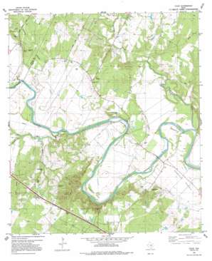
Utley Topo Map Texas
To zoom in, hover over the map of Utley
USGS Topo Quad 30097b4 - 1:24,000 scale
| Topo Map Name: | Utley |
| USGS Topo Quad ID: | 30097b4 |
| Print Size: | ca. 21 1/4" wide x 27" high |
| Southeast Coordinates: | 30.125° N latitude / 97.375° W longitude |
| Map Center Coordinates: | 30.1875° N latitude / 97.4375° W longitude |
| U.S. State: | TX |
| Filename: | o30097b4.jpg |
| Download Map JPG Image: | Utley topo map 1:24,000 scale |
| Map Type: | Topographic |
| Topo Series: | 7.5´ |
| Map Scale: | 1:24,000 |
| Source of Map Images: | United States Geological Survey (USGS) |
| Alternate Map Versions: |
Utley TX 1982, updated 1982 Download PDF Buy paper map Utley TX 1982, updated 1991 Download PDF Buy paper map Utley TX 1982, updated 1991 Download PDF Buy paper map Utley TX 2010 Download PDF Buy paper map Utley TX 2013 Download PDF Buy paper map Utley TX 2016 Download PDF Buy paper map |
1:24,000 Topo Quads surrounding Utley
> Back to 30097a1 at 1:100,000 scale
> Back to 30096a1 at 1:250,000 scale
> Back to U.S. Topo Maps home
Utley topo map: Gazetteer
Utley: Bends
Hemphill Bend elevation 109m 357′Pope Bend elevation 121m 396′
Wilbargers Bend elevation 121m 396′
Utley: Flats
Hemphill Prairie elevation 119m 390′Utley: Populated Places
Utley elevation 127m 416′Wyldwood elevation 156m 511′
Utley: Streams
Coleman Branch elevation 113m 370′Cottonwood Creek elevation 116m 380′
Dry Creek elevation 110m 360′
Dry Creek elevation 119m 390′
Moss Branch elevation 116m 380′
Red Gully Creek elevation 116m 380′
Wilbarger Creek elevation 111m 364′
Utley: Summits
Caldwell Knob elevation 177m 580′Utley: Trails
Northern Loop Trail elevation 146m 479′Southern Loop Trail elevation 171m 561′
Wildflower Trail elevation 146m 479′
Utley digital topo map on disk
Buy this Utley topo map showing relief, roads, GPS coordinates and other geographical features, as a high-resolution digital map file on DVD:


