Fedor Topo Map Texas
To zoom in, hover over the map of Fedor
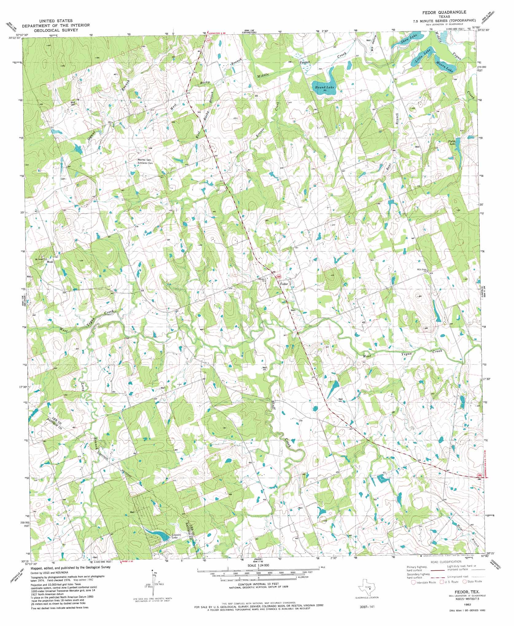
USGS Topo Quad 30097c1 - 1:24,000 scale
| Topo Map Name: | Fedor |
| USGS Topo Quad ID: | 30097c1 |
| Print Size: | ca. 21 1/4" wide x 27" high |
| Southeast Coordinates: | 30.25° N latitude / 97° W longitude |
| Map Center Coordinates: | 30.3125° N latitude / 97.0625° W longitude |
| U.S. State: | TX |
| Filename: | o30097c1.jpg |
| Download Map JPG Image: | Fedor topo map 1:24,000 scale |
| Map Type: | Topographic |
| Topo Series: | 7.5´ |
| Map Scale: | 1:24,000 |
| Source of Map Images: | United States Geological Survey (USGS) |
| Alternate Map Versions: |
Fedor TX 1982, updated 1982 Download PDF Buy paper map Fedor TX 2010 Download PDF Buy paper map Fedor TX 2012 Download PDF Buy paper map Fedor TX 2016 Download PDF Buy paper map |
1:24,000 Topo Quads surrounding Fedor
Thrall |
Thorndale |
Alcoa Lake |
Hicks |
Chriesman |
Structure |
Beaukiss |
Lexington |
Tanglewood |
Deanville |
Elgin East |
Mcdade |
Fedor |
Lincoln |
Dime Box |
Lake Bastrop |
Smithville Nw |
Paige |
Giddings |
Ledbetter |
Bastrap |
Smithville |
Winchester |
Warda |
Nechanitz |
> Back to 30097a1 at 1:100,000 scale
> Back to 30096a1 at 1:250,000 scale
> Back to U.S. Topo Maps home
Fedor topo map: Gazetteer
Fedor: Dams
Field Lake Dam elevation 117m 383′Lincoln Dam elevation 145m 475′
Fedor: Lakes
Little Lake elevation 106m 347′Mourn Lake elevation 106m 347′
Shaw Lake elevation 107m 351′
Fedor: Populated Places
Fedor elevation 122m 400′Fedor: Reservoirs
Field Lake elevation 117m 383′Fields Lake elevation 115m 377′
Lincoln Lake elevation 145m 475′
Fedor: Streams
Bluff Creek elevation 116m 380′East Rock Creek elevation 112m 367′
East Rocky Branch elevation 116m 380′
Krones Creek elevation 109m 357′
Long Branch elevation 122m 400′
Red Branch elevation 107m 351′
West Rocky Branch elevation 116m 380′
Willie Branch elevation 125m 410′
Fedor: Valleys
Big Hollow elevation 107m 351′Fedor digital topo map on disk
Buy this Fedor topo map showing relief, roads, GPS coordinates and other geographical features, as a high-resolution digital map file on DVD: