Mcdade Topo Map Texas
To zoom in, hover over the map of Mcdade
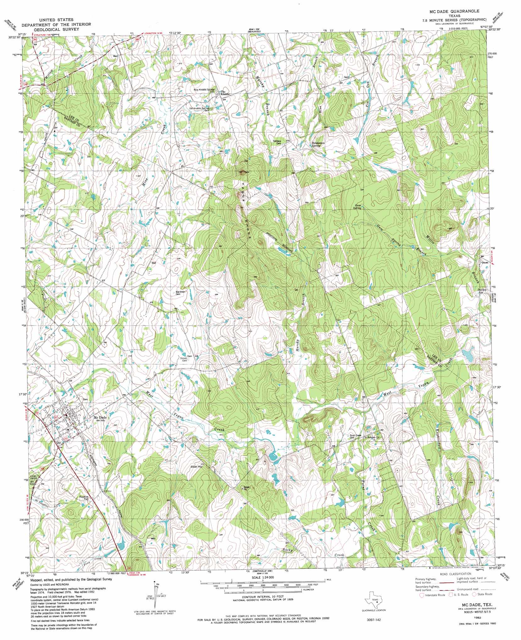
USGS Topo Quad 30097c2 - 1:24,000 scale
| Topo Map Name: | Mcdade |
| USGS Topo Quad ID: | 30097c2 |
| Print Size: | ca. 21 1/4" wide x 27" high |
| Southeast Coordinates: | 30.25° N latitude / 97.125° W longitude |
| Map Center Coordinates: | 30.3125° N latitude / 97.1875° W longitude |
| U.S. State: | TX |
| Filename: | o30097c2.jpg |
| Download Map JPG Image: | Mcdade topo map 1:24,000 scale |
| Map Type: | Topographic |
| Topo Series: | 7.5´ |
| Map Scale: | 1:24,000 |
| Source of Map Images: | United States Geological Survey (USGS) |
| Alternate Map Versions: |
McDade TX 1982, updated 1982 Download PDF Buy paper map McDade TX 2010 Download PDF Buy paper map McDade TX 2012 Download PDF Buy paper map McDade TX 2016 Download PDF Buy paper map |
1:24,000 Topo Quads surrounding Mcdade
Taylor |
Thrall |
Thorndale |
Alcoa Lake |
Hicks |
Coupland |
Structure |
Beaukiss |
Lexington |
Tanglewood |
Elgin West |
Elgin East |
Mcdade |
Fedor |
Lincoln |
Utley |
Lake Bastrop |
Smithville Nw |
Paige |
Giddings |
Bastrop Sw |
Bastrap |
Smithville |
Winchester |
Warda |
> Back to 30097a1 at 1:100,000 scale
> Back to 30096a1 at 1:250,000 scale
> Back to U.S. Topo Maps home
Mcdade topo map: Gazetteer
Mcdade: Populated Places
Knobbs Springs elevation 165m 541′McDade elevation 168m 551′
Mcdade: Springs
Gum Spring elevation 164m 538′Knobbs Springs elevation 200m 656′
Mcdade: Streams
Gum Spring Branch elevation 140m 459′Marshy Branch elevation 137m 449′
Mid Springs Creek elevation 143m 469′
Paint Creek elevation 132m 433′
Rocky Creek elevation 140m 459′
Mcdade: Summits
Yegua Knobbs elevation 225m 738′Mcdade digital topo map on disk
Buy this Mcdade topo map showing relief, roads, GPS coordinates and other geographical features, as a high-resolution digital map file on DVD: