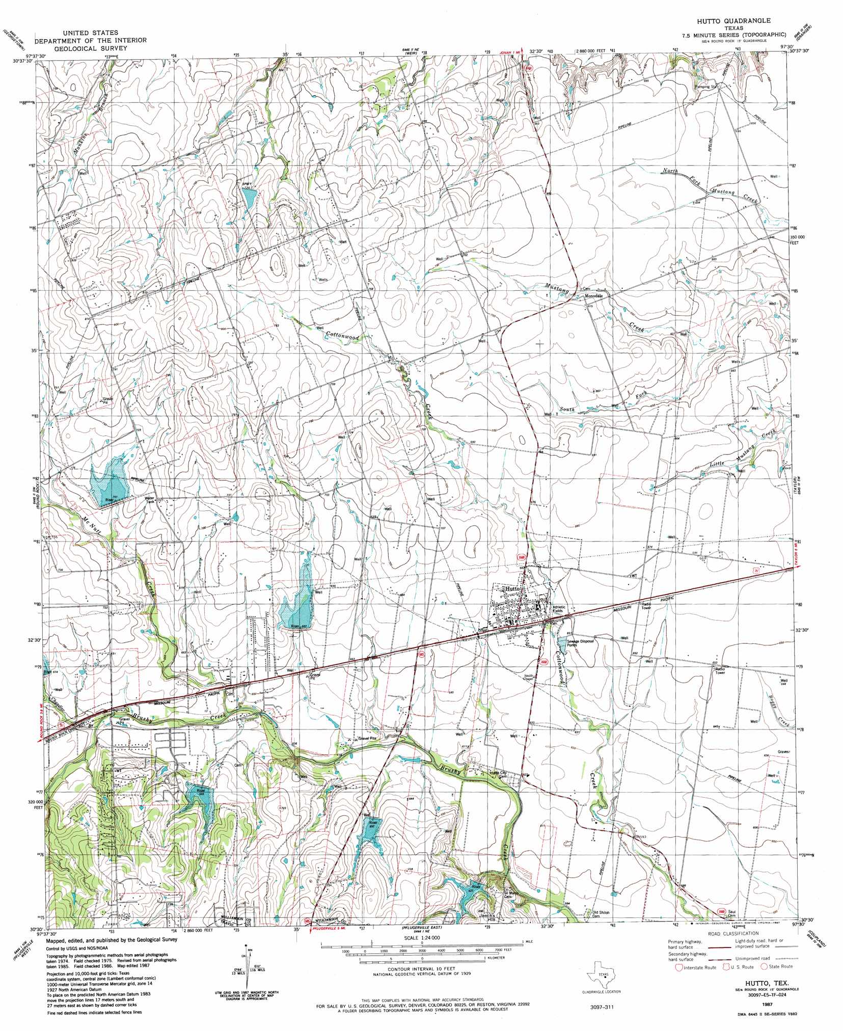
Hutto Topo Map Texas
To zoom in, hover over the map of Hutto
USGS Topo Quad 30097e5 - 1:24,000 scale
| Topo Map Name: | Hutto |
| USGS Topo Quad ID: | 30097e5 |
| Print Size: | ca. 21 1/4" wide x 27" high |
| Southeast Coordinates: | 30.5° N latitude / 97.5° W longitude |
| Map Center Coordinates: | 30.5625° N latitude / 97.5625° W longitude |
| U.S. State: | TX |
| Filename: | o30097e5.jpg |
| Download Map JPG Image: | Hutto topo map 1:24,000 scale |
| Map Type: | Topographic |
| Topo Series: | 7.5´ |
| Map Scale: | 1:24,000 |
| Source of Map Images: | United States Geological Survey (USGS) |
| Alternate Map Versions: |
Hutto TX 1982, updated 1982 Download PDF Buy paper map Hutto TX 1987, updated 1987 Download PDF Buy paper map Hutto TX 2010 Download PDF Buy paper map Hutto TX 2013 Download PDF Buy paper map Hutto TX 2016 Download PDF Buy paper map |
1:24,000 Topo Quads surrounding Hutto
Florence |
Cobbs Cavern |
Jarrell |
Bartlett |
Davilla |
Leander Ne |
Georgetown |
Weir |
Granger |
Friendship |
Leander |
Round Rock |
Hutto |
Taylor |
Thrall |
Jollyville |
Pflugerville West |
Pflugerville East |
Coupland |
Structure |
Austin West |
Austin East |
Manor |
Elgin West |
Elgin East |
> Back to 30097e1 at 1:100,000 scale
> Back to 30096a1 at 1:250,000 scale
> Back to U.S. Topo Maps home
Hutto topo map: Gazetteer
Hutto: Airports
Hummingbird Heliport elevation 209m 685′Hutto: Dams
Soil Conservation Service Site 15 Dam elevation 211m 692′Soil Conservation Service Site 18 Dam elevation 206m 675′
Soil Conservation Service Site 19 Dam elevation 205m 672′
Soil Conservation Service Site 20 Dam elevation 192m 629′
Soil Conservation Service Site 21 Dam elevation 190m 623′
Texas No Name Number 48 Dam elevation 225m 738′
Hutto: Parks
Old Settlers Park at Palm Valley elevation 216m 708′Hutto: Populated Places
Hutto elevation 202m 662′Hutto: Post Offices
Hutto Post Office elevation 202m 662′Hutto: Reservoirs
Soil Conservation Service Site 15 Reservoir elevation 211m 692′Soil Conservation Service Site 18 Reservoir elevation 206m 675′
Soil Conservation Service Site 19 Reservoir elevation 205m 672′
Soil Conservation Service Site 20 Reservoir elevation 192m 629′
Soil Conservation Service Site 21 Reservoir elevation 190m 623′
Hutto: Streams
Chandler Branch elevation 196m 643′McNutt Creek elevation 187m 613′
South Fork Mustang Creek elevation 190m 623′
Hutto digital topo map on disk
Buy this Hutto topo map showing relief, roads, GPS coordinates and other geographical features, as a high-resolution digital map file on DVD: