Pettibone Topo Map Texas
To zoom in, hover over the map of Pettibone
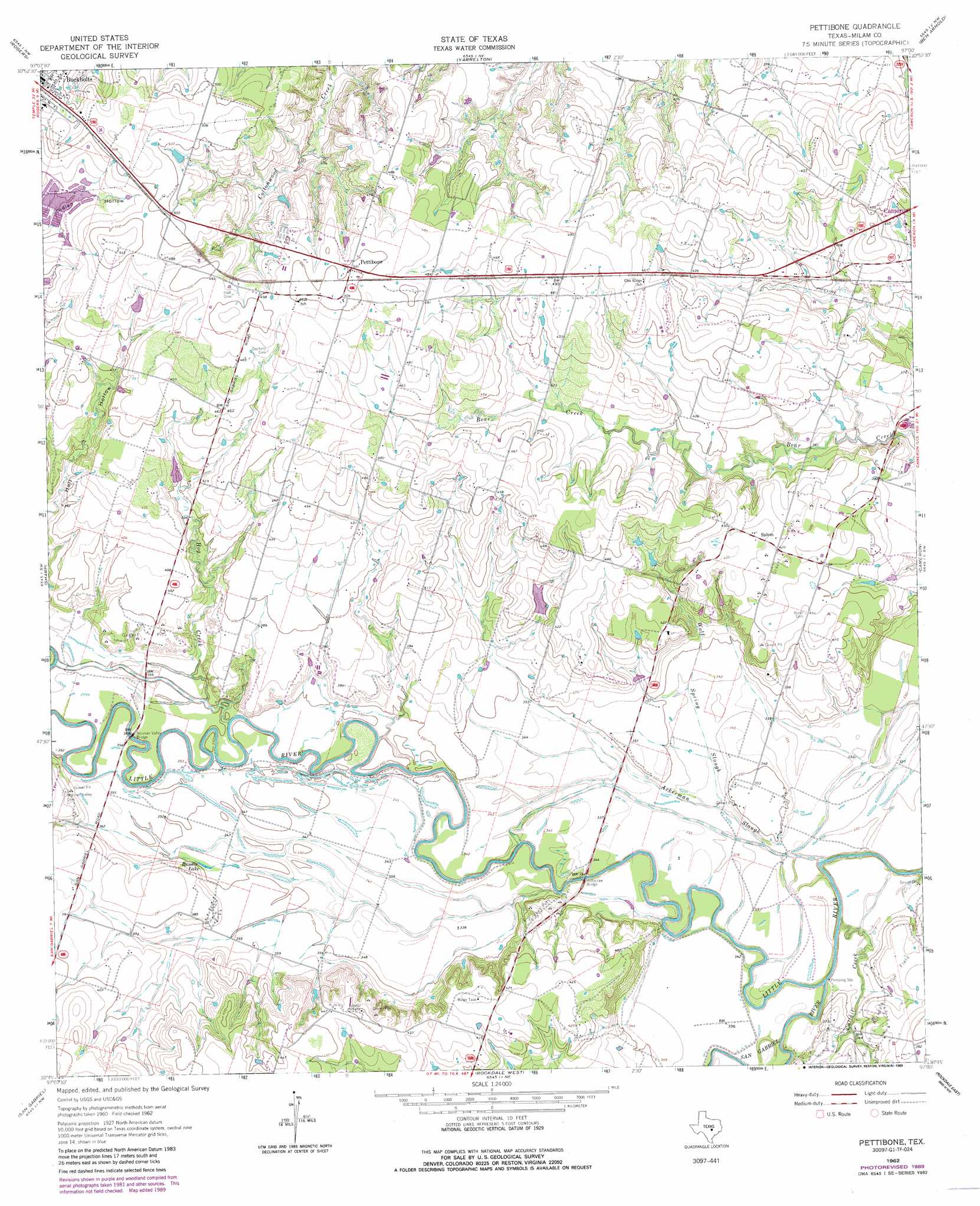
USGS Topo Quad 30097g1 - 1:24,000 scale
| Topo Map Name: | Pettibone |
| USGS Topo Quad ID: | 30097g1 |
| Print Size: | ca. 21 1/4" wide x 27" high |
| Southeast Coordinates: | 30.75° N latitude / 97° W longitude |
| Map Center Coordinates: | 30.8125° N latitude / 97.0625° W longitude |
| U.S. State: | TX |
| Filename: | o30097g1.jpg |
| Download Map JPG Image: | Pettibone topo map 1:24,000 scale |
| Map Type: | Topographic |
| Topo Series: | 7.5´ |
| Map Scale: | 1:24,000 |
| Source of Map Images: | United States Geological Survey (USGS) |
| Alternate Map Versions: |
Pettibone TX 1962, updated 1964 Download PDF Buy paper map Pettibone TX 1962, updated 1989 Download PDF Buy paper map Pettibone TX 2010 Download PDF Buy paper map Pettibone TX 2013 Download PDF Buy paper map Pettibone TX 2016 Download PDF Buy paper map |
1:24,000 Topo Quads surrounding Pettibone
Temple |
Seaton |
Westphalia |
Rosebud |
Baileyville |
Little River |
Rogers |
Yarrelton |
Ben Arnold |
Maysfield |
Davilla |
Sharp |
Pettibone |
Cameron |
Hanover |
Friendship |
San Gabriel |
Rockdale West |
Rockdale East |
Milano |
Thrall |
Thorndale |
Alcoa Lake |
Hicks |
Chriesman |
> Back to 30097e1 at 1:100,000 scale
> Back to 30096a1 at 1:250,000 scale
> Back to U.S. Topo Maps home
Pettibone topo map: Gazetteer
Pettibone: Bridges
Holtzclaw Bridge elevation 98m 321′Norman Valley Bridge elevation 104m 341′
Pettibone: Dams
Glaser Lake Number 1 Dam elevation 136m 446′Hlavacek Lake Dam elevation 116m 380′
Pettibone: Lakes
Randle Lake elevation 106m 347′Pettibone: Populated Places
Buckholts elevation 159m 521′Elm Ridge elevation 146m 479′
Pettibone elevation 153m 501′
Salem elevation 131m 429′
Pettibone: Reservoirs
Glaser Lake Number 1 elevation 136m 446′Hlavacek Lake elevation 116m 380′
Pettibone: Streams
Ackerman Slough elevation 98m 321′Cattail Creek elevation 95m 311′
Hog Creek elevation 102m 334′
San Gabriel River elevation 95m 311′
Wolf Spring Slough elevation 101m 331′
Pettibone digital topo map on disk
Buy this Pettibone topo map showing relief, roads, GPS coordinates and other geographical features, as a high-resolution digital map file on DVD: