Jarrell Topo Map Texas
To zoom in, hover over the map of Jarrell
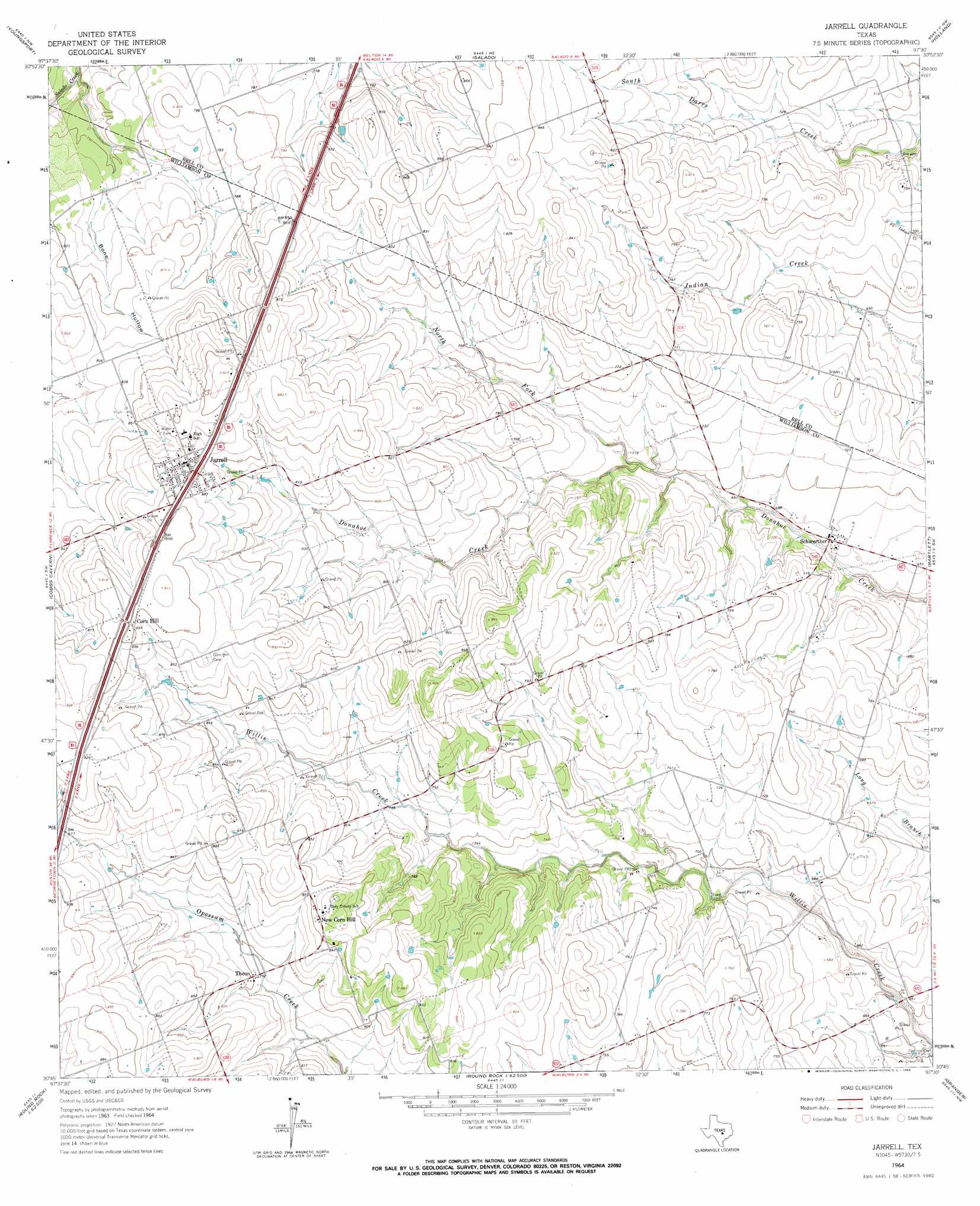
USGS Topo Quad 30097g5 - 1:24,000 scale
| Topo Map Name: | Jarrell |
| USGS Topo Quad ID: | 30097g5 |
| Print Size: | ca. 21 1/4" wide x 27" high |
| Southeast Coordinates: | 30.75° N latitude / 97.5° W longitude |
| Map Center Coordinates: | 30.8125° N latitude / 97.5625° W longitude |
| U.S. State: | TX |
| Filename: | o30097g5.jpg |
| Download Map JPG Image: | Jarrell topo map 1:24,000 scale |
| Map Type: | Topographic |
| Topo Series: | 7.5´ |
| Map Scale: | 1:24,000 |
| Source of Map Images: | United States Geological Survey (USGS) |
| Alternate Map Versions: |
Jarrell TX 1964, updated 1966 Download PDF Buy paper map Jarrell TX 2010 Download PDF Buy paper map Jarrell TX 2012 Download PDF Buy paper map Jarrell TX 2016 Download PDF Buy paper map |
1:24,000 Topo Quads surrounding Jarrell
Mcmillan Mountains |
Killeen |
Nolanville |
Belton |
Temple |
Ding Dong |
Youngsport |
Salado |
Holland |
Little River |
Florence |
Cobbs Cavern |
Jarrell |
Bartlett |
Davilla |
Leander Ne |
Georgetown |
Weir |
Granger |
Friendship |
Leander |
Round Rock |
Hutto |
Taylor |
Thrall |
> Back to 30097e1 at 1:100,000 scale
> Back to 30096a1 at 1:250,000 scale
> Back to U.S. Topo Maps home
Jarrell topo map: Gazetteer
Jarrell: Populated Places
Corn Hill elevation 274m 898′Jarrell elevation 265m 869′
New Corn Hill elevation 264m 866′
Schwertner elevation 209m 685′
Theon elevation 243m 797′
Jarrell: Streams
North Fork Donahoe Creek elevation 215m 705′Jarrell: Valleys
Bone Hollow elevation 225m 738′Jarrell digital topo map on disk
Buy this Jarrell topo map showing relief, roads, GPS coordinates and other geographical features, as a high-resolution digital map file on DVD: