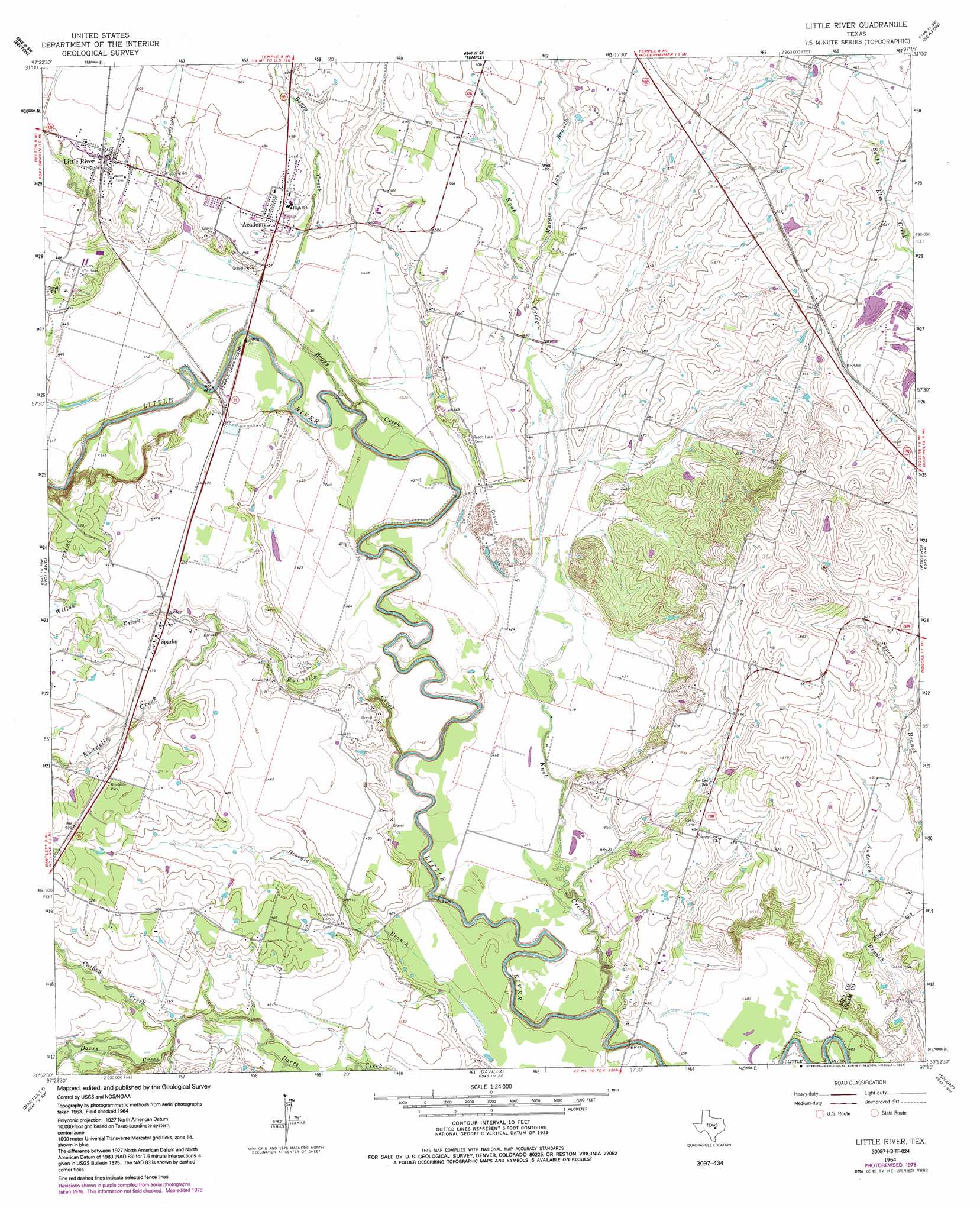
Little River Topo Map Texas
To zoom in, hover over the map of Little River
USGS Topo Quad 30097h3 - 1:24,000 scale
| Topo Map Name: | Little River |
| USGS Topo Quad ID: | 30097h3 |
| Print Size: | ca. 21 1/4" wide x 27" high |
| Southeast Coordinates: | 30.875° N latitude / 97.25° W longitude |
| Map Center Coordinates: | 30.9375° N latitude / 97.3125° W longitude |
| U.S. State: | TX |
| Filename: | o30097h3.jpg |
| Download Map JPG Image: | Little River topo map 1:24,000 scale |
| Map Type: | Topographic |
| Topo Series: | 7.5´ |
| Map Scale: | 1:24,000 |
| Source of Map Images: | United States Geological Survey (USGS) |
| Alternate Map Versions: |
Little River TX 1910 Download PDF Buy paper map Little River TX 1964, updated 1966 Download PDF Buy paper map Little River TX 1964, updated 1979 Download PDF Buy paper map Little River TX 1964, updated 1991 Download PDF Buy paper map Little River TX 2010 Download PDF Buy paper map Little River TX 2012 Download PDF Buy paper map Little River TX 2016 Download PDF Buy paper map |
1:24,000 Topo Quads surrounding Little River
Bland |
Moffat |
Troy |
Belfalls |
Lott |
Nolanville |
Belton |
Temple |
Seaton |
Westphalia |
Salado |
Holland |
Little River |
Rogers |
Yarrelton |
Jarrell |
Bartlett |
Davilla |
Sharp |
Pettibone |
Weir |
Granger |
Friendship |
San Gabriel |
Rockdale West |
> Back to 30097e1 at 1:100,000 scale
> Back to 30096a1 at 1:250,000 scale
> Back to U.S. Topo Maps home
Little River topo map: Gazetteer
Little River: Dams
Langham Lake Dam elevation 162m 531′Prewitt Lake 2 Dam elevation 163m 534′
Prewitt Lake 5 Dam elevation 161m 528′
Little River: Parks
John Glover Stadium elevation 150m 492′Little River: Populated Places
Academy elevation 147m 482′Joe Lee elevation 144m 472′
Little River elevation 152m 498′
Little River-Academy elevation 148m 485′
Sparks elevation 143m 469′
Little River: Post Offices
City of Little River Post Office elevation 152m 498′Little River: Reservoirs
Lansham Lake elevation 162m 531′Prewitt Lake 2 elevation 163m 534′
Prewitt Lake 5 elevation 161m 528′
Little River: Streams
Boggy Creek elevation 122m 400′Cathey Creek elevation 134m 439′
Georgia Branch elevation 125m 410′
Knob Creek elevation 119m 390′
Margie Lou Branch elevation 137m 449′
Runnells Creek elevation 126m 413′
Willow Creek elevation 131m 429′
Little River digital topo map on disk
Buy this Little River topo map showing relief, roads, GPS coordinates and other geographical features, as a high-resolution digital map file on DVD: