Briggs Topo Map Texas
To zoom in, hover over the map of Briggs
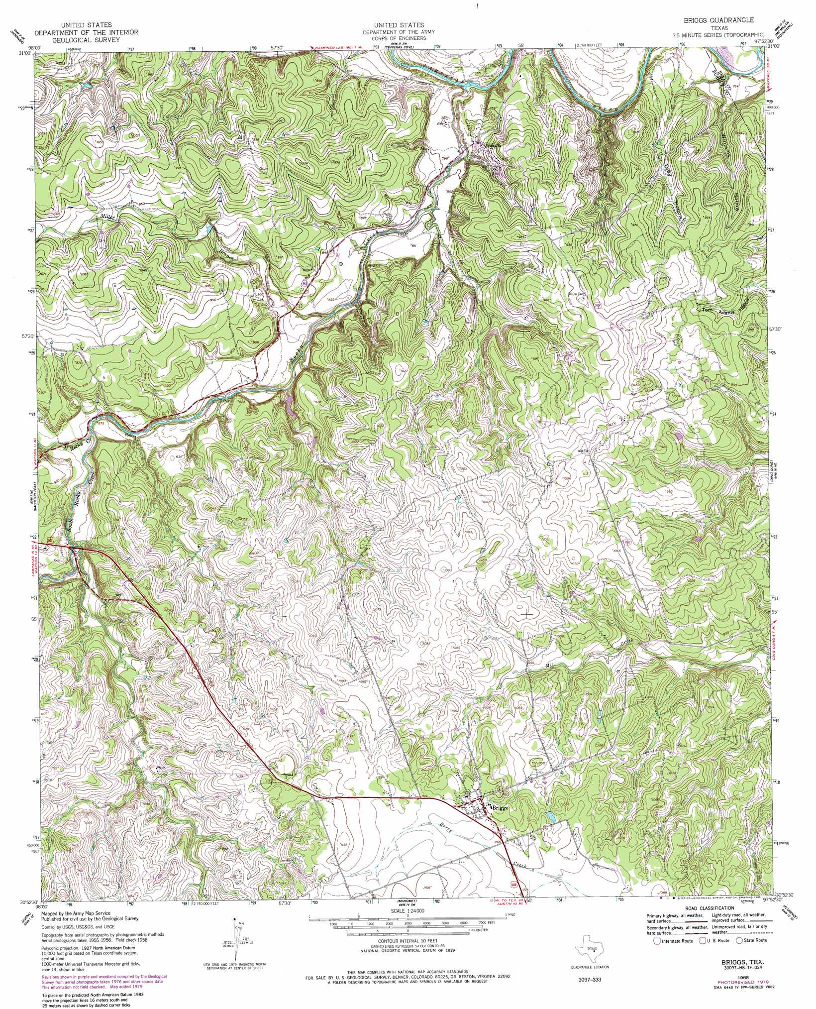
USGS Topo Quad 30097h8 - 1:24,000 scale
| Topo Map Name: | Briggs |
| USGS Topo Quad ID: | 30097h8 |
| Print Size: | ca. 21 1/4" wide x 27" high |
| Southeast Coordinates: | 30.875° N latitude / 97.875° W longitude |
| Map Center Coordinates: | 30.9375° N latitude / 97.9375° W longitude |
| U.S. State: | TX |
| Filename: | o30097h8.jpg |
| Download Map JPG Image: | Briggs topo map 1:24,000 scale |
| Map Type: | Topographic |
| Topo Series: | 7.5´ |
| Map Scale: | 1:24,000 |
| Source of Map Images: | United States Geological Survey (USGS) |
| Alternate Map Versions: |
Briggs TX 1958, updated 1961 Download PDF Buy paper map Briggs TX 1958, updated 1985 Download PDF Buy paper map Briggs TX 2010 Download PDF Buy paper map Briggs TX 2013 Download PDF Buy paper map Briggs TX 2016 Download PDF Buy paper map |
1:24,000 Topo Quads surrounding Briggs
Flat Top Peak |
Rumley |
Twin Mountains |
Fort Hood |
Post Oak Mountain |
Lampasas |
Kempner |
Copperas Cove |
Mcmillan Mountains |
Killeen |
Lake Victor |
Bachelor Peak |
Briggs |
Ding Dong |
Youngsport |
Burnet |
Joppa |
Mahomet |
Florence |
Cobbs Cavern |
Mormon Mill |
Bertram |
Liberty Hill |
Leander Ne |
Georgetown |
> Back to 30097e1 at 1:100,000 scale
> Back to 30096a1 at 1:250,000 scale
> Back to U.S. Topo Maps home
Briggs topo map: Gazetteer
Briggs: Populated Places
Briggs elevation 336m 1102′Oakalla elevation 244m 800′
Briggs: Streams
Campbells Branch elevation 268m 879′Miller Branch elevation 246m 807′
North Rocky Creek elevation 262m 859′
Rocky Creek elevation 231m 757′
South Rocky Creek elevation 262m 859′
Briggs: Valleys
Toby Hollow elevation 230m 754′Williams Hollow elevation 230m 754′
Briggs digital topo map on disk
Buy this Briggs topo map showing relief, roads, GPS coordinates and other geographical features, as a high-resolution digital map file on DVD: