Rough Hollow Topo Map Texas
To zoom in, hover over the map of Rough Hollow
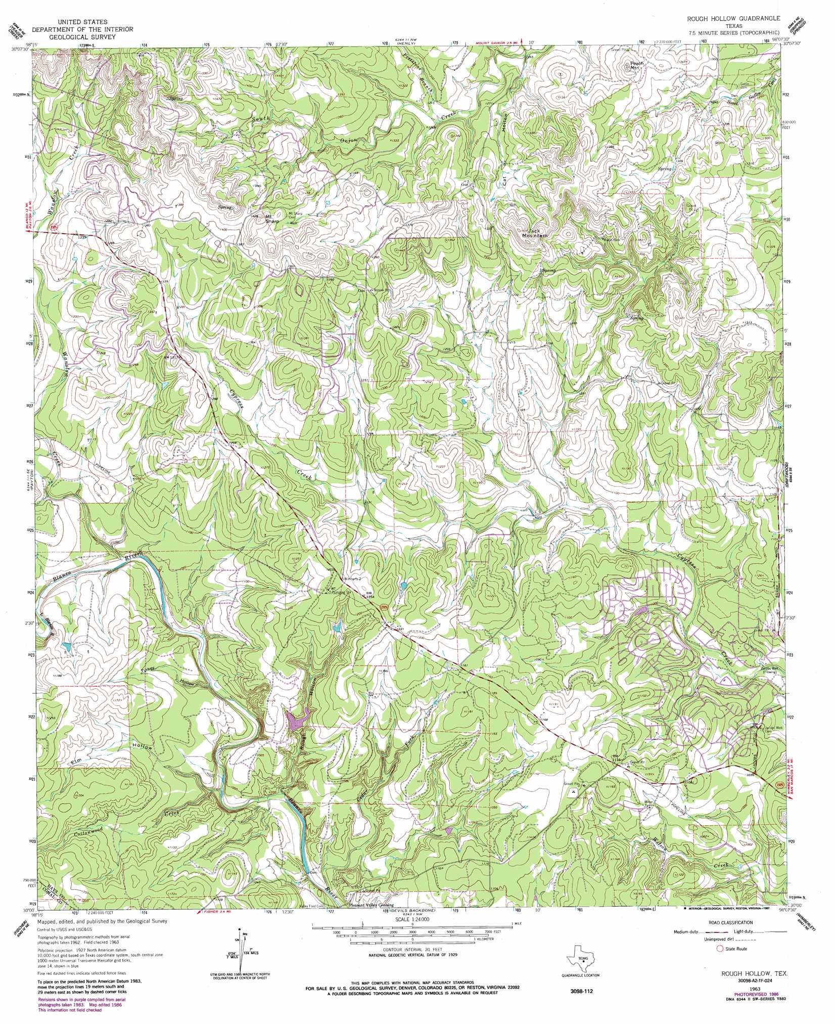
USGS Topo Quad 30098a2 - 1:24,000 scale
| Topo Map Name: | Rough Hollow |
| USGS Topo Quad ID: | 30098a2 |
| Print Size: | ca. 21 1/4" wide x 27" high |
| Southeast Coordinates: | 30° N latitude / 98.125° W longitude |
| Map Center Coordinates: | 30.0625° N latitude / 98.1875° W longitude |
| U.S. State: | TX |
| Filename: | o30098a2.jpg |
| Download Map JPG Image: | Rough Hollow topo map 1:24,000 scale |
| Map Type: | Topographic |
| Topo Series: | 7.5´ |
| Map Scale: | 1:24,000 |
| Source of Map Images: | United States Geological Survey (USGS) |
| Alternate Map Versions: |
Rough Hollow TX 1963, updated 1965 Download PDF Buy paper map Rough Hollow TX 1963, updated 1975 Download PDF Buy paper map Rough Hollow TX 1963, updated 1987 Download PDF Buy paper map Rough Hollow TX 2010 Download PDF Buy paper map Rough Hollow TX 2012 Download PDF Buy paper map Rough Hollow TX 2016 Download PDF Buy paper map |
1:24,000 Topo Quads surrounding Rough Hollow
Johnson City |
Pedernales Falls |
Hammetts Crossing |
Shingle Hills |
Bee Cave |
Monument Hill |
Yeager Creek |
Henly |
Dripping Springs |
Signal Hill |
Blanco |
Payton |
Rough Hollow |
Driftwood |
Mountain City |
Spring Branch |
Fischer |
Devils Backbone |
Wimberley |
San Marcos North |
Anhalt |
Smithson Valley |
Sattler |
Hunter |
San Marcos South |
> Back to 30098a1 at 1:100,000 scale
> Back to 30098a1 at 1:250,000 scale
> Back to U.S. Topo Maps home
Rough Hollow topo map: Gazetteer
Rough Hollow: Airports
Garnett Ranch Airport elevation 403m 1322′Rough Hollow: Dams
Big Dam elevation 300m 984′Seven H Ranch Lake Dam elevation 384m 1259′
Rough Hollow: Populated Places
Pleasant Valley Crossing elevation 280m 918′Rough Hollow: Reservoirs
Big Dam Lake elevation 300m 984′Seven H Ranch Lake elevation 384m 1259′
Rough Hollow: Springs
Jacobs Well Spring elevation 284m 931′Rough Hollow: Streams
Cedar Fork elevation 283m 928′Cottonwood Creek elevation 286m 938′
Freestone Branch elevation 377m 1236′
Wanslow Creek elevation 303m 994′
Rough Hollow: Summits
Jack Mountain elevation 451m 1479′Mount Sharp elevation 463m 1519′
Peach Mountain elevation 429m 1407′
Rough Hollow: Valleys
Cat Hollow elevation 368m 1207′Elm Hollow elevation 290m 951′
Rough Hollow elevation 288m 944′
Turkey Hollow elevation 291m 954′
Rough Hollow: Wells
Jacobs Well elevation 286m 938′Rough Hollow digital topo map on disk
Buy this Rough Hollow topo map showing relief, roads, GPS coordinates and other geographical features, as a high-resolution digital map file on DVD: