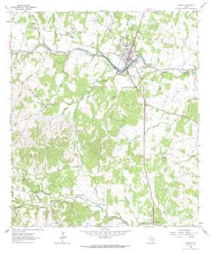
Blanco Topo Map Texas
To zoom in, hover over the map of Blanco
USGS Topo Quad 30098a4 - 1:24,000 scale
| Topo Map Name: | Blanco |
| USGS Topo Quad ID: | 30098a4 |
| Print Size: | ca. 21 1/4" wide x 27" high |
| Southeast Coordinates: | 30° N latitude / 98.375° W longitude |
| Map Center Coordinates: | 30.0625° N latitude / 98.4375° W longitude |
| U.S. State: | TX |
| Filename: | o30098a4.jpg |
| Download Map JPG Image: | Blanco topo map 1:24,000 scale |
| Map Type: | Topographic |
| Topo Series: | 7.5´ |
| Map Scale: | 1:24,000 |
| Source of Map Images: | United States Geological Survey (USGS) |
| Alternate Map Versions: |
Blanco TX 1963, updated 1965 Download PDF Buy paper map Blanco TX 2010 Download PDF Buy paper map Blanco TX 2012 Download PDF Buy paper map Blanco TX 2016 Download PDF Buy paper map |
1:24,000 Topo Quads surrounding Blanco
> Back to 30098a1 at 1:100,000 scale
> Back to 30098a1 at 1:250,000 scale
> Back to U.S. Topo Maps home
Blanco topo map: Gazetteer
Blanco: Airports
Ford Arabian Ranch Airport elevation 420m 1377′Tatum Ranch Airport elevation 429m 1407′
Blanco: Dams
Blanco City Dam Number 1 elevation 407m 1335′Soil Conservation Service Site 1 Dam elevation 431m 1414′
Wayne Smith Dam elevation 405m 1328′
Blanco: Gaps
Stubbins Gap elevation 491m 1610′Blanco: Parks
Blanco State Park elevation 396m 1299′Blanco State Park elevation 401m 1315′
Blanco: Populated Places
Blanco elevation 405m 1328′Twin Sisters elevation 389m 1276′
Blanco: Reservoirs
Blanco City Lake Number 1 elevation 407m 1335′Soil Conservation Service Site 1 Reservoir elevation 431m 1414′
Wayne Smith Lake elevation 405m 1328′
Blanco: Springs
Beckman Springs elevation 399m 1309′Koch Springs elevation 426m 1397′
Blanco: Streams
Blasingame Creek elevation 407m 1335′Cottonwood Creek elevation 408m 1338′
Durham Branch elevation 390m 1279′
East Fork Hinds Branch elevation 408m 1338′
Hinds Branch elevation 410m 1345′
Koch Branch elevation 396m 1299′
Manahan Creek elevation 445m 1459′
McKinney Creek elevation 416m 1364′
Schuetz Creek elevation 400m 1312′
West Fork Hinds Branch elevation 411m 1348′
Blanco: Trails
Blanco State Park Trail elevation 401m 1315′Blanco digital topo map on disk
Buy this Blanco topo map showing relief, roads, GPS coordinates and other geographical features, as a high-resolution digital map file on DVD:


