Crabapple Creek Topo Map Texas
To zoom in, hover over the map of Crabapple Creek
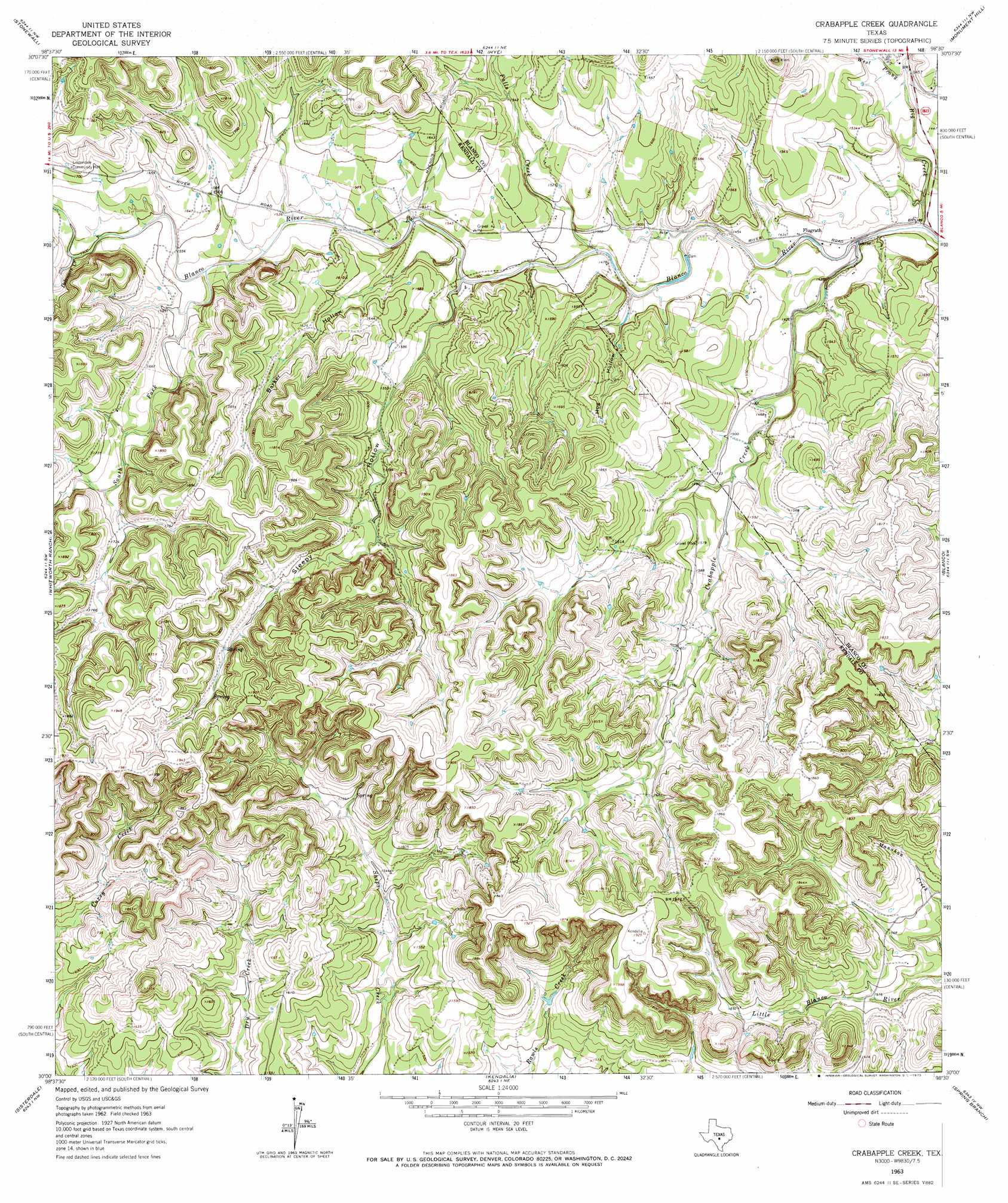
USGS Topo Quad 30098a5 - 1:24,000 scale
| Topo Map Name: | Crabapple Creek |
| USGS Topo Quad ID: | 30098a5 |
| Print Size: | ca. 21 1/4" wide x 27" high |
| Southeast Coordinates: | 30° N latitude / 98.5° W longitude |
| Map Center Coordinates: | 30.0625° N latitude / 98.5625° W longitude |
| U.S. State: | TX |
| Filename: | o30098a5.jpg |
| Download Map JPG Image: | Crabapple Creek topo map 1:24,000 scale |
| Map Type: | Topographic |
| Topo Series: | 7.5´ |
| Map Scale: | 1:24,000 |
| Source of Map Images: | United States Geological Survey (USGS) |
| Alternate Map Versions: |
Crabapple Creek TX 1963, updated 1965 Download PDF Buy paper map Crabapple Creek TX 1963, updated 1973 Download PDF Buy paper map Crabapple Creek TX 2010 Download PDF Buy paper map Crabapple Creek TX 2012 Download PDF Buy paper map Crabapple Creek TX 2016 Download PDF Buy paper map |
1:24,000 Topo Quads surrounding Crabapple Creek
Fredericksburg East |
Cave Creek School |
Rocky Creek |
Johnson City |
Pedernales Falls |
Cain City |
Stonewall |
Hye |
Monument Hill |
Yeager Creek |
Rafter Hollow |
Whitworth Ranch |
Crabapple Creek |
Blanco |
Payton |
Waring |
Sisterdale |
Kendalia |
Spring Branch |
Fischer |
Ranger Creek |
Boerne |
Bergheim |
Anhalt |
Smithson Valley |
> Back to 30098a1 at 1:100,000 scale
> Back to 30098a1 at 1:250,000 scale
> Back to U.S. Topo Maps home
Crabapple Creek topo map: Gazetteer
Crabapple Creek: Bridges
Gooseneck Bridge elevation 554m 1817′Crabapple Creek: Populated Places
Flugrath elevation 433m 1420′Flugrath elevation 433m 1420′
Crabapple Creek: Streams
Big Creek elevation 418m 1371′Crabapple Creek elevation 420m 1377′
Delaware Creek elevation 488m 1601′
East Prong Big Creek elevation 439m 1440′
Falls Creek elevation 444m 1456′
South Fork Blanco River elevation 471m 1545′
West Prong Big Creek elevation 439m 1440′
Crabapple Creek: Valleys
Barker Hollow elevation 454m 1489′Hog Hollow elevation 438m 1437′
Sleepy Hollow elevation 451m 1479′
Crabapple Creek digital topo map on disk
Buy this Crabapple Creek topo map showing relief, roads, GPS coordinates and other geographical features, as a high-resolution digital map file on DVD: