Cypress Creek Topo Map Texas
To zoom in, hover over the map of Cypress Creek
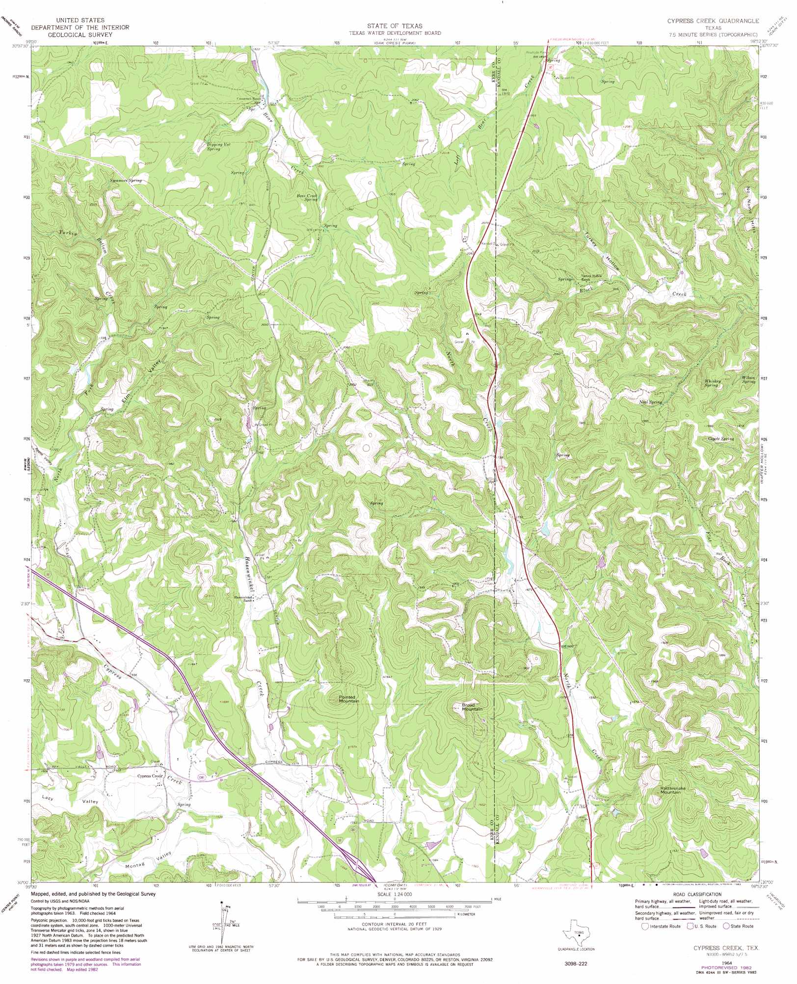
USGS Topo Quad 30098a8 - 1:24,000 scale
| Topo Map Name: | Cypress Creek |
| USGS Topo Quad ID: | 30098a8 |
| Print Size: | ca. 21 1/4" wide x 27" high |
| Southeast Coordinates: | 30° N latitude / 98.875° W longitude |
| Map Center Coordinates: | 30.0625° N latitude / 98.9375° W longitude |
| U.S. State: | TX |
| Filename: | o30098a8.jpg |
| Download Map JPG Image: | Cypress Creek topo map 1:24,000 scale |
| Map Type: | Topographic |
| Topo Series: | 7.5´ |
| Map Scale: | 1:24,000 |
| Source of Map Images: | United States Geological Survey (USGS) |
| Alternate Map Versions: |
Cypress Creek TX 1964, updated 1966 Download PDF Buy paper map Cypress Creek TX 1964, updated 1975 Download PDF Buy paper map Cypress Creek TX 1964, updated 1982 Download PDF Buy paper map Cypress Creek TX 2010 Download PDF Buy paper map Cypress Creek TX 2012 Download PDF Buy paper map Cypress Creek TX 2016 Download PDF Buy paper map |
1:24,000 Topo Quads surrounding Cypress Creek
Harper East |
Roundhead |
Fredericksburg West |
Fredericksburg East |
Cave Creek School |
Nott Branch |
Morris Ranch |
Oak Crest Park |
Cain City |
Stonewall |
Kerrville |
Legion |
Cypress Creek |
Rafter Hollow |
Whitworth Ranch |
Fall Creek |
Center Point |
Comfort |
Waring |
Sisterdale |
Rock Cliff Reservoir |
Bandera Pass |
Turkey Knob |
Ranger Creek |
Boerne |
> Back to 30098a1 at 1:100,000 scale
> Back to 30098a1 at 1:250,000 scale
> Back to U.S. Topo Maps home
Cypress Creek topo map: Gazetteer
Cypress Creek: Populated Places
Cypress Creek elevation 469m 1538′Cypress Creek: Springs
Bear Creek Spring elevation 574m 1883′Coyote Spring elevation 572m 1876′
Dipping Vat Spring elevation 575m 1886′
Neal Spring elevation 566m 1856′
Sycamore Spring elevation 604m 1981′
Whiskey Spring elevation 560m 1837′
Wilson Spring elevation 542m 1778′
Cypress Creek: Streams
North Fork Cypress Creek elevation 477m 1564′Turkey Bottom Creek elevation 528m 1732′
Cypress Creek: Summits
Broad Mountain elevation 593m 1945′Pointed Mountain elevation 581m 1906′
Rattlesnake Mountain elevation 577m 1893′
Cypress Creek: Valleys
Apple Valley elevation 499m 1637′Elm Valley elevation 510m 1673′
Lazy Valley elevation 465m 1525′
Montag Valley elevation 457m 1499′
Turkey Hollow elevation 544m 1784′
Cypress Creek digital topo map on disk
Buy this Cypress Creek topo map showing relief, roads, GPS coordinates and other geographical features, as a high-resolution digital map file on DVD: