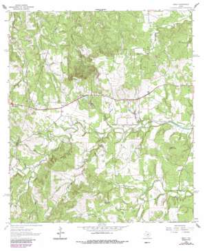
Henly Topo Map Texas
To zoom in, hover over the map of Henly
USGS Topo Quad 30098b2 - 1:24,000 scale
| Topo Map Name: | Henly |
| USGS Topo Quad ID: | 30098b2 |
| Print Size: | ca. 21 1/4" wide x 27" high |
| Southeast Coordinates: | 30.125° N latitude / 98.125° W longitude |
| Map Center Coordinates: | 30.1875° N latitude / 98.1875° W longitude |
| U.S. State: | TX |
| Filename: | o30098b2.jpg |
| Download Map JPG Image: | Henly topo map 1:24,000 scale |
| Map Type: | Topographic |
| Topo Series: | 7.5´ |
| Map Scale: | 1:24,000 |
| Source of Map Images: | United States Geological Survey (USGS) |
| Alternate Map Versions: |
Henly TX 1963, updated 1965 Download PDF Buy paper map Henly TX 1963, updated 1975 Download PDF Buy paper map Henly TX 1963, updated 1987 Download PDF Buy paper map Henly TX 1963, updated 1987 Download PDF Buy paper map Henly TX 2010 Download PDF Buy paper map Henly TX 2012 Download PDF Buy paper map Henly TX 2016 Download PDF Buy paper map |
1:24,000 Topo Quads surrounding Henly
> Back to 30098a1 at 1:100,000 scale
> Back to 30098a1 at 1:250,000 scale
> Back to U.S. Topo Maps home
Henly topo map: Gazetteer
Henly: Airports
Bleakley Ranch Airport elevation 417m 1368′Halm Ranch Airport elevation 415m 1361′
Henly: Dams
Reeves Lake Dam elevation 387m 1269′Henly: Populated Places
Henly elevation 403m 1322′Mount Gainor elevation 350m 1148′
Henly: Reservoirs
Reeves Lake elevation 387m 1269′Henly: Streams
Cadell Branch elevation 385m 1263′Cottonwood Branch elevation 402m 1318′
Eskew Branch elevation 394m 1292′
Grooms Branch elevation 351m 1151′
Henly Branch elevation 371m 1217′
Millseat Branch elevation 354m 1161′
Mustang Branch elevation 372m 1220′
White Branch elevation 397m 1302′
Henly: Summits
Gainor Mountain elevation 429m 1407′Roundtree Mountain elevation 440m 1443′
Henly: Valleys
Rattlesnake Hollow elevation 412m 1351′Sprouse Hollow elevation 378m 1240′
Henly digital topo map on disk
Buy this Henly topo map showing relief, roads, GPS coordinates and other geographical features, as a high-resolution digital map file on DVD:


