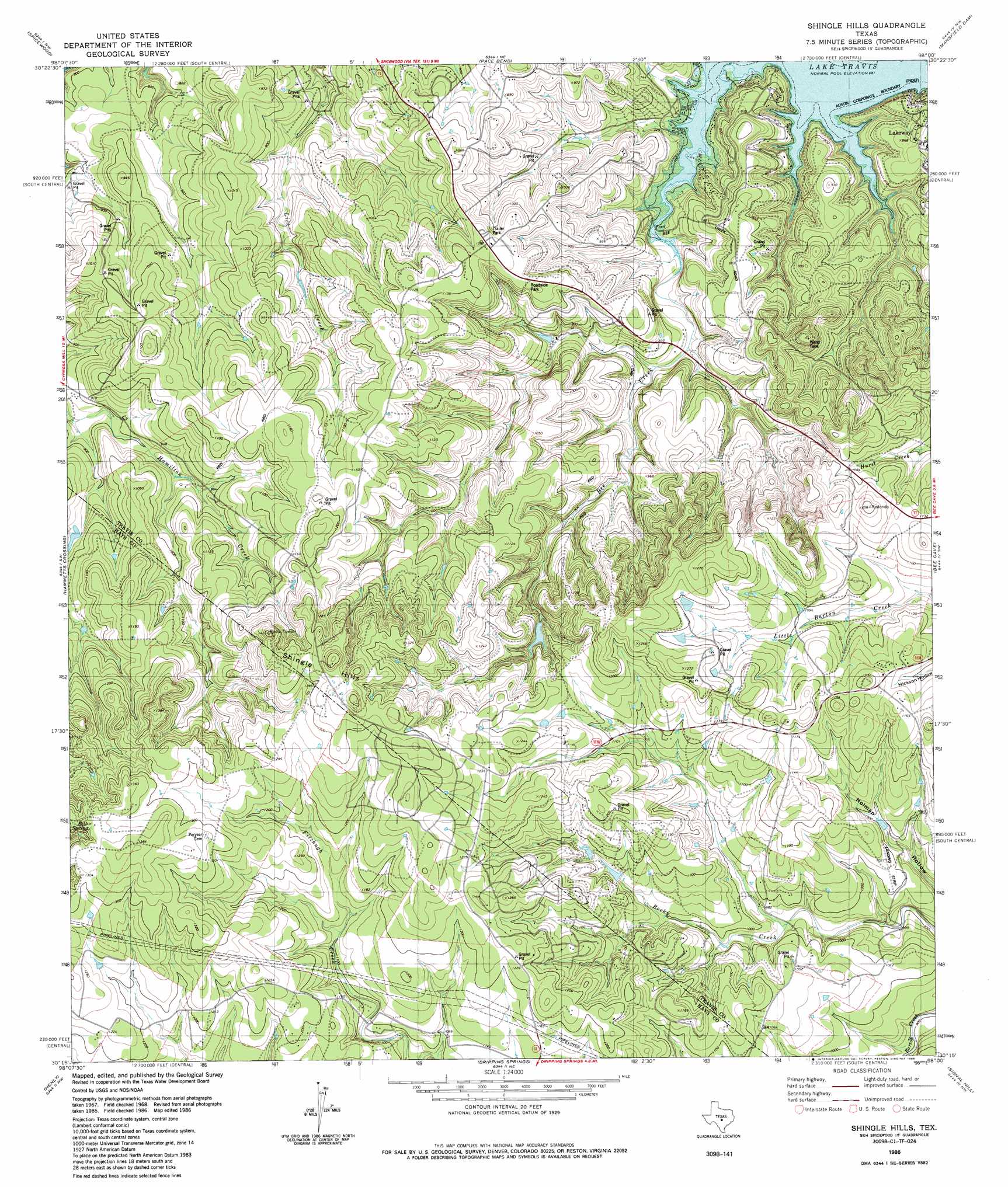
Shingle Hills Topo Map Texas
To zoom in, hover over the map of Shingle Hills
USGS Topo Quad 30098c1 - 1:24,000 scale
| Topo Map Name: | Shingle Hills |
| USGS Topo Quad ID: | 30098c1 |
| Print Size: | ca. 21 1/4" wide x 27" high |
| Southeast Coordinates: | 30.25° N latitude / 98° W longitude |
| Map Center Coordinates: | 30.3125° N latitude / 98.0625° W longitude |
| U.S. State: | TX |
| Filename: | o30098c1.jpg |
| Download Map JPG Image: | Shingle Hills topo map 1:24,000 scale |
| Map Type: | Topographic |
| Topo Series: | 7.5´ |
| Map Scale: | 1:24,000 |
| Source of Map Images: | United States Geological Survey (USGS) |
| Alternate Map Versions: |
Shingle Hills TX 1967, updated 1970 Download PDF Buy paper map Shingle Hills TX 1986, updated 1986 Download PDF Buy paper map Shingle Hills TX 2010 Download PDF Buy paper map Shingle Hills TX 2012 Download PDF Buy paper map Shingle Hills TX 2016 Download PDF Buy paper map |
1:24,000 Topo Quads surrounding Shingle Hills
Marble Falls |
Smithwick |
Travis Peak |
Nameless |
Leander |
Round Mountain |
Spicewood |
Pace Bend |
Mansfield Dam |
Jollyville |
Pedernales Falls |
Hammetts Crossing |
Shingle Hills |
Bee Cave |
Austin West |
Yeager Creek |
Henly |
Dripping Springs |
Signal Hill |
Oak Hill |
Payton |
Rough Hollow |
Driftwood |
Mountain City |
Buda |
> Back to 30098a1 at 1:100,000 scale
> Back to 30098a1 at 1:250,000 scale
> Back to U.S. Topo Maps home
Shingle Hills topo map: Gazetteer
Shingle Hills: Airports
Alexander Ranch Airport elevation 400m 1312′Shingle Hills: Springs
Barton Creek Springs elevation 361m 1184′Bell Spring elevation 412m 1351′
Hamilton Spring elevation 272m 892′
Shingle Hills: Streams
Bee Creek elevation 211m 692′Shingle Hills: Summits
Shingle Hills elevation 433m 1420′Shingle Hills digital topo map on disk
Buy this Shingle Hills topo map showing relief, roads, GPS coordinates and other geographical features, as a high-resolution digital map file on DVD: