Hammetts Crossing Topo Map Texas
To zoom in, hover over the map of Hammetts Crossing
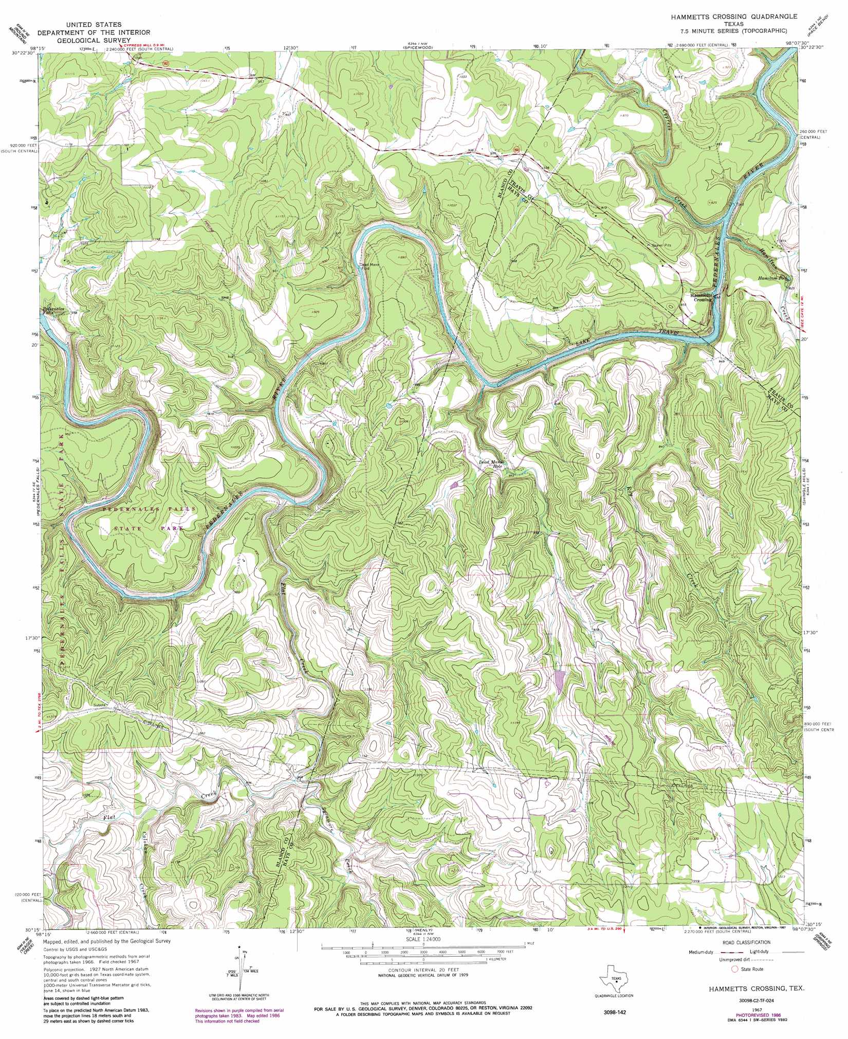
USGS Topo Quad 30098c2 - 1:24,000 scale
| Topo Map Name: | Hammetts Crossing |
| USGS Topo Quad ID: | 30098c2 |
| Print Size: | ca. 21 1/4" wide x 27" high |
| Southeast Coordinates: | 30.25° N latitude / 98.125° W longitude |
| Map Center Coordinates: | 30.3125° N latitude / 98.1875° W longitude |
| U.S. State: | TX |
| Filename: | o30098c2.jpg |
| Download Map JPG Image: | Hammetts Crossing topo map 1:24,000 scale |
| Map Type: | Topographic |
| Topo Series: | 7.5´ |
| Map Scale: | 1:24,000 |
| Source of Map Images: | United States Geological Survey (USGS) |
| Alternate Map Versions: |
Hammetts Crossing TX 1967, updated 1970 Download PDF Buy paper map Hammetts Crossing TX 1967, updated 1987 Download PDF Buy paper map Hammetts Crossing TX 2010 Download PDF Buy paper map Hammetts Crossing TX 2012 Download PDF Buy paper map Hammetts Crossing TX 2016 Download PDF Buy paper map |
1:24,000 Topo Quads surrounding Hammetts Crossing
Dunman Mountain |
Marble Falls |
Smithwick |
Travis Peak |
Nameless |
Howell Mountain |
Round Mountain |
Spicewood |
Pace Bend |
Mansfield Dam |
Johnson City |
Pedernales Falls |
Hammetts Crossing |
Shingle Hills |
Bee Cave |
Monument Hill |
Yeager Creek |
Henly |
Dripping Springs |
Signal Hill |
Blanco |
Payton |
Rough Hollow |
Driftwood |
Mountain City |
> Back to 30098a1 at 1:100,000 scale
> Back to 30098a1 at 1:250,000 scale
> Back to U.S. Topo Maps home
Hammetts Crossing topo map: Gazetteer
Hammetts Crossing: Airports
Keyes Ranch Airport elevation 353m 1158′Hammetts Crossing: Dams
Purola Lake Dam elevation 304m 997′Hammetts Crossing: Lakes
Dead Mans Hole elevation 259m 849′Hamilton Pool elevation 251m 823′
Hammetts Crossing: Parks
Hamilton Pool Park elevation 257m 843′Pedernales Falls State Park elevation 271m 889′
Hammetts Crossing: Populated Places
Hammetts Crossing elevation 218m 715′Hammetts Crossing: Reservoirs
Purola Lake elevation 304m 997′Hammetts Crossing: Springs
West Cave Spring elevation 236m 774′Hammetts Crossing: Streams
Calohan Creek elevation 283m 928′Cypress Creek elevation 208m 682′
Flat Creek elevation 226m 741′
Hamilton Creek elevation 215m 705′
Roy Creek elevation 209m 685′
Sycamore Creek elevation 265m 869′
Hammetts Crossing: Trails
Fou Mile Loop elevation 281m 921′Hamilton Pool Park Trail elevation 251m 823′
Hammetts Crossing digital topo map on disk
Buy this Hammetts Crossing topo map showing relief, roads, GPS coordinates and other geographical features, as a high-resolution digital map file on DVD: