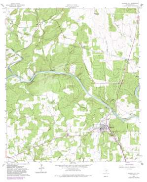
Johnson City Topo Map Texas
To zoom in, hover over the map of Johnson City
USGS Topo Quad 30098c4 - 1:24,000 scale
| Topo Map Name: | Johnson City |
| USGS Topo Quad ID: | 30098c4 |
| Print Size: | ca. 21 1/4" wide x 27" high |
| Southeast Coordinates: | 30.25° N latitude / 98.375° W longitude |
| Map Center Coordinates: | 30.3125° N latitude / 98.4375° W longitude |
| U.S. State: | TX |
| Filename: | o30098c4.jpg |
| Download Map JPG Image: | Johnson City topo map 1:24,000 scale |
| Map Type: | Topographic |
| Topo Series: | 7.5´ |
| Map Scale: | 1:24,000 |
| Source of Map Images: | United States Geological Survey (USGS) |
| Alternate Map Versions: |
Johnson City TX 1961, updated 1962 Download PDF Buy paper map Johnson City TX 1961, updated 1972 Download PDF Buy paper map Johnson City TX 1961, updated 1982 Download PDF Buy paper map Johnson City TX 2010 Download PDF Buy paper map Johnson City TX 2012 Download PDF Buy paper map Johnson City TX 2016 Download PDF Buy paper map |
1:24,000 Topo Quads surrounding Johnson City
> Back to 30098a1 at 1:100,000 scale
> Back to 30098a1 at 1:250,000 scale
> Back to U.S. Topo Maps home
Johnson City topo map: Gazetteer
Johnson City: Dams
Lake Johnson City Dam elevation 334m 1095′Johnson City: Populated Places
Johnson City elevation 365m 1197′Sandy elevation 389m 1276′
Johnson City: Reservoirs
Lake Johnson City elevation 334m 1095′Johnson City: Springs
Buffalo Springs elevation 398m 1305′Crofts Springs elevation 368m 1207′
Hobbs Spring elevation 341m 1118′
Johnson City: Streams
Buffalo Creek elevation 350m 1148′Deer Creek elevation 335m 1099′
Flat Creek elevation 347m 1138′
Hardin Russell Creek elevation 336m 1102′
Hickory Creek elevation 352m 1154′
North Grape Creek elevation 360m 1181′
Salter Spring Creek elevation 341m 1118′
Spring Creek elevation 368m 1207′
Towhead Creek elevation 337m 1105′
Town Creek elevation 335m 1099′
Johnson City: Summits
Buffalo Peak elevation 491m 1610′Johnson City digital topo map on disk
Buy this Johnson City topo map showing relief, roads, GPS coordinates and other geographical features, as a high-resolution digital map file on DVD:


